
Step by step map analysis
Learn about map regression
This activity will guide you through the process of map regression. Map regression is the study of a sequence of maps to reveal changes in individual features and the landscapes you can find them in.
It’s a useful way for archaeologists to study changes in the landscape – maps can act as a historical record and can help provide information on potential archaeological sites. Maps not only show these landscape changes and potentially when these changes happened, they can also indicate what features are important to map makers at that time.
Before you start looking at historical maps, it's a good idea to identify what information you need to find out – essentially, why are you looking at these maps?
What question is it that you want to answer? Starting with a question will help you stay focused while looking at a series of historic maps and it will help you identify what aspects of the map you need to pay attention to.
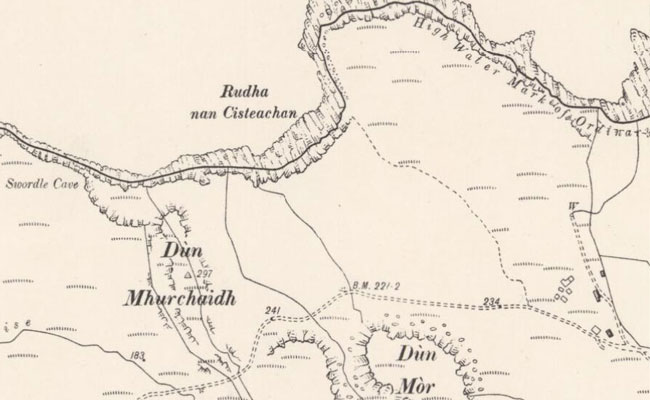
Your question could be 'When did the building lose its roof?' or 'How has Swordle Bay farmhouse expanded over time?' Perhaps you even want to start with a more general question, like ‘how has this landscape changed within the last 200 years?’
Although it might be interesting to find out as much as possible about your local area, it will be easier to answer your main question by setting a study area boundary.
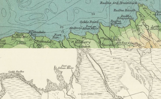
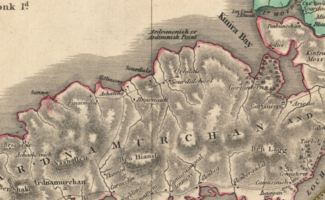
Your study area boundary should include the features you are interested in and some useful landmark points such as buildings prominent natural features or place names. Although we have used a historical map here, you might find it easier starting with a modern map on which you can trace your study area boundary.
Identify two to three fixed landscape reference points which will help pinpoint your location as you make your way through the historical maps. Be careful not to pick obvious reference points though! For example, a supermarket from the 1990s is not going to be found on the same spot in the 1850s!
It's also important to have consistent reference points because maps can be so different that sometimes it's easy to get lost within one map sheet! Historical maps can often show different scales or use different symbols to show the same feature so using a place name or a burn can sometimes help you accurately identify your study area. Choose reference points that have not changed very much over time.
Go back to your original question and think about which map sources will help you.
Consider the scale of the map (is it detailed enough?), the date of the map (will the features appear on an early map?) why are they producing the map? And finally the source of the map (will a naval chart tell you about a land-based limekiln?).
Look at every map which shows your study area – not all of them are going to be useful. You might want to narrow down your list of maps to those that will be the most help in answering your original question.
Now that you have selected your maps, you can look at them one by one and start identifying any landscape changes. Think about the skills you learned in the comparing maps secton and use them here to help you.
What changes can you identify between the different maps and how can they answer you original question? What features are shown, what features are no longer shown? Why might a feature no longer be there? Was it built over by another feature or was it no longer important?
Step 6: Recording map regression and gathering results
To continue your understanding of map regression, it's important that you make a thorough and accurate record of your work – it will save you time later on! You might find it helpful to create a gazetteer, or list of the changes you have seen for each feature on the map you are interested in.
Remember to always keep a detailed record of the map reference so you can refer back to it at any point. Important things to record include:
- The title of map
- The author of the map
- Scale of the map
- The date the map was surveyed
- The date of publication.
It's important to be consistent in your descriptions, to be accurate with dates and provide detailed but clear descriptions of the landscape changes. Think about how someone who might read your research at a later stage will interpret your work.
Try it yourself
To guide you through the process of map regression there are two case studies to download. You can work through the rural case study in the step by step activity above.
'Urban case study' PDF (1.83 MB; 10 pages)
'Industrial case study' PDF (1.97 MB; 10 pages)
Go further
Go out and explore your study area on foot, what still survives as archaeological remains, and which features are no longer visible? Download this PDF to find other sources of information.
'Go further: case study' PDF(169 KB; 1 page)