Download files
Complete book:
Individual page:
Thumbnail gallery: Grid view | List view
GEOGRAPHICAL AND EDUCATIONAL WORKS
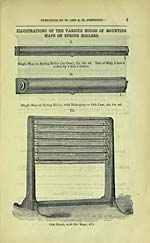
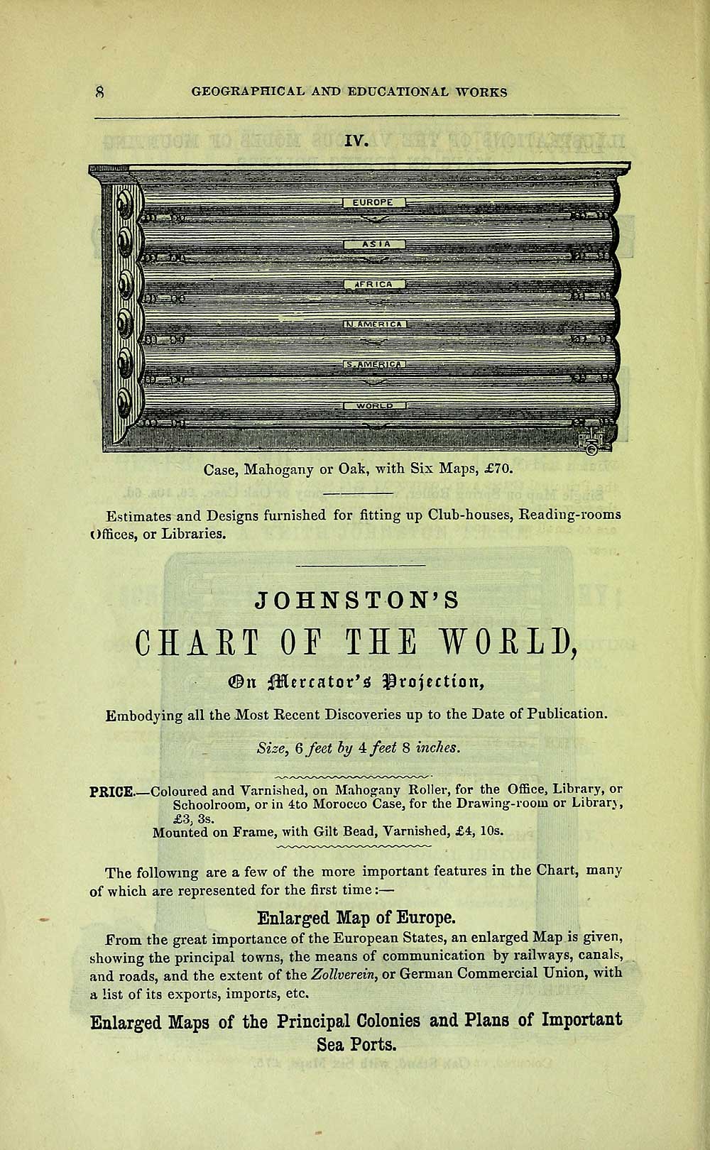
IV.
Case, Mahogany or Oak, with Six Maps, £70.
Estimates and Designs furnished for fitting up Club-houses, Reading-rooms
Offices, or Libraries.
JOHNSTON'S
CHART OF TIE WOELD,
(©n 0lercator'^ projection,
Embodying all the Most Recent Discoveries up to the Date of Publication.
Size, 6 feet hy 4: feet 8 inches.
PRICE Coloured and Varnished, on Mahograny Roller, for the Office, Library, or
Schoolroom, or in 410 Morocco Case, for the Drawing-room or Library,
£3, 3s.
Mounted on Frame, with Gilt Bead, Varnished, £4, 10s.
The following are a few of the more important features in the Chart, many
of which are represented for the first time : —
Enlarged Map of Europe.
From the great importance of the European States, an enlarged Map is given,
showing the principal towns, the means of communication by railways, canals,
and roads, and the extent of the ZoUverein, or German Commercial Union, with
a list of its exports, imports, etc.
Enlarged Maps of the Principal Colonies and Plans of Important
Sea Ports.
Set display mode to: Large image | Transcription
Images and transcriptions on this page, including medium image downloads, may be used under the Creative Commons Attribution 4.0 International Licence unless otherwise stated. ![]()
| Scottish Post Office Directories > Towns > Edinburgh > Post Office Edinburgh and Leith directory > 1860-1861 > (546) |
|---|
| Permanent URL | https://digital.nls.uk/84937939 |
|---|
| Description | Post-Office Edinburgh & Leith directory 1860-61 |
|---|---|
| Attribution and copyright: |
|
| Description | Edinburgh : Postmaster General, [1846-1975]. Preceded by: Edinburgh & Leith Post Office Directory Limited. |
|---|---|
| Shelfmark | Various |
| Description | Directories of individual Scottish towns and their suburbs. |
|---|
| Description | Around 700 Scottish directories published annually by the Post Office or private publishers between 1773 and 1911. Most of Scotland covered, with a focus on Edinburgh, Glasgow, Dundee and Aberdeen. Most volumes include a general directory (A-Z by surname), street directory (A-Z by street) and trade directory (A-Z by trade). |
|---|