Ordnance gazetteer of Scotland
(1419) Page 1411 - ROX
Download files
Complete book:
Individual page:
Thumbnail gallery: Grid view | List view

ROXBURGHSHIRE
Igneous Rocks.
(Porphy rites, tuffs, etc., of Lower Carboni-
ferous age.
PorphyriteB, tuffs, etc., of Upper Old Bed
Sandstone age.
Porphyrites, tuffs, etc., of Lower Old Bed
Sandstone age.
(Basalt dykes of Tertiary age.
Diabase, Basalt, Porphyrite, and yolcanic
necks of Carboniferous age.
Minette and Granite, Post Upper Silurian
and Lower Old Bed Sandstone age.
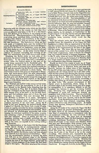
Beginning with the Silurian rocks, which are the oldest
sedimentary strata in the county, we find that they
cover an extensive area lying to the W of a line drawn
from Old Melrose, S by Kirkton to the sources of the
Teviot and Jed. The representatives of the Moffat series
occur along sharp anticlinal folds, extending from the
boundary with Selkirk, near Coldshiels, to the Leader,
near Leaderfoot, where they are overlain by the Upper
Old Red Sandstone. The Radiolarian cherts are met
with south of Coldshiels Loch, near the border of the
county; the Hartfell black shales are seen in the Rhymer's
Glen and in the Tweed, at Leaderfoot; while the Birk-
hill black shales are exposed at the Coldshiels Loch and
in the Rhymer's Glen. At the latter locality there is
evidence of excessive crumpling and crushing of the
beds, but, nevertheless, they yield characteristic fossils.
Overlying the Moffat series on both sides of the
anticlines, the observer finds the 'Gala grits' or 'Queens-
berry series.' To the north they form a succession of
normal folds — the highest strata in this part of the
county being represented by tb.3 Buckholm grits. To
the south of the black shale series these strata are re-
peated by a series of inverted folds inclined towards the
NW, and are succeeded by the Hawick rocks, extending
from Bowden Moor southwards to Stobs Castle. The
chief fossils found in this group are fragments of Euryp-
terus, and tracts among which the most characteristic
form is Protovirgularia. It is apparent, therefore, that
the Gala grits and Hawick rocks occupy the larger part
of the county, and from their relation to the highest
members of the Moffat series have been classed with the
Llandovery formation.
The Wenlock and Ludlow rocks occupy several areas,
the largest of which lies immediately to the S of the
tract covered by the Hawick beds, extending from the
county boundary at Wisp Hill E by Stobs Castle, till
they are overlapped by the Upper Old Red Sandstone.
Other masses occur in the heart of the Old Red Sand-
stone and Carboniferous areas, and of these, the most
important is traceable from near Riccarton NE to
near Hobkirk — a distance of 14 miles. Throughout
these areas, the strata are as much folded and contorted
as the Lower Silurian rocks, and hence there is a
constant repetition of the same beds. Along the N
limit of the tract bounding the Ardwell Group, about
3 miles S of Hawick, the lowest beds consist of grits,
which are rapidly succeeded by shales containing a thin
band crowded with graptolites and orthoceratites. These
are followed by greenish-grey greywackes and shales
forming the dominant members of the series, occasion-
ally containing a band of fossiliferous shales similar to
that just indicated. Zones of pebbly grit and con-
glomerate, yielding casts of shells, encrinites, etc., are
frequently met with. Excellent sections of the highest
beds of the series are exposed in the railway cuttings
near Riccarton.
The representatives of the Lower Old Red Sandstone
consist almost wholly of contemporaneous volcanic
rocks, and cover an area of about 80 square miles on
the Cheviots. Before the outburst of volcanic activity
during this period, the Silurian rocks had been plicated
and subjected to a vast amount of denudation. Wher-
ever the unconformable junction is exposed, the lavas
and tuffs rest on the upturned edges of the Silurian
strata, so that a long interval of time must have elapsed
between the close of the Upper Silurian period and the
earliest volcanic eruptions of the Lower Old Red Sand-
stone in this region. The oldest member of the volcanic
ROXBURGHSHIRE
series in Roxburghshire consists of a coarse agglomerate
or tuff exposed on the hill slopes E of Hindhope at the
head of Kale Water, where it rests on the Upper Silurian
greywackes and shales. Sheet after sheet of porphyrite
succeeds this basal tuff, the whole series being inclined
at a gentle angle to the SE. Few intercalations of tuff
are associated with these ancient lavas, but occasionally
thin seams of chocolate-coloured sandstone are met with,
thereby indicating that the area had subsided beneath
the waters of the Old Red Sandstone lake. An excel-
lent example of the alternation of sandstones and lavas
occurs on the Kale Water, about 4 miles S of the village
of Hounam. Some of the bands still retain their original
glassy matrix, as, for example, at Cocklawfoot in the
neighbourhood of the Big Cheviot and near Morebattle
on Kale Water. A few volcanic necks pierce these
gorphyrite lavas, occurring chiefly round the Big
heviot.
That the volcanic series just described was highly
denuded before the deposition of the Upper Old Red
Sandstone is evident from an examination of the boun-
dary line between the two formations, and also from the
character of the conglomerate at the base of the Upper
Old Red strata. The latter fills up bays and hollows
cut out of the ancient lavas, while the included pebbles
of the basal conglomerate, where it flanks the volcanic
area, are composed mainly of trappean fragments. Far
to the W, even, where no Lower Old Red lavas or tuffs
are now to be found, as, for instance, S of Hawick, there
is a larger number of blocks of Cheviot porphyrites in
the conglomerates than Silurian fragments.
Nearly one-third of the county is made up of Upper
Old Red strata. A line drawn from Newtown St Boswells
to Kirkton, thence to Edgerton, Kelso, and back to St
Boswells, encloses the largest mass of this formation.
To the SW of this area long tongues of Upper Old Red
Sandstone fill old valleys carved out of the older rocks,
while another narrow belt skirting the Cheviot volcanic
rocks extends from Crailing to the English border on the
S side of the Tweed. The oldest member of this for-
mation consists of a coarse conglomerate resembling a
boulder clay, filling up old hollows and river courses in
the older rocks. The greatest development of this
deposit occurs in Lauderdale, where, owing to the
smoothed edges of the included blocks and their irregu-
lar arrangement, it is sometimes difficult to tell the
boundary line between it and the overlying boulder
clay. Overlying this conglomerate we find a great
development of marls and sandstones forming the
prominent beds of this formation. They are admirably
exposed in the Tweed from St Boswells to Rutherford,
in the Ale Water near Ancrum, and in the Jed Water
near Kelso. From the sandstone bands in these sections,
• fish remains have been obtained, comprising Salop-
tyckius nobilissimus and PtericMAys major. In Belses
quarry, near Ancrum, Paloeopteris Sibernica is said to
have been found.
Along the N border of the county the Upper Old Red
Sandstone attains its greatest development; and near
the upper limits of the formation near Smailholm, a
thin band of porphyrite lava is intercalated with the
red sandstones — evidently the first indication of the
Kelso volcanic rocks. The latter form an important
horizon between the Upper Old Red Sandstone and the
overlying Calciferous Sandstones in Roxburghshire.
From the N border of the county near Stitchel, where
they pass into Berwickshire, these ancient lavas, com-
posed of diabase-porphyrites, can be traced W to Smail-
holm, thence across the Tweed to Makerstoun, causing
the gorge known as ' the Makerstoun trows ' (troughs).
From this point the volcanic belt can be followed E
along the S side of the Tweed as far as the county
boundary. This volcanic zone, represented by a few
bands of slaggy diabase with an overlying bed of tuff,
occurs in the neighbourhood of Riccarton, coming to the
surface wherever this horizon is exposed. Between this
point and Kelso the volcanic rocks are absent, the Calci-
ferous Sandstones resting directly on the Upper Old Red
Sandstone. It reappears, however, in the Dinley Burn,
1411
Set display mode to: Large image | Transcription
Images and transcriptions on this page, including medium image downloads, may be used under the Creative Commons Attribution 4.0 International Licence unless otherwise stated. ![]()
| Gazetteers of Scotland, 1803-1901 > Ordnance gazetteer of Scotland > (1419) Page 1411 - ROX |
|---|
| Permanent URL | https://digital.nls.uk/97410274 |
|---|

