Ordnance gazetteer of Scotland > Volume 5
(258) Page 168
Download files
Complete book:
Individual page:
Thumbnail gallery: Grid view | List view

PEEBLESSHIRE
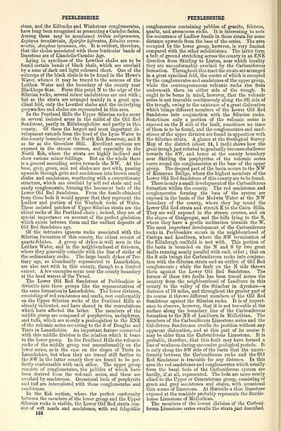
stone, and the Kilbuclio and Winkstone conglomerates,
have long been recognised as presenting a Caradoc facies.
Among these may be mentioned Orthis caligramma,
Leptcetia temiAstriata, Spirifer biforatus, Lituites cornu-
arietis, Asaphus tyrannus, etc. It is evident, therefore,
that the shales associated with these lenticular bands of
limestone are of Llandeilo-Caradoc Age.
Lying in synclines of the Lowther shales are to be
found certain bands of black shale, which are overlaid
by a zone of dark and light coloured chert. One of the
outcrops of the black shale is to be found in the Howe's
"Water, whence it may be traced to the sources of the
Leithen Water and the boundary of the county near
Blackhope Scar. From this point N to the edge of the
Silurian rocks, several minor undulations are met with ;
but as the strata are arranged mainly in a great syn-
clinal fold, only the Lowther shales and the underlying
greywackes and shales are represented in this area.
In the Pentland Hills the Upper Silurian rocks occur
in several isolated areas in the midst of the Old Red
Sandstone, partly in Edinburghshire and partly in this
county. Of these the largest and most important de-
velopment extends from the head of the Lyne Water to
the county boundary at the North Esk Reservoir, and E
as far as the Greenlaw Hill. Excellent sections are
exposed in the stream courses, and especially in the
North Esk, where the strata are highly inclined and
show various minor foldings. But on the whole there
is a general ascending series towards the NW. At the
base, grey, green, and red shales are met with, passing
upwards through grits and sandstones into brown sandy
shales and sandstones, weathering with a concretionary
structure, which are overlaid by soft red shale and red
sandy conglomerate, forming the basement beds of the
Lower Old Red Sandstone. From the fossils obtained
from these beds it would appear that they represent the
Ludlow and portion of the Wenlock rocks of Wales.
These isolated patches of Upper Silurian strata are the
oldest rocks of the Pentland chain ; indeed, they are of
special importance on account of tlie perfect gradation
which exists between them and the earliest deposits of
Old Red Sandstone age.
Of the intrusive igneous rocks associated with the
Silurian formation of this county, the oldest consist of
quartz-felsites. A group of dykes is well seen in the
Leithen Water, and in the neighbourhood of Grieston,
where they generally coincide with the line of strike of
the sedimentary rocks. The large basalt dykes of Ter-
tiary age, so abundantly represented in Lanarkshire,
are also met with in this county, though to a limited
extent. A few examples occur near the county boundary
at the head waters of the Tweed.
The Lower Old Red Sandstone of Peeblesshire is
divisible into three groups like the representatives of
the same formation in Lanarkshire. The lower division,
consisting of red sandstones and marls, rest conformably
on the Upper Silurian rocks of the Pentland Hills as
already indicated, and have shared in the convolutions
which have affected the latter. The members of the
middle group are composed of porphyrites, melaphyres,
and tuffs, which are merely a prolongation to the ENE
of the volcanic series occurring to the S of Douglas and
Tinto in Lanarkshire. An important feature connected
with this middle division is the relation which it bears
to the lower group. In the Pentland Hills the volcanic
rocks of the middle group rest unconformably on the
lower series, as is the case on the slopes of Tinto in
Lanarkshire, but when they are traced still farther to
the SW in the latter county they are found to be per-
fectly conformable with each other. The upper group
consists of conglomerates, the pebbles of which have
been derived from the volcanic series, and these are
overlaid by sandstones. Occasional beds of porphyrite
and tuff are intercalated with these conglomerates and
sandstones.
In the Esk section, where the perfect conformity
between the members of the lower group and the Upper
Silurian rocks is visible, the Lower Old Red strata con-
sist of soft marls and sandstones, with red felspathic
X68
PEEBLESSHIRE
conglomerates containing pebbles of granite, felstone,
quartz, and arenaceous rocks. It is interesting to note
the occurrence of Ludlow fossils in these strata for some
distance upwards from the base of the series. The area
occupied by the lower group, however, is very limited
compared with the other subdivisions. The latter form
a belt of ground stretching across the county in an ENE
direction from Skirling to Linton, near which locality
they are unconformably overlaid by the Carboniferous
formation. Throughout this tract the strata are arranged
in a great synclinal fold, tlie centre of which is occupied
by the conglomerates and sandstones of the upper gi'oup,
while the contemporaneous volcanic rocks rise from
underneath them on either side of the trough. It
ought to be borne in mind, however, that the volcanic
series is not traceable continuously along the SE side of
the trough, owing to the existence of a great dislocation
which brings different members of the Lower Old Red
Sandstone into conjunction with the Silurian rooks.
Sometimes only a portion of the volcanic series is
exposed on the N side of the fault, sometimes no trace
of them is to be found, and the conglomerates and sand-
stones of the upper division are found in apposition with
the Silurian strata. A glance at the Geological Survey
Map of the district (sheet 24, 1 inch) shows how the
great trough just referred to gradually becomes shallower
towards the SW, and hence at tlie county boundary
near Skirling the porphyrites of the volcanic series
curve round the conglomerates at the base of the upper
group. The deepest part of the basin occurs to the NW
of Romanno Bridge, where the highest members of the
Lower Old Red Sandstone of this county are to be found.
There is only a small development of the Carboniferous
formation within the county. The red sandstones and
conglomerates forming the base of the system are
exposed in the basin of the Med win Water at the NW
boundary of the county, where they lap round the
Lower Old Red strata and stretch E to the Cairn Hills.
They are well exposed in the stream courses, and on
the slopes of Craigengar, and the hills lying to the S,
where they have a gentle inclination towards the W.
The most important development of the Carboniferous
rocks in Peeblesshire occurs in the neighbourhood of
Carlops and Leadburn, where the SW termination of
the Edinburgh coalfield is met with. This portion of
the basin is bounded on the N and S by two great
faults running nearly parallel with each other ; that on
the S side brings the Carboniferous rocks into conjunc-
tion with the Silurian strata and an outlier of Old Red
conglomerate ; while the fault on the N side throws
them against the Lower Old Red Sandstone. The
former of these two faults has been traced across the
country from the neighbourhood of Leadburn in this
county to the valley of the Stinchar in Ayrshire — a
distance of 70 miles, and throughout the greater part of
its course it throws different members of the Old Red
Sandstone against the Silurian rocks. It is of import-
ance to observe, however, that it is not traceable at the
surface along the boundai-y line of the Carboniferous
formation to the NE of Leadburn in Midlothian. The
members of the Carboniferous Limestone series and the
Calciferous Sandstones overlie its position without any
apparent dislocation, and at this part of its course it
may he older than the Carboniferous Limestone. It is
probable, therefore, that this fault may have formed a
line of weakness during successive geological periods. It
is only along the SW side of the basin that the uncon-
formity between the Carboniferous rocks and the Old
Red Sandstone is traceable for any distance. In this
area the red sandstones and conglomerates which usually
form the basal beds of the Carboniferous system are
hardly, if at all, represented. The beds are more nearly
allied to the Upper or Cementstone group, consisting of
green and grey sandstones and shales, with occasional
thin seams of limestone. At Hartside a thin limestone
exposed at the roadside probably represents the Burdie-
house Limestone of Midlothian.
The members of the lowest division of the Carboni-
ferous Limestone series overlie the strata just described.
Set display mode to: Large image | Transcription
Images and transcriptions on this page, including medium image downloads, may be used under the Creative Commons Attribution 4.0 International Licence unless otherwise stated. ![]()
| Gazetteers of Scotland, 1803-1901 > Ordnance gazetteer of Scotland > Volume 5 > (258) Page 168 |
|---|
| Permanent URL | https://digital.nls.uk/97387046 |
|---|
| Attribution and copyright: |
|
|---|---|

