Ordnance gazetteer of Scotland > Volume 4
(183) Page 399
Download files
Complete book:
Individual page:
Thumbnail gallery: Grid view | List view
KING EDWARD
Dee, 1J mile E by S of Culter station. Its owner,
Archer Irvine-Fortescuo, Esq. of Swanbister (b. 1819 ;
sue. 1875), holds 1S89 acres in Kincardineshire and
2620 in Orkney, valued at £1583 and £387 per annum.
—Ord. Sur., sh. 77, 1873.
King Edward (pronounced Kin-cdart or Kin-eddar),
a parish of Kff Aberdeenshire, containing King Edward
station on the Macduff branch of the Great North [of
Scotland railway, 4| miles SSE of Banff Bridge station,
6|N by W of Turriff, 24 jN by W of Inveramsay Junction,
and 45^- NNW of Aberdeen, with a post and telegraph
office under Banff. Containing also Newbyth village,
8 miles to the ESE, it is bounded N by Gamrie in
Banffshire, E by Aberdour and New Deer, S by Mon-
quhitter and Turriff, W by Forglen and Alvah in Banff-
shire, and NW by Alvah. Its utmost length, from E
to W, is 9 miles ; its breadth, from N to S, varies be-
tween 2 and 4 f miles ; and its area is 18,646 acres, of
which 75| are water, and 1046f belong to the detached
or Montcoffer section. The Deveron flows 1J mile
northward along the western boundary of the main body,
and here is joined by the Burn of King Edward, which,
formed by two head-streams near Fisherie, winds 6J-
niiles westward through the interior. The surface de-
clines along the Deveron to less than 40 feet above sea-
level, thence rising eastward to 32S feet at Wester Keil-
hill, 443 near Foulzie, 422 at Waller Hill, 701 at the
Hill of Overbrae, 563 at the Hill of Tillymauld, and 749
at the Hill of Fisherie. The principal rocks are grey-
wacke and clay slate in the W, Old Red sandstone in
the E ; and both the greywacke and the sandstone have
been quarried. The soil along the Deveron is chiefly
fertile alluvium ; of many parts in the central districts,
is either a loamy clay or a black loam on a gravelly or
rocky bottom ; and, in the eastern district, is generally
of a mossy nature, very various in quality, and incum-
bent either on gravel or on clay. Kather more than
one-half of the entire area is in tillage ; some 1600 acres
are under wood ; and the rest is mostly pasture, moor,
or moss. At 'Kenedor,' in the first half of the 10th
century, St Gervadius or Gernadius, a native of Ireland,
is said to have built a cell or oratory, and to have led
the life of an anchorite. William Guild, D.D. (15S6-
1657), principal of King's College, Aberdeen, was
minister for 23 years. The Castle of King Edward, 9
furlongs S of the station, crowned a bold precipitous
rock on the N side of the deep ravine of the Burn of
King Edward, and, occupied in the 13th century by the
Comyns, Earls of Buchan, appears to have been a place
of great strength, but now is a shapeless ruin. Man-
sions, all noticed separately, are Byth, Craigston, Eden,
and Montcoffer ; and 5 proprietors hold each an annual
value of £500 and upwards, 1 of between £100 and
£500, and 2 of from £20 to £50. Including almost the
whole of Newbyth quoad sacra parish, King Edward is
in the presbytery of Turriff and synod of Aberdeen ; the
living is worth £399. The parish church, J mile WNW
of the station, is an Early English edifice of 1848,
containing 600 sittings. A Congregational chapel at
Millseat, 6 miles NE of Turriff, was built in 1831, and
contains 210 sittings ; and 2 public schools, Fisherie
and King Edward, with respective accommodation for
60 and 130 children, had (1881) an average attendance
of 41 and 123, and grants of £32, 7s. 6d. and £121,
4s. 6d. Valuation (1860) £9562, (1882) £13,789,
13s. 10d., plus £857 for railway. Pop. (1801) 1723,
(1831) 1966, (1861) 2843, (1871) 3111, (1881) 3068, of
whom 1164 were in the ecclesiastical parish. — Ord. Sur.,
shs. 96, 86, 87, 1S76.
Kingennie, a station in Monifieth parish, Forfarshire,
on the Dundee and Forfar Direct section of the Cale-
donian railway, 7 miles NE of Dundee. Kingennie
estate, around the station, has a trap-rock quarry; and
Kingennie chapelry, comprising the estate, belonged to
Arbroath Abbey. Its church, having passed to a state
of ruin, was erased about 1S30. — Ord. Sur., sh. 49, 1865.
Kingerloch. See Kingairloch.
Kinghorn (Gael, ceann-gorm, 'blue headland'), a
coast town and parish of S Fife. A royal, parliamentary,
KINGHORN
and police burgh, the town has a station on the Edin-
burgh, Perth, and Dundee section of the North British,
3 miles S by W of Kirkcaldy, 2J ENE of Burntisland,
and 12 N by E of Edinburgh, whilst by water it is 6J
miles N of Leith. It occupies the face of a sloping
ground ; and, formerly one of the meanest and most
irregular towns in Fife, has undergone such improve-
ment that its streets, which for ages were almost im-
passable, are levelled now and well-paved, and that its
public buildings are fairly respectable. The town hall,
with accommodation for 150 persons, is a Gothic edifice,
built at a cost of £2500 from designs by Hamilton of
Edinburgh ; and places of worship are the parish church
(1774 ; 700 sittings), a Free church, and a U.P. church
(1779 ; 554 sittings). The public school, a handsome
building of 1S29, was enlarged in 1874. Kinghorn,
besides, has a post office, with money order, savings'
bank, and telegraph departments, a branch bank of the
British Linen Co., 3 insurance agencies, gasworks, and
an hotel. Its own small harbour has fallen to decay ;
but that of Pettycur, f mile to the SSW, has a good
quay though the ferry hence to Leith or Newhaven
has since 1848 been quite superseded by the Granton
aud Burntisland railway ferry. Two flax-spinning mills,
a bleachfield, a glue factory, and an iron shipbuilding
yard, employ a large number of hands ; but fishing
engages only 20 men with 1 1 boats. Kinghorn or Glamis
Tower, on rising ground to the N of the town, was a
royal castle from the reign at least of William the Lyon
(1166-1214), but in the latter half of the 14th century
was granted by Robert II. to his son-in-law, Sir John
Lyon, whose eighth descendant was created Earl of
Kinghorue in 1606 — a title exchanged by his grandson
in 1677 for that of Earl of Strathmore and Kinghorne.
(See Glamis Castle, Forfarshire. ) The plough passes
over its site ; and the ancient tower of St Leonard's
church, converted after the Reformation into a town-
house and jail, has likewise been wholly demolished, to
make room for the present town hall. The rout of 9000
Norsemen at Kinghorn by Macbeth, 'Thane of Fife,' is
a baseless tradition ; but with one great historic event
the place is for ever associated — the death of Alexander
III., on 12 March 1286, at the rugged basaltic promon-
tory of Kinghorn Ness, near Pettycur. He was gallop-
ing in the dusk along the coast from Inverkeithing
to Kinghorn Tower, when, his horse stumbling, he
was pitched over the precipice and broke his neck.
(See Dunbar. ) In Nov. 1881 two 18-ton guns were
mounted on a battery at Kinghorn Ness, subsidiary to
the fortifications of Inchkeith. The Witch Hill, to
the N of Pettycur, was the scene of the execution in
olden times of reputed witches, and now is pierced by a
railway tunnel 250 yards long.
A royal burgh under a charter
of Alexander III., confirmed
by James VI. in 1611, King-
horn is governed by a provost,
2 bailies, a treasurer, a cham-
berlain, and 5 councillors ; and |
with Kirkcaldy, Burnt-
island, and Dysart it returns
one member to parliament.
The parliamentary and the
municipal constituency num-
bered 226 and 314 in 1833,
when the annual value of real
property amounted to £5230
(£3695 in 1867), whilst the corporation revenue was
£689 in 18S2. Pop of parliamentary burgh (1841) 1555,
(1861) 1426, (1871) 1739, (1881) 1790 ; of royal burgh
(1831) 1439. Houses (1881) 425 inhabited, 44 vacant,
4 building.
The parish, containing also the hamlet of Pettycur,
the Invertiel suburb of Kirkcaldy, and the island of
Inchkeith, is bounded NW by Auehtertool, N by
Abbotshall, E and S by the Firth of Forth, and W by
Burntisland and Aberdour. Its utmost length, from E
to W, is 4 J miles ; its breadth, from N to S, varies
between f mile and 22 miles ; and its area is 5596^
399
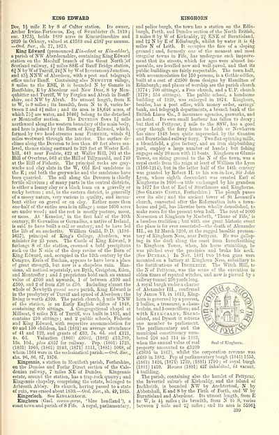
Seal of Kinghorn.
Dee, 1J mile E by S of Culter station. Its owner,
Archer Irvine-Fortescuo, Esq. of Swanbister (b. 1819 ;
sue. 1875), holds 1S89 acres in Kincardineshire and
2620 in Orkney, valued at £1583 and £387 per annum.
—Ord. Sur., sh. 77, 1873.
King Edward (pronounced Kin-cdart or Kin-eddar),
a parish of Kff Aberdeenshire, containing King Edward
station on the Macduff branch of the Great North [of
Scotland railway, 4| miles SSE of Banff Bridge station,
6|N by W of Turriff, 24 jN by W of Inveramsay Junction,
and 45^- NNW of Aberdeen, with a post and telegraph
office under Banff. Containing also Newbyth village,
8 miles to the ESE, it is bounded N by Gamrie in
Banffshire, E by Aberdour and New Deer, S by Mon-
quhitter and Turriff, W by Forglen and Alvah in Banff-
shire, and NW by Alvah. Its utmost length, from E
to W, is 9 miles ; its breadth, from N to S, varies be-
tween 2 and 4 f miles ; and its area is 18,646 acres, of
which 75| are water, and 1046f belong to the detached
or Montcoffer section. The Deveron flows 1J mile
northward along the western boundary of the main body,
and here is joined by the Burn of King Edward, which,
formed by two head-streams near Fisherie, winds 6J-
niiles westward through the interior. The surface de-
clines along the Deveron to less than 40 feet above sea-
level, thence rising eastward to 32S feet at Wester Keil-
hill, 443 near Foulzie, 422 at Waller Hill, 701 at the
Hill of Overbrae, 563 at the Hill of Tillymauld, and 749
at the Hill of Fisherie. The principal rocks are grey-
wacke and clay slate in the W, Old Red sandstone in
the E ; and both the greywacke and the sandstone have
been quarried. The soil along the Deveron is chiefly
fertile alluvium ; of many parts in the central districts,
is either a loamy clay or a black loam on a gravelly or
rocky bottom ; and, in the eastern district, is generally
of a mossy nature, very various in quality, and incum-
bent either on gravel or on clay. Kather more than
one-half of the entire area is in tillage ; some 1600 acres
are under wood ; and the rest is mostly pasture, moor,
or moss. At 'Kenedor,' in the first half of the 10th
century, St Gervadius or Gernadius, a native of Ireland,
is said to have built a cell or oratory, and to have led
the life of an anchorite. William Guild, D.D. (15S6-
1657), principal of King's College, Aberdeen, was
minister for 23 years. The Castle of King Edward, 9
furlongs S of the station, crowned a bold precipitous
rock on the N side of the deep ravine of the Burn of
King Edward, and, occupied in the 13th century by the
Comyns, Earls of Buchan, appears to have been a place
of great strength, but now is a shapeless ruin. Man-
sions, all noticed separately, are Byth, Craigston, Eden,
and Montcoffer ; and 5 proprietors hold each an annual
value of £500 and upwards, 1 of between £100 and
£500, and 2 of from £20 to £50. Including almost the
whole of Newbyth quoad sacra parish, King Edward is
in the presbytery of Turriff and synod of Aberdeen ; the
living is worth £399. The parish church, J mile WNW
of the station, is an Early English edifice of 1848,
containing 600 sittings. A Congregational chapel at
Millseat, 6 miles NE of Turriff, was built in 1831, and
contains 210 sittings ; and 2 public schools, Fisherie
and King Edward, with respective accommodation for
60 and 130 children, had (1881) an average attendance
of 41 and 123, and grants of £32, 7s. 6d. and £121,
4s. 6d. Valuation (1860) £9562, (1882) £13,789,
13s. 10d., plus £857 for railway. Pop. (1801) 1723,
(1831) 1966, (1861) 2843, (1871) 3111, (1881) 3068, of
whom 1164 were in the ecclesiastical parish. — Ord. Sur.,
shs. 96, 86, 87, 1S76.
Kingennie, a station in Monifieth parish, Forfarshire,
on the Dundee and Forfar Direct section of the Cale-
donian railway, 7 miles NE of Dundee. Kingennie
estate, around the station, has a trap-rock quarry; and
Kingennie chapelry, comprising the estate, belonged to
Arbroath Abbey. Its church, having passed to a state
of ruin, was erased about 1S30. — Ord. Sur., sh. 49, 1865.
Kingerloch. See Kingairloch.
Kinghorn (Gael, ceann-gorm, 'blue headland'), a
coast town and parish of S Fife. A royal, parliamentary,
KINGHORN
and police burgh, the town has a station on the Edin-
burgh, Perth, and Dundee section of the North British,
3 miles S by W of Kirkcaldy, 2J ENE of Burntisland,
and 12 N by E of Edinburgh, whilst by water it is 6J
miles N of Leith. It occupies the face of a sloping
ground ; and, formerly one of the meanest and most
irregular towns in Fife, has undergone such improve-
ment that its streets, which for ages were almost im-
passable, are levelled now and well-paved, and that its
public buildings are fairly respectable. The town hall,
with accommodation for 150 persons, is a Gothic edifice,
built at a cost of £2500 from designs by Hamilton of
Edinburgh ; and places of worship are the parish church
(1774 ; 700 sittings), a Free church, and a U.P. church
(1779 ; 554 sittings). The public school, a handsome
building of 1S29, was enlarged in 1874. Kinghorn,
besides, has a post office, with money order, savings'
bank, and telegraph departments, a branch bank of the
British Linen Co., 3 insurance agencies, gasworks, and
an hotel. Its own small harbour has fallen to decay ;
but that of Pettycur, f mile to the SSW, has a good
quay though the ferry hence to Leith or Newhaven
has since 1848 been quite superseded by the Granton
aud Burntisland railway ferry. Two flax-spinning mills,
a bleachfield, a glue factory, and an iron shipbuilding
yard, employ a large number of hands ; but fishing
engages only 20 men with 1 1 boats. Kinghorn or Glamis
Tower, on rising ground to the N of the town, was a
royal castle from the reign at least of William the Lyon
(1166-1214), but in the latter half of the 14th century
was granted by Robert II. to his son-in-law, Sir John
Lyon, whose eighth descendant was created Earl of
Kinghorue in 1606 — a title exchanged by his grandson
in 1677 for that of Earl of Strathmore and Kinghorne.
(See Glamis Castle, Forfarshire. ) The plough passes
over its site ; and the ancient tower of St Leonard's
church, converted after the Reformation into a town-
house and jail, has likewise been wholly demolished, to
make room for the present town hall. The rout of 9000
Norsemen at Kinghorn by Macbeth, 'Thane of Fife,' is
a baseless tradition ; but with one great historic event
the place is for ever associated — the death of Alexander
III., on 12 March 1286, at the rugged basaltic promon-
tory of Kinghorn Ness, near Pettycur. He was gallop-
ing in the dusk along the coast from Inverkeithing
to Kinghorn Tower, when, his horse stumbling, he
was pitched over the precipice and broke his neck.
(See Dunbar. ) In Nov. 1881 two 18-ton guns were
mounted on a battery at Kinghorn Ness, subsidiary to
the fortifications of Inchkeith. The Witch Hill, to
the N of Pettycur, was the scene of the execution in
olden times of reputed witches, and now is pierced by a
railway tunnel 250 yards long.
A royal burgh under a charter
of Alexander III., confirmed
by James VI. in 1611, King-
horn is governed by a provost,
2 bailies, a treasurer, a cham-
berlain, and 5 councillors ; and |
with Kirkcaldy, Burnt-
island, and Dysart it returns
one member to parliament.
The parliamentary and the
municipal constituency num-
bered 226 and 314 in 1833,
when the annual value of real
property amounted to £5230
(£3695 in 1867), whilst the corporation revenue was
£689 in 18S2. Pop of parliamentary burgh (1841) 1555,
(1861) 1426, (1871) 1739, (1881) 1790 ; of royal burgh
(1831) 1439. Houses (1881) 425 inhabited, 44 vacant,
4 building.
The parish, containing also the hamlet of Pettycur,
the Invertiel suburb of Kirkcaldy, and the island of
Inchkeith, is bounded NW by Auehtertool, N by
Abbotshall, E and S by the Firth of Forth, and W by
Burntisland and Aberdour. Its utmost length, from E
to W, is 4 J miles ; its breadth, from N to S, varies
between f mile and 22 miles ; and its area is 5596^
399
Seal of Kinghorn.
Set display mode to: Large image | Transcription
Images and transcriptions on this page, including medium image downloads, may be used under the Creative Commons Attribution 4.0 International Licence unless otherwise stated. ![]()
| Gazetteers of Scotland, 1803-1901 > Ordnance gazetteer of Scotland > Volume 4 > (183) Page 399 |
|---|
| Permanent URL | https://digital.nls.uk/97382542 |
|---|
| Attribution and copyright: |
|
|---|---|
| Description | A survey of Scottish topography, statistical, biographical, and historical. Edited by Francis H. Groome. Edinburgh: Thomas C. Jack, 1884-85. "General survey": v.6, 134 p. at end. |
|---|---|
| Shelfmark | Map.Ref.C18 |
| Additional NLS resources: | |
| Description | 20 volumes of the most popular descriptive gazetteers of Scotland, providing a comprehensive geographical encyclopaedia of Scotland in the 19th century. Principal places in Scotland, including towns, counties, castles, glens, antiquities and parishes, are listed alphabetically. Each entry includes detailed historical and geographical information about each place. |
|---|---|