Download files
Complete book:
Individual page:
Thumbnail gallery: Grid view | List view

ADAM AND CHARLES BLACK’S PUBLICATIONS.
15
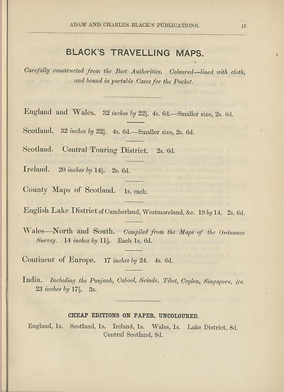
BLACKS TRAVELLING MAPS.
✓ f
Carefully construe,ted from, the Best Authorities, Coloured—lined with cloth,
and hound in portable Cases for the Pocket.
England and Wales. 32 inches by 22J. 4s. 6d.—Smaller size, 2s. 6d.
Scotland. 32 inches by 22J. 4s. 6d.—Smaller size, 2s. 6d.
Scotland. Central Touring District. 2s. 6d.
Ireland. 20 inches by 14J. 2s. 6d.
County Maps of Scotland, is. each.
English Lake District of Cumberland, Westmoreland, &c. 19 by 14. 2s. 6d.
Wales—North and South. Compiled from the Maps of the Ordnance
Survey. 14 inches by 11|. Each Is. 6d.
Continent of Europe. 17 inches by 24. 4s. 6d.
India. Including the Punjaub, Cabool, Scinde, Tibet, Ceylon, Singapore, fc.
23 inches by 17|. 3s.
CHEAP EDITIONS ON PAPER, UNCOLOURED.
England, Is. Scotland, Is. Ireland, Is. Wales, Is. Lake District, 8d.
Central Scotland, 8d.
Set display mode to:
![]() Universal Viewer |
Universal Viewer | ![]() Mirador |
Large image | Transcription
Mirador |
Large image | Transcription
Images and transcriptions on this page, including medium image downloads, may be used under the Creative Commons Attribution 4.0 International Licence unless otherwise stated. ![]()
| Encyclopaedia Britannica > Encyclopaedia Britannica > Volume 3, Anatomy-Astronomy > (1053) |
|---|
| Permanent URL | https://digital.nls.uk/193771037 |
|---|
| Attribution and copyright: |
|
|---|---|
| Shelfmark | EB.16 |
|---|---|
| Description | Ten editions of 'Encyclopaedia Britannica', issued from 1768-1903, in 231 volumes. Originally issued in 100 weekly parts (3 volumes) between 1768 and 1771 by publishers: Colin Macfarquhar and Andrew Bell (Edinburgh); editor: William Smellie: engraver: Andrew Bell. Expanded editions in the 19th century featured more volumes and contributions from leading experts in their fields. Managed and published in Edinburgh up to the 9th edition (25 volumes, from 1875-1889); the 10th edition (1902-1903) re-issued the 9th edition, with 11 supplementary volumes. |
|---|---|
| Additional NLS resources: |
|

