Download files
Complete book:
Individual page:
Thumbnail gallery: Grid view | List view
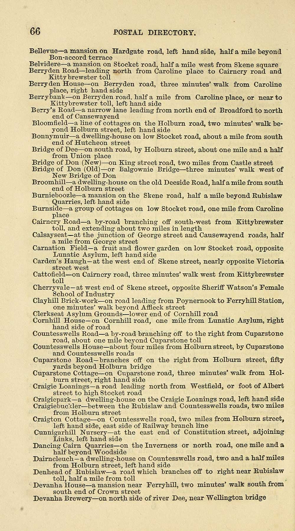
66 POSTAL DIRECTORY.
Bellevue— a mansion on Hardgate road, left hand side, half a mile beyond
Bon-accord terrace
Belvidere— a mansion on Stocket road, half a mile west from Skene square
Berryden Road — leading north, from CaroUne place to Cairncry road and
Kitty brewster toll
Berryden House — on Berryden road, three minutes' walk from Caroline
place, right hand side
Berrybank — on Berryden road, half a mile from Caroline place, or near to
Kitty brewster toll, left hand side
Berry's Road— a narrow lane leading from nortli end of Broadford to north
end of Cansewayend
Bloomfield — a line of cottages on the Holburn road, two minutes' walk be-
yond Holburn street, left hand side
Bonnymuir — a dwelUng-house on low Stocket road, about a mUe from south
end of Hutcheon street
Bridge of Dee — on south road, by Holburn street, about one mile and a half
from Union place
Bridge of Don (New) — on King street road, two miles from Castle street
Bridge of Don (Old) — or Balgownie Bridge — ^three minutes' walk west of
New Bridge of Don
Broomhill — a dwelling-house on the old Deeside Road, half a mile from south
end of Holburn street
Bumieboozle— a mansion on the Skene road, half a mile beyond Rubislaw
Quarries, left hand side
Eumside — a group of cottages on low Stocket road, one mile from Caroline
place
Cairncry Road — a by-road branching off south-west from Kittybrewster
toll, and extending about two miles in length
Calsayseat— at the junction of George street and Causewayend roads, half
a mile from George street
Carnation Field— a fruit and flower garden on low Stocket road, opposite
Lunatic Asylum, left hand side
Carden's Haugh— at the west end of Skene street, nearly opposite Victoria
street west
Cattofield — on Cairncry road, three minutes' walk west from Kittybrewster
toU
Cherryvale— at west end of Skene street, opposite Sheriff "Watson's Female
School of Industry
Clayhill Brick-work — on road leading from Poynernook to Ferryhill Station,
one minutes' walk beyond Affleck street
Clerkseat Asylum Grounds — lower end of Cornhill road
Comhill House— on Cornhill road, one mile from Lunatic Asylum, right
hand side of road
Countesswells Road — a by-road branching off to the right from Cuparstone
road, about one mile beyond Cuparstone toll
Countesswells House — aboiit four miles from Holburn street, by Cuparstone
and Countesswells roads
Cuparstone Road— branches off on the right from Holburn street, fifty
yards beyond Holburn bridge
Cuparstone Cottage^-on Cuparstone road, three minutes' walk from Hol-
• burn street, right hand side
Craigie Loanings— a road leading north from Westfield, or foot of Albert
street to high Stocket road
Craigiepark— a dwelling-house on tbe Craigie Loanings road, left hand side
Craigiebuc'-der — between the Rubislaw and Countesswells roads, two miles
from Holburn street
Craigton Cottage — on Countesswells road, two miles from Holburn street,
left hand side, east side of Railway branch line
Cunnigarhill Nursery— at the east end of Constitution street, adjoining
Links, left hand side
Dancing Cairn Quarries — on the Inverness or north road, one mile and a
half beyond Woodside
Daimcleuch— a dwelling-house on Countesswells road, two and a half miles
from Holburn street, left hand side
Denhead of Rubislaw— a road which branches off to right near Rubislaw
toll, half a mile from toll
Devanha House— a mansion near Ferryhill, two minutes' walk south from
south end of Crown street
DevEinha Brewery— on north side of river Dee, near Wellington bridge
Set display mode to: Large image | Transcription
Images and transcriptions on this page, including medium image downloads, may be used under the Creative Commons Attribution 4.0 International Licence unless otherwise stated. ![]()
| Scottish Post Office Directories > Towns > Aberdeen > Post Office Aberdeen directory > 1863-1864 > (70) |
|---|
| Permanent URL | https://digital.nls.uk/84785331 |
|---|
| Description | Post Office Aberdeen directory 1863-64. |
|---|---|
| Shelfmark | Y.54 |
| Additional NLS resources: | |
| Attribution and copyright: |
|
| Description | Annual. 1944/45 not published. |
|---|---|
| Shelfmark | Various |
| Description | Directories of individual Scottish towns and their suburbs. |
|---|
| Description | Around 700 Scottish directories published annually by the Post Office or private publishers between 1773 and 1911. Most of Scotland covered, with a focus on Edinburgh, Glasgow, Dundee and Aberdeen. Most volumes include a general directory (A-Z by surname), street directory (A-Z by street) and trade directory (A-Z by trade). |
|---|