Download files
Complete book:
Individual page:
Thumbnail gallery: Grid view | List view
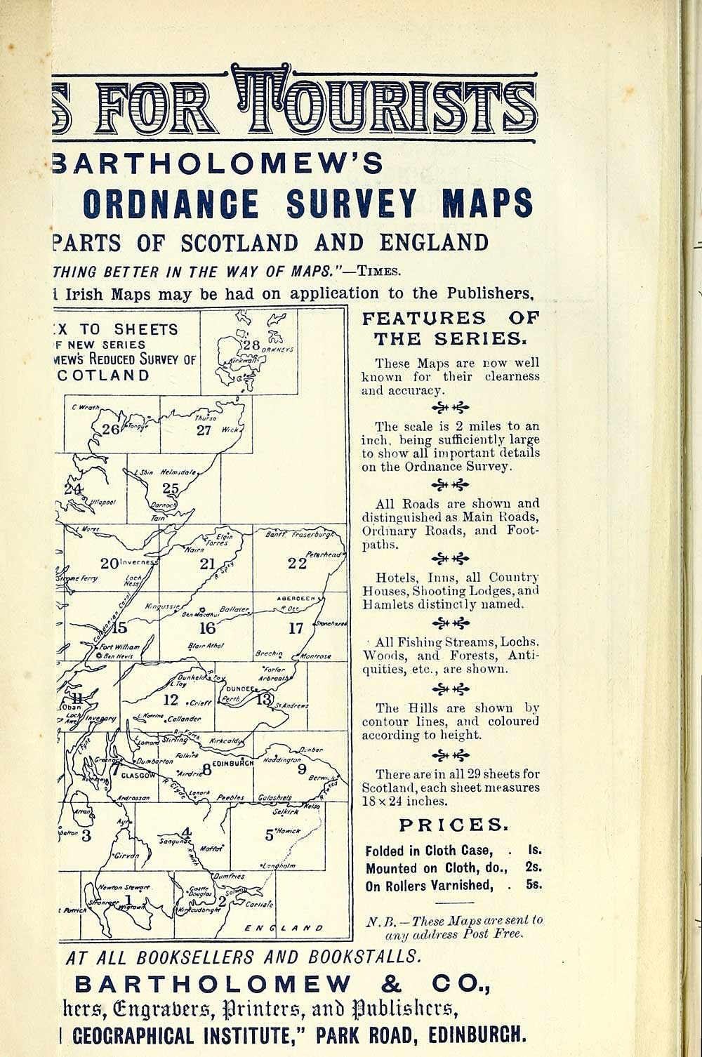
BARTHOLOMEW'S
ORDNANCE SURVEY MAPS
PARTS OF SCOTLAND AND ENGLAND
THING BETTER IN THE WAY OF MAPS."— Twes.
I Irish Maps may be had on application to the Publishers.
FEATURES OP
;X TO SHEETS
F NEW SERIES
VIEWS Reduced Survey of
GOTLAND
THE SERIES.
These Maps are r.ow well
known for their clearness
and accuracy.
^^
The scale is 2 miles to an
inch, being sufficiently large
to show all important details
on the Ordnance Survey.
^^
All Roads are shown and
distinguished as Main Roads,
Ordinary Roads, and Foot-
patlis.
^^
Hotels, Inns, all Country
Houses, Sliooting Lodges, and
Hamlets distinctly named.
■ All Fi.shing Streams, Lochs.
Woods, and Forests, Anti-
quities, etc., are shown.
^^
The Hills are shown by
contour lines, and coloured
according to height.
There are in all 29 sheets for
Scotland, each siieet measures
18x24 inches.
PRICES.
Folded in Cloth Case,
Mounted on Cloth, do.,
On Rollers Varnished, .
Is.
2s.
5s.
iV. B. — These Maps are sent to
ani/ adilress Post Free.
AT ALL BOOKSELLERS AND BOOKSTALLS.
BARTHOLOMEW & CO.,
herjs, (Engraberjs, printers, aiib gubliBhcvs,
I GEOGRAPHICAL INSTITUTE," PARK ROAD, EDINBURGH.
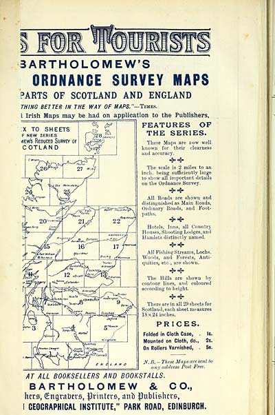
Set display mode to: Large image | Transcription
Images and transcriptions on this page, including medium image downloads, may be used under the Creative Commons Attribution 4.0 International Licence unless otherwise stated. ![]()
| Scottish Post Office Directories > Towns > Glasgow > Post-Office annual Glasgow directory > 1892-1893 > (10) |
|---|
| Permanent URL | https://digital.nls.uk/84659762 |
|---|
| Description | Post-Office annual Glasgow directory 1892-1893 |
|---|---|
| Shelfmark | NH.675-676 |
| Additional NLS resources: | |
| Attribution and copyright: |
|
| Description | Glasgow : Printed by J. Graham for the letter-carriers of the Post-Office, 1828-? Imprint and title vary. [Varying forms of title: Glasgow Post-Office directory, Glasgow Post-Office annual directory, Post Office Glasgow annual directory.] |
|---|---|
| Shelfmark | Various |
| Description | Directories of individual Scottish towns and their suburbs. |
|---|
| Description | Around 700 Scottish directories published annually by the Post Office or private publishers between 1773 and 1911. Most of Scotland covered, with a focus on Edinburgh, Glasgow, Dundee and Aberdeen. Most volumes include a general directory (A-Z by surname), street directory (A-Z by street) and trade directory (A-Z by trade). |
|---|