John (Ian) Bartholomew
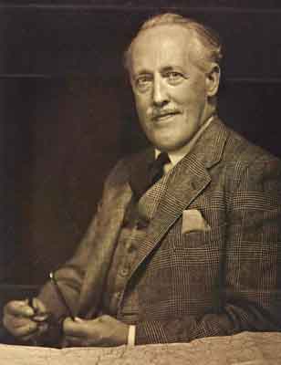
The sudden death of his father, John George, placed the responsibility for the firm on the shoulders of John (Ian) Bartholomew (1890-1962) when he was only 30.
John (Ian) was quick to embrace new technology, adopting photolithography as the firm's main printing technique in 1925. He completed one of Bartholomew’s most celebrated works — the 'Times survey atlas of the world' (1922) — and oversaw the production of the five volumes of 'The Times atlas of the world' mid-century edition (1955-1959). This was the last major work that Bartholomew produced using copperplates.
John (Ian) is perhaps best remembered for designing a number of map projections, contributing to Bartholomew's reputation as an influential and academically rigorous mapmaker.
John (Ian)
Although christened John, to his family he was usually known as 'Ian'. Early letters between his parents reveal that his father, John George, was fondly known as 'Ian' by his wife. It is possible the couple gave John this nickname in remembrance of this.
John (Ian) had a number of nicknames throughout his life. As a very young infant, his parents often referred to him as 'Boy' and, later, Bartholomew's staff called him 'Captain Ian', recognising his wartime military service.
This photo was taken in the mid-1950s, around the same time that John (Ian) was awarded the Scottish Geographical Medal of the Royal Scottish Geographical Society for outstanding work in the field of cartography.
Designing map projections
John (Ian) is perhaps best remembered for designing a number of map projections. This is his re-centred, interrupted sinusoidal map projection, which shows the British Isles towards the centre of the map. The firm used this projection on letterheads and in advertising such as in this example from 1940. These projections contributed to Bartholomew's reputation as an academically rigorous mapmaking firm.
Map of Edinburgh Zoo, 1932
The layout of Edinburgh Zoo was designed by Patrick Geddes and his son-in-law, the architect Frank Mears. The zoo's founder, Thomas Gillespie, favoured open spaces and natural enclosures, rather than the cages of earlier zoos.
John (Ian) produced this attractive map of the zoo's grounds, which is one of his most recognisable contributions to cartography.
'Pearson’s Weekly' signature contest
In 1933, popular magazine 'Pearson’s Weekly' ran a competition, challenging readers to decipher the signatures of famous people. John (Ian) was one of the contributors — his signature is number 15 on the page.
This appears to demonstrate the prominence that maps, and mapmakers, had at this time.
John (Ian) and the First World War
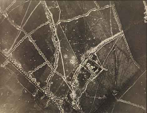
Captain John (Ian) Bartholomew MC was a highly decorated soldier of the First World War. For at least part of the war he worked as an Intelligence Officer which afforded him the privilege of carrying a camera. We do not know if he took these photographs, but he certainly collected them. Aerial photographs were part of his work as a wartime mapmaker.
In the trenches
A view of a trench during First World War. On the reverse someone has written: 'Heine prisoners and Canadians sheltering in a captured trench'.
The photograph belonged to John (Ian) Bartholomew. It is not known if he took this picture.
The John Bartholomew Collection
The Bartholomew family put together an important collection of antiquarian maps and atlases, which is now at the National Library of Scotland. Hand-written notes show that John (Ian) was particularly keen to research the items in the collection. Using "Bart." in a shelfmark search, you will find details of the John Bartholomew Collection in the NLS main catalogue.
This map, from 1566, by Paolo Forlani, is the second ever printed map of North America. It is one of the first maps to show the Bering Strait, called the 'Strait of Anian' on the map — which was an educated guess, because it was not discovered until 1648.


