Unst -- Yetholm
(482) Page 26
Thumbnail gallery: Grid view | List view
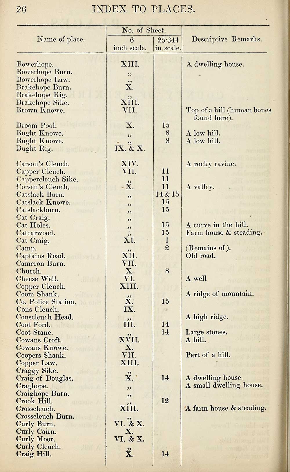
26
INDEX TO PLACES.
Name of place.
Bowerliope.
Bowerhope Burn.
Bowerhope Law.
Brakehope Burn.
Brakehope Rig.
Brakehope Sike.
Brown Knowe.
Broom Pool.
Buoht Knowe.
O
Bught Knowe.
Bught Rig.
Carson’s Cleuch.
Capper Cleuch.
Cappercleuch Sike.
Corson’s Cleuch.
Catslack Burn.
Catslack Knowe.
Catslackhurn.
Cat Craig.
Cat Holes.
Catcarwood.
Cat Craig.
Camp.
Captains Road.
Cameron Burn.
Church.
Cheese Well.
Copper Cleuch.
Coom Shank.
Co. Police Station.
Cons Cleuch.
Conscleuch Head.
Coot Ford.
Coot Stane.
Cowans Croft.
Cowans Knowe.
Coopers Shank.
Copper Law.
Craggy Sike.
Craig of Douglas.
Craghope.
Craighope Burn.
Crook Hill.
Crosscleuch.
Crosscleuch Burn.
Curly Burn.
Curly Cairn.
Curly Moor.
Curly Cleuch.
Craig Hill.
No. of Sheet.
6
inch scale.
25-344
in. scale,
Descriptive Remarks.
XIII.
X.
XIII.
VII.
X.
IX. & X.
XIV.
VII.
99
-X.
XL
99
XII.
VII.
X.
VI.
XIII.
X
IX.
99
III.
XVII.
X.
VII.
XIII.
99
X.'
XIII.
VI. & X.
X.
VI. & X.
>5
X.
15
8
8
11
11
11
14&15
15
15
15
15
1
15
14
14
14
12
14
A dwelling house.
Top of a hill (human bones
found here).
A low hill.
A low hill.
A rocky ravine.
A valley.
A curve in the hill.
Faun house & steading.
(Remains of).
Old road.
A well
A ridge of mountain.
A high ridge.
Large stones.
A hill.
Part of a hill.
A dwelling house
A small dwelling house.
A farm house & steading.
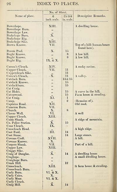
Set display mode to:
![]() Universal Viewer |
Universal Viewer | ![]() Mirador |
Large image | Transcription
Mirador |
Large image | Transcription
Images and transcriptions on this page, including medium image downloads, may be used under the Creative Commons Attribution 4.0 International Licence unless otherwise stated. ![]()
| Ordnance Survey Books of Reference 1855-1882 > Unst -- Yetholm > (482) Page 26 |
|---|
| Permanent URL | https://digital.nls.uk/99377319 |
|---|
| Attribution and copyright: |
|
|---|---|
| Description | These volumes record acreages of fields and land-use information for each parish in Scotland from 1855-1882. They were compiled with the Ordnance Survey 25 inch to the mile maps for that period, which cover all the inhabited parts of Scotland. Numbered land parcels on these maps, listed consecutively within each parish, are included in the relevant parish Book of Reference. |
|---|---|
| Shelfmark | Map.Ref.C18 |
| Additional NLS resources: | |