Melrose -- Muthill
(105) Page 11
Thumbnail gallery: Grid view | List view
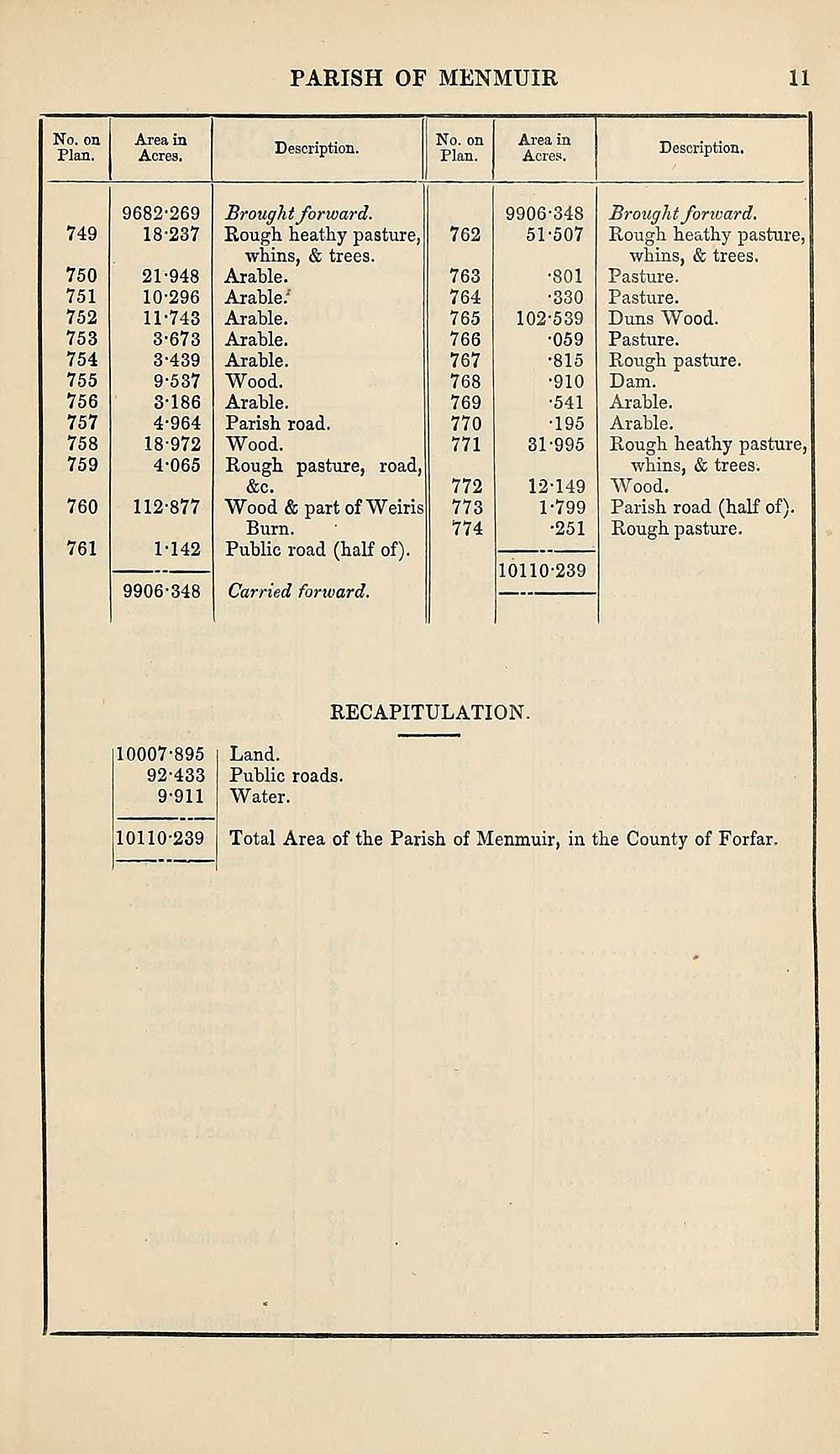
PARISH OF MENMUIR
11
No. on
Plan.
Area in
Acres.
Description.
No. on
Plan.
Area in
Acres.
Description.
749
750
751
752
753
754
755
756
757
758
759
760
761
9682-269
18-237
21-948
10- 296
11- 743
3-673
3-439
9-537
3- 186
4- 964
18-972
4-065
112-877
1-142
9906-348
Brought forward.
Rough heathy pasture,
whins, & trees.
Arable.
Arable/
Arable.
Arable.
Arable.
Wood.
Arable.
Parish road.
Wood.
Rough pasture, road,
&c.
Wood & part of Weiris
Burn.
Public road (half of).
Carried fonvard.
762
763
764
765
766
767
768
769
770
771
772
773
774
9906-348
51-507
•801
•330
102-539
•059
•815
•910
•541
•195
31-995
12-149
1-799
•251
10110-239
Brought forward.
Rough heathy pasture,
whins, & trees.
Pasture.
Pasture.
Duns Wood.
Pasture.
Rough pasture.
Dam.
Arable.
Arable.
Rough heathy pasture,
whins, & trees.
Wood.
Parish road (half of).
Rough pasture.
RECAPITULATION.
10007-895
92-433
9-911
10110-239
Land.
Public roads.
Water.
Total Area of the Parish of Menmuir, in the County of Forfar.
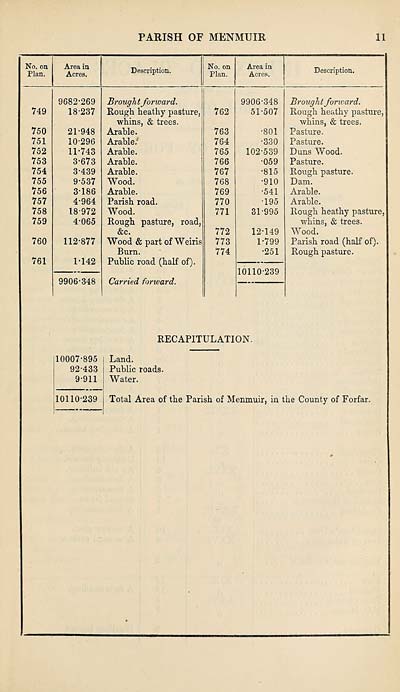
Set display mode to:
![]() Universal Viewer |
Universal Viewer | ![]() Mirador |
Large image | Transcription
Mirador |
Large image | Transcription
Images and transcriptions on this page, including medium image downloads, may be used under the Creative Commons Attribution 4.0 International Licence unless otherwise stated. ![]()
| Ordnance Survey Books of Reference 1855-1882 > Melrose -- Muthill > (105) Page 11 |
|---|
| Permanent URL | https://digital.nls.uk/99327651 |
|---|
| Attribution and copyright: |
|
|---|---|
| Description | These volumes record acreages of fields and land-use information for each parish in Scotland from 1855-1882. They were compiled with the Ordnance Survey 25 inch to the mile maps for that period, which cover all the inhabited parts of Scotland. Numbered land parcels on these maps, listed consecutively within each parish, are included in the relevant parish Book of Reference. |
|---|---|
| Shelfmark | Map.Ref.C18 |
| Additional NLS resources: | |