Logie -- Meldrum
(600) Page 14
Thumbnail gallery: Grid view | List view
14
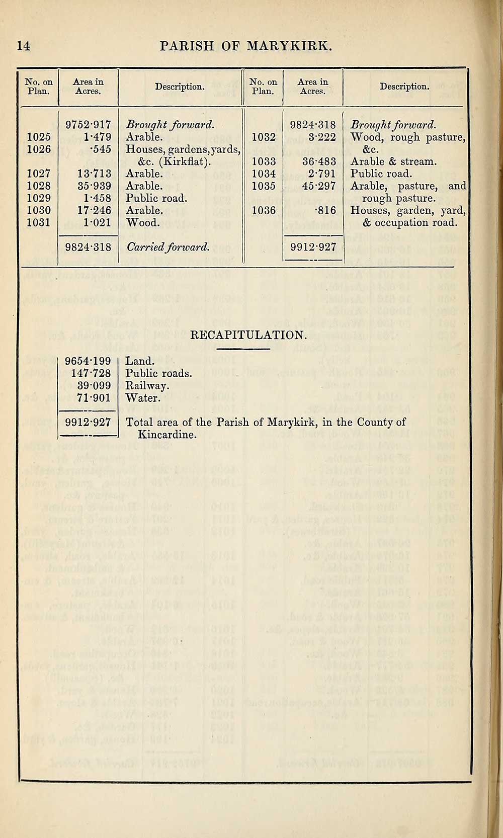
PARISH OF MARYKIRK.
No. on
Plan.
Area in
Acres.
Description.
No. on
Plan.
Area in
Acres.
Description.
1025
1026
1027
1028
1029
1030
1031
9752-917
1-479
•545
13-713
35-939
1-458
17-246
1-021
9824-318
Brought forward.
Arable.
Houses, gardens,yards,
&c. (Kirkflat).
Arable.
Arable.
Public road.
Arable.
Wood.
Carried forward.
1032
1033
1034
1035
1036
9824-318
3-222
36-483
2-791
45-297
•816
9912-927
Brought forward.
Wood, rough pasture,
&c.
Arable & stream.
Public road.
Arable, pasture, and
rough pasture.
Houses, garden, yard,
& occupation road.
RECAPITULATION.
9654-199
147-728
39-099
71-901
9912-927
Land.
Public roads.
Railway.
Water.
Total area of the Parish of Marykirk, in the County of
Kincardine.
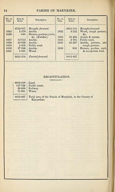
Set display mode to:
![]() Universal Viewer |
Universal Viewer | ![]() Mirador |
Large image | Transcription
Mirador |
Large image | Transcription
Images and transcriptions on this page, including medium image downloads, may be used under the Creative Commons Attribution 4.0 International Licence unless otherwise stated. ![]()
| Ordnance Survey Books of Reference 1855-1882 > Logie -- Meldrum > (600) Page 14 |
|---|
| Permanent URL | https://digital.nls.uk/99325475 |
|---|
| Attribution and copyright: |
|
|---|---|
| Description | These volumes record acreages of fields and land-use information for each parish in Scotland from 1855-1882. They were compiled with the Ordnance Survey 25 inch to the mile maps for that period, which cover all the inhabited parts of Scotland. Numbered land parcels on these maps, listed consecutively within each parish, are included in the relevant parish Book of Reference. |
|---|---|
| Shelfmark | Map.Ref.C18 |
| Additional NLS resources: | |