Kilmartin -- Kinclaven
(607) Explanatory remarks
Thumbnail gallery: Grid view | List view
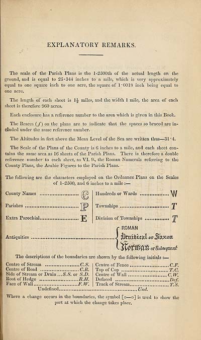
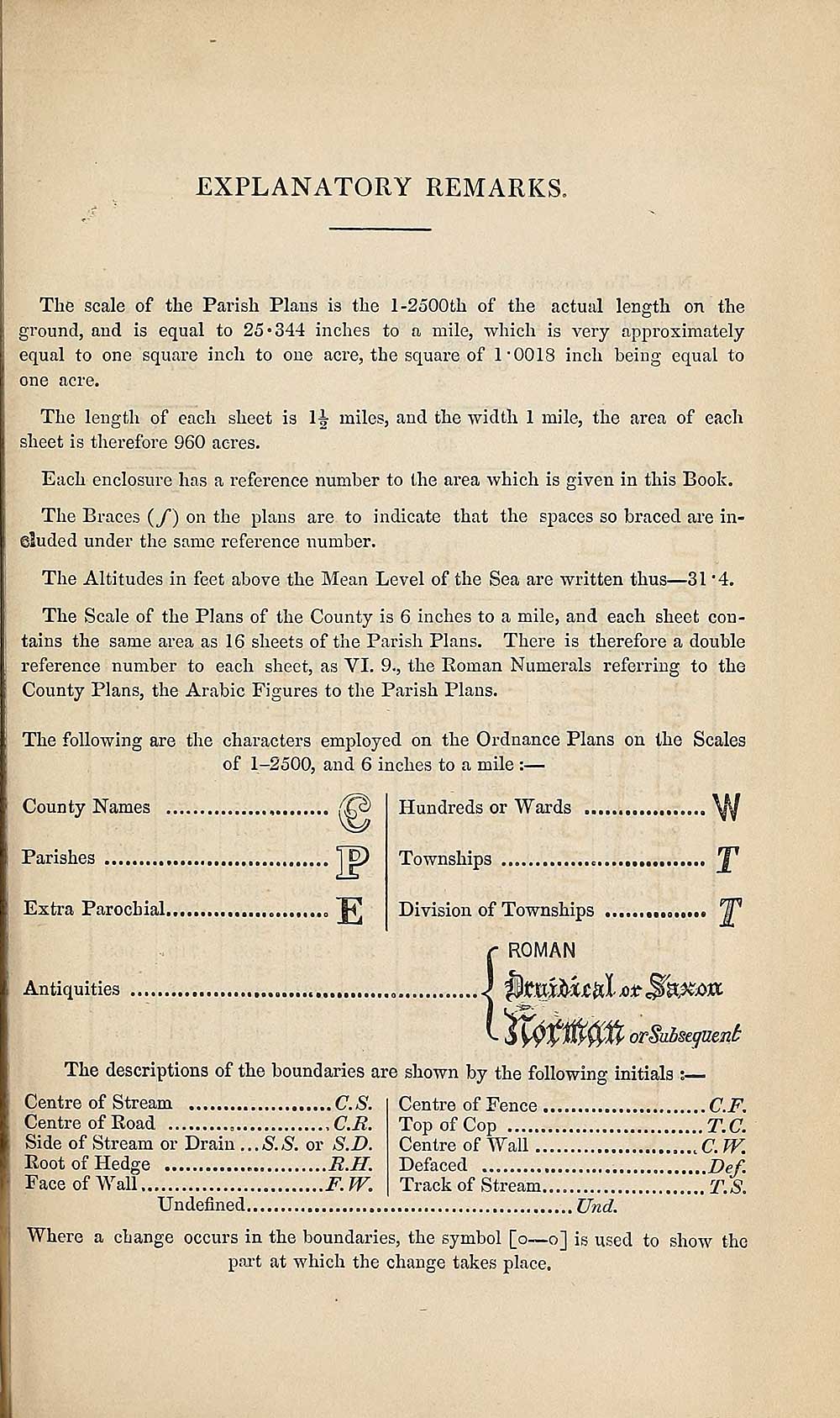
EXPLANATORY REMARKS,
The scale of the Parish Plans is the 1-2500th of the actual length on the
ground, and is equal to 25 • 344 inches to a mile, which is very approximately
equal to one square inch to one acre, the square of 1*0018 inch being equal to
one acre.
The length of each sheet is H miles, and the width 1 mile, the area of each
sheet is therefore 960 acres.
Each enclosure has a reference number to the area which is given in this Book.
The Braces {/) on the plans are to indicate that the spaces so braced are in-
eluded under the same reference number.
The Altitudes in feet above the Mean Level of the Sea are written thus—31 *4.
The Scale of the Plans of the County is 6 inches to a mile, and each sheet con¬
tains the same area as 16 sheets of the Parish Plans. There is therefore a double
reference number to each sheet, as YI. 9., the Roman Numerals referring to the
County Plans, the Arabic Figures to the Parish Plans.
The following are the characters employed on the Ordnance Plans on the Scales
of 1-2500, and 6 inches to a mile :—
County Names
Parishes IE
Extra Parochial.
Hundreds or Wards
Townships
Division of Townships
ROMAN
Antiquities
orSubseguent
The descriptions of the boundaries are shown by the following initials :■
Centre of Stream C.S.
Centre of Road C.R.
Side of Stream or Drain ...S.S. or S.D.
Root of Hedge R.H.
Face of Wall F. JY.
Centre of Fence C.F.
Top of Cop T.C.
Centre of Wall C. JY.
Defaced Def.
Track of Stream.... T.S.
Undefined Und.
Where a change occurs in the boundaries, the symbol [o—o] is used to show the
part at which the change takes place.
Set display mode to:
![]() Universal Viewer |
Universal Viewer | ![]() Mirador |
Large image | Transcription
Mirador |
Large image | Transcription
Images and transcriptions on this page, including medium image downloads, may be used under the Creative Commons Attribution 4.0 International Licence unless otherwise stated. ![]()
| Ordnance Survey Books of Reference 1855-1882 > Kilmartin -- Kinclaven > (607) Explanatory remarks |
|---|
| Permanent URL | https://digital.nls.uk/99302795 |
|---|
| Attribution and copyright: |
|
|---|---|
| Description | These volumes record acreages of fields and land-use information for each parish in Scotland from 1855-1882. They were compiled with the Ordnance Survey 25 inch to the mile maps for that period, which cover all the inhabited parts of Scotland. Numbered land parcels on these maps, listed consecutively within each parish, are included in the relevant parish Book of Reference. |
|---|---|
| Shelfmark | Map.Ref.C18 |
| Additional NLS resources: | |