Glenisla -- Jura
(271) Page 13
Thumbnail gallery: Grid view | List view
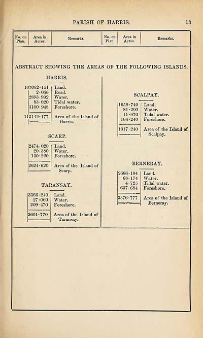
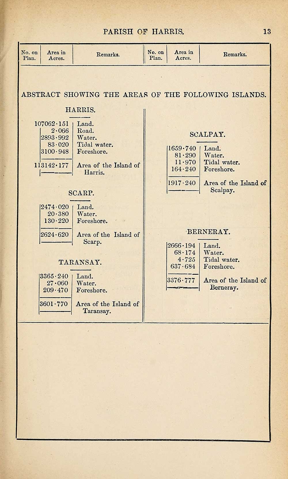
PARISH OF HARRIS.
13
No. on Area in
Plan. Acres.
Remarks.
No. on Area in
Plan. Acres.
Remarks.
ABSTRACT SHOWING THE AREAS OF THE FOLLOWING ISLANDS.
HARRIS.
107062-151
2-066
2893-992
83■020
3100-948
113142-177
Land.
Road.
Water.
Tidal water.
Foreshore.
Area of the Island of
Harris.
SCARP.
2474-020
20-380
130-220
2624-620
Land.
Water.
Foreshore.
Area of the
Scarp.
Island of
TARANSAY.
3365-240
27-060
209-470
3601-770
Land.
Water.
Foreshore.
Area of the Island of
Taransay.
SOALPAY.
1659-740
81-290
11-970
164-240
1917-240
Land.
W ater.
Tidal water.
Foreshore.
Area of the Island of
Scalpay.
BERNERAY.
2666-194
68-174
4-725
637-684
3376-777
Land.
Water.
Tidal water.
Foreshore.
Area of the Island of
Berneray.
Set display mode to:
![]() Universal Viewer |
Universal Viewer | ![]() Mirador |
Large image | Transcription
Mirador |
Large image | Transcription
Images and transcriptions on this page, including medium image downloads, may be used under the Creative Commons Attribution 4.0 International Licence unless otherwise stated. ![]()
| Ordnance Survey Books of Reference 1855-1882 > Glenisla -- Jura > (271) Page 13 |
|---|
| Permanent URL | https://digital.nls.uk/99283371 |
|---|
| Attribution and copyright: |
|
|---|---|
| Description | These volumes record acreages of fields and land-use information for each parish in Scotland from 1855-1882. They were compiled with the Ordnance Survey 25 inch to the mile maps for that period, which cover all the inhabited parts of Scotland. Numbered land parcels on these maps, listed consecutively within each parish, are included in the relevant parish Book of Reference. |
|---|---|
| Shelfmark | Map.Ref.C18 |
| Additional NLS resources: | |