Eday -- Forfar
(527) Page 17
(528) next ›››
Agents for the sale of the ordnance plans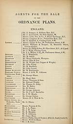
Download files
Complete book:
Individual page:
Thumbnail gallery: Grid view | List view

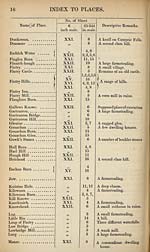
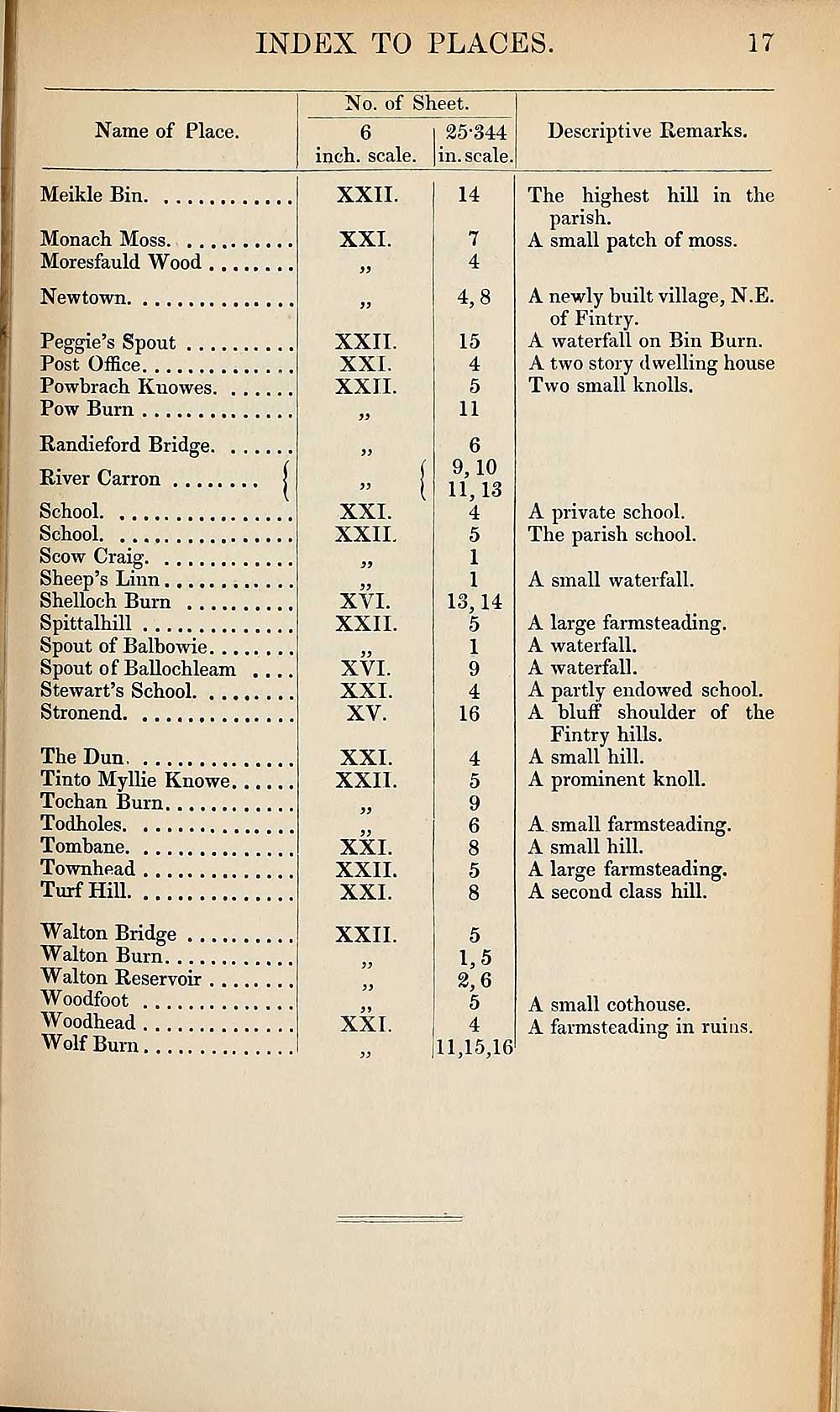
INDEX TO PLACES.
17
Name of Place.
No. of Sheet.
6
inch, scale.
25-344
in. scale.
Descriptive Remarks.
Meikle Bin
Monach Moss
Moresfauld Wood
Newtown
Peggie’s Spout
Post Office
Powbrach Knowes
Pow Bum
Randieford Bridge
River Carr on j
School
School
Scow Craig
Sheep’s Linn
Shelloch Burn
Spittalhill
Spout of Balbowie
Spout of Ballochleam . ...
Stewart’s School
Stronend
The Dun
Tinto Myllie Knowe. .....
Tochan Burn
Todholes
Tombane
Townhead
Turf Hill
Walton Bridge
Walton Bum
Walton Reservoir
Woodfoot
Woodhead
Wolf Burn
XXII.
XXI.
XXII.
XXI.
XXII.
XXI.
XXII.
XYI.
XXII.
XVI.
XXI.
XV.
XXL
XXII.
XXI.
XXII.
XXL
XXII.
XXL
14
7
4
4,8
15
4
5
11
6
9,10
11.13
4
5
1
1
13.14
5
1
9
4
16
4
5
9
6
8
5
8
5
1.5
2.6
5
, 4
ill,15,16
The highest hill in the
parish.
A small patch of moss.
A newly built village, N.E.
of Fintry.
A waterfall on Bin Bum.
A two story dwelling house
Two small knolls.
A private school.
The parish school.
A small waterfall.
A large farmsteading.
A waterfall.
A waterfall.
A partly endowed school.
A bluff shoulder of the
Fintry hills.
A small hill.
A prominent knoll.
A small farmsteading.
A small hill.
A large farmsteading.
A second class hill.
A small cothouse.
A farmsteading in ruins.
Set display mode to:
![]() Universal Viewer |
Universal Viewer | ![]() Mirador |
Large image | Transcription
Mirador |
Large image | Transcription
Images and transcriptions on this page, including medium image downloads, may be used under the Creative Commons Attribution 4.0 International Licence unless otherwise stated. ![]()
| Ordnance Survey Books of Reference 1855-1882 > Eday -- Forfar > (527) Page 17 |
|---|
| Permanent URL | https://digital.nls.uk/99270667 |
|---|
| Attribution and copyright: |
|
|---|---|
| Description | These volumes record acreages of fields and land-use information for each parish in Scotland from 1855-1882. They were compiled with the Ordnance Survey 25 inch to the mile maps for that period, which cover all the inhabited parts of Scotland. Numbered land parcels on these maps, listed consecutively within each parish, are included in the relevant parish Book of Reference. |
|---|---|
| Shelfmark | Map.Ref.C18 |
| Additional NLS resources: | |