Drymen -- Eckford
(431) Page 29
![[Page 30]Auchterarder (detached)](https://deriv.nls.uk/dcn4/9926/99261725.4.jpg)
Download files
Complete book:
Individual page:
Thumbnail gallery: Grid view | List view
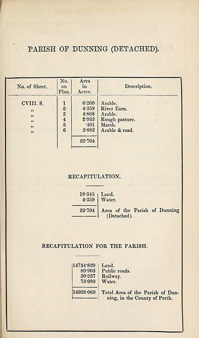
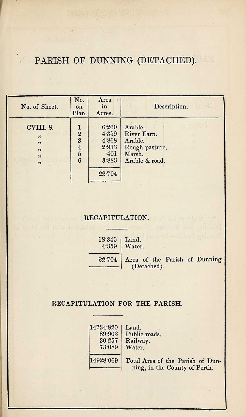
PARISH OF DUNNING (DETACHED)
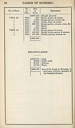
No. of Sheet.
No.
on
Plan.
Area
in
Acres.
Description.
CVIII. 8.
6-260
4-359
4-868
2- 933
•401
3- 883
Arable.
River Earn.
Arable.
Rough pasture.
Marsh.
Arable & road.
22-704
RECAPITULATION.
18-345
4*359
22*704
Land.
Water.
Area of the Parish of Dunning
(Detached).
RECAPITULATION FOR THE PARISH.
14734-820
89-903
30-257
73-089
14928-069
Land.
Public roads.
Railway.
Water.
Total Area of the Parish of Dun¬
ning, in the County of Perth.
Set display mode to:
![]() Universal Viewer |
Universal Viewer | ![]() Mirador |
Large image | Transcription
Mirador |
Large image | Transcription
Images and transcriptions on this page, including medium image downloads, may be used under the Creative Commons Attribution 4.0 International Licence unless otherwise stated. ![]()
| Ordnance Survey Books of Reference 1855-1882 > Drymen -- Eckford > (431) Page 29 |
|---|
| Permanent URL | https://digital.nls.uk/99261711 |
|---|
| Attribution and copyright: |
|
|---|---|
| Description | These volumes record acreages of fields and land-use information for each parish in Scotland from 1855-1882. They were compiled with the Ordnance Survey 25 inch to the mile maps for that period, which cover all the inhabited parts of Scotland. Numbered land parcels on these maps, listed consecutively within each parish, are included in the relevant parish Book of Reference. |
|---|---|
| Shelfmark | Map.Ref.C18 |
| Additional NLS resources: | |