Abbey -- Ardclach
(24) [Page 14] - Parish of Low Church
![[Page 15]Parish of Abbey](https://deriv.nls.uk/dcn4/9920/99207449.4.jpg)
Download files
Complete book:
Individual page:
Thumbnail gallery: Grid view | List view
![(24) [Page 14] - Parish of Low Church](https://deriv.nls.uk/dcn17/9920/99207437.17.jpg)
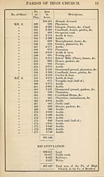
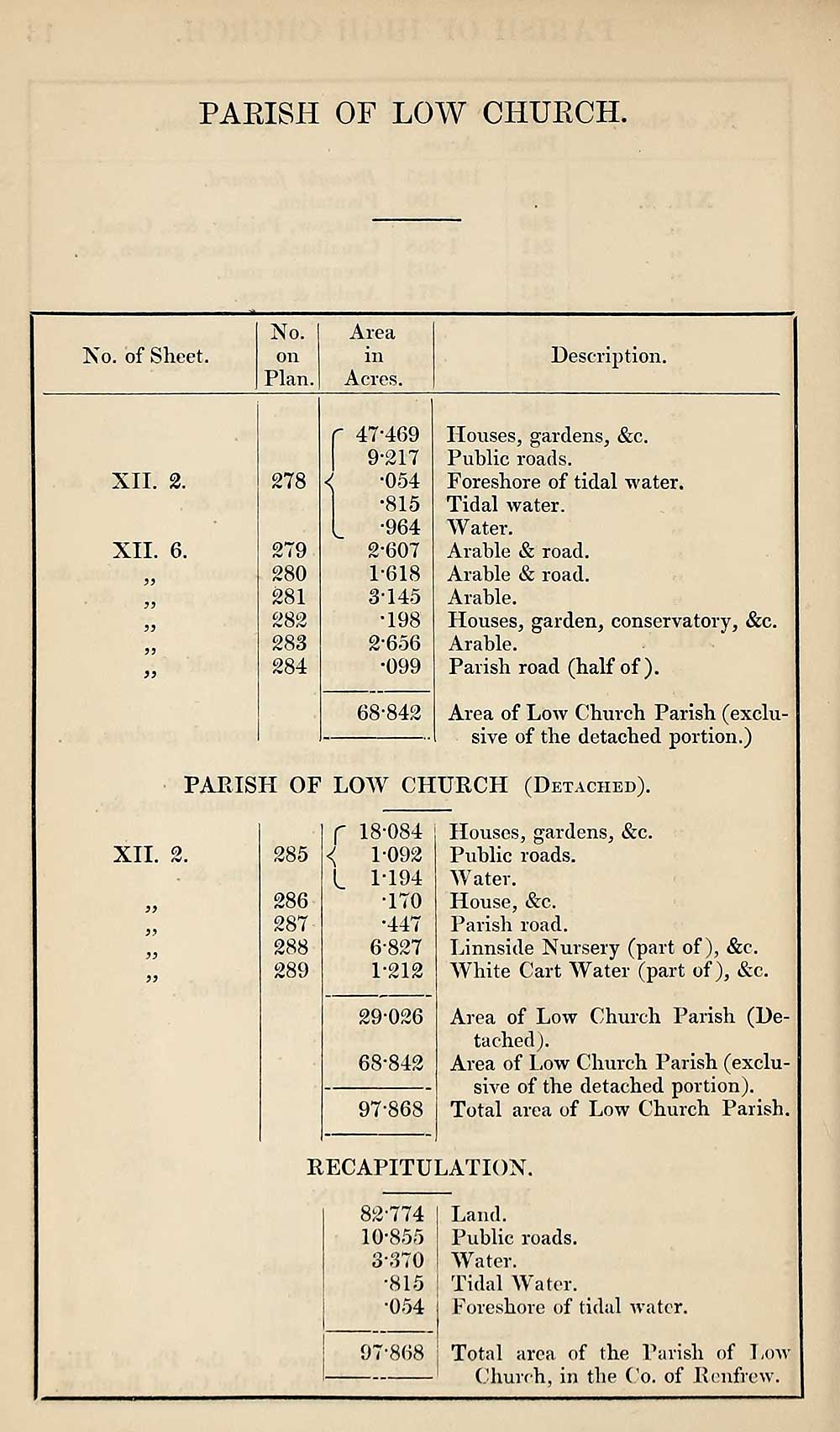
PARISH OF LOW CHURCH
No. of Sheet.
No.
on
Plan.
Area
in
Acres.
Description.
XII. 2.
XII. 6.
5J
278
279
280
281
282
283
284
47*469
9-217
•054
•815
•964
2- 607
1-618
3- 145
•198
2’656
•099
68-842
Houses, gardens, &c.
Public roads.
Foreshore of tidal water.
Tidal water.
W ater.
Arable & road.
Arable & road.
Arable.
Houses, garden, conservatory, &c.
Arable.
Parish road (half of).
Area of Low Church Parish (exclu¬
sive of the detached portion.)
PARISH OF LOW CHURCH (Detached).
XII. 2.
9)
285
286
287
288
289
18-084
1-092
1-194
•170
•447
6-827
1-212
29-026
68-842
97-868
Houses, gardens, &c.
Public roads.
Water.
House, &c.
Parish road.
Linnside Nursery (part of), &c.
White Cart Water (part of), &c.
Area of Low Church Parish (De¬
tached ).
Area of Low Church Parish (exclu¬
sive of the detached portion).
Total area of Low Church Parish.
RECAPITULATION.
82-774
10-855
3-370
•815
•054
97-868
Land.
Public roads.
Water.
Tidal Water.
Foreshore of tidal water.
Total area of the Parish of Low-
Church, in the Co. of Renfrew.
Set display mode to:
![]() Universal Viewer |
Universal Viewer | ![]() Mirador |
Large image | Transcription
Mirador |
Large image | Transcription
Images and transcriptions on this page, including medium image downloads, may be used under the Creative Commons Attribution 4.0 International Licence unless otherwise stated. ![]()
| Ordnance Survey Books of Reference 1855-1882 > Abbey -- Ardclach > (24) [Page 14] - Parish of Low Church |
|---|
| Permanent URL | https://digital.nls.uk/99207435 |
|---|
| Attribution and copyright: |
|
|---|---|
| Description | These volumes record acreages of fields and land-use information for each parish in Scotland from 1855-1882. They were compiled with the Ordnance Survey 25 inch to the mile maps for that period, which cover all the inhabited parts of Scotland. Numbered land parcels on these maps, listed consecutively within each parish, are included in the relevant parish Book of Reference. |
|---|---|
| Shelfmark | Map.Ref.C18 |
| Additional NLS resources: | |