Lady -- Lochgoilhead
(663) Map - Parish of Lochgoilhead
Thumbnail gallery: Grid view | List view
Stob Liath
Ben Donich
a"277*
\Xar'ewhpar
'ow/wrlutn/.
; Mu Mach
Coire a’ Chuir
fapp
lorn nan
Cam hna
Corr'o w
/Mu I lach
667 A
va.’ ChjaTrj:
Woodli
’p/ 'liftirtiTl'
B ei n n
axtfy
Cruach nam
41886
Miseab
The Saddle
7eoil&(trm
Corrccrt'' \
Tjochanf—V.
Glach"
ffiarrifte
MealT'
.4-74
Daraich
■ig ruv
Vccrcdg
Cccrra-iff fvtrnsJRmt
Toll' nartvMuc
Cruach an
isoi 'L
Dra6hair
Jtzu^imnan/
\JE<rui'
'idWa/SKuLv
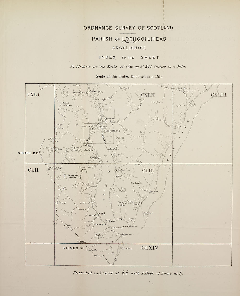
ORDNANCE SURVEY OF SCOTLAND
PARISH of LOCHCOILHEAD
( IP art of)
ARCYLLSHIRE
INDEX TO THE SHEET
Published7 on/ the Scale of
L
2500
on 2S'34f Inches' to a Mile .
Scale of tills index OneInclx to a Mile.
ISLI
B ei or*
f.h arS u i n'n
Bei r ri,
Loci a
HUR PH\X
CLII
Cnoc3»^r»a/
. ^
In c ri'che
^ .4^148
SgcCr Coinnich
C r ira c h
a’ Bhuic
Cj7 u%£. h
E)6hffrxh
C1YXI\
K l LM U N P”
Creacftan Mot
m lb
Pud? lished ini Sheet' at Z/f , }vith I Hoof of Ireas 'at Th,
Ben Donich
a"277*
\Xar'ewhpar
'ow/wrlutn/.
; Mu Mach
Coire a’ Chuir
fapp
lorn nan
Cam hna
Corr'o w
/Mu I lach
667 A
va.’ ChjaTrj:
Woodli
’p/ 'liftirtiTl'
B ei n n
axtfy
Cruach nam
41886
Miseab
The Saddle
7eoil&(trm
Corrccrt'' \
Tjochanf—V.
Glach"
ffiarrifte
MealT'
.4-74
Daraich
■ig ruv
Vccrcdg
Cccrra-iff fvtrnsJRmt
Toll' nartvMuc
Cruach an
isoi 'L
Dra6hair
Jtzu^imnan/
\JE<rui'
'idWa/SKuLv
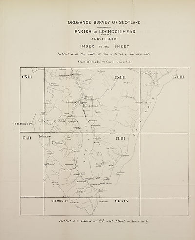
ORDNANCE SURVEY OF SCOTLAND
PARISH of LOCHCOILHEAD
( IP art of)
ARCYLLSHIRE
INDEX TO THE SHEET
Published7 on/ the Scale of
L
2500
on 2S'34f Inches' to a Mile .
Scale of tills index OneInclx to a Mile.
ISLI
B ei or*
f.h arS u i n'n
Bei r ri,
Loci a
HUR PH\X
CLII
Cnoc3»^r»a/
. ^
In c ri'che
^ .4^148
SgcCr Coinnich
C r ira c h
a’ Bhuic
Cj7 u%£. h
E)6hffrxh
C1YXI\
K l LM U N P”
Creacftan Mot
m lb
Pud? lished ini Sheet' at Z/f , }vith I Hoof of Ireas 'at Th,
Set display mode to:
![]() Universal Viewer |
Universal Viewer | ![]() Mirador |
Large image | Transcription
Mirador |
Large image | Transcription
Images and transcriptions on this page, including medium image downloads, may be used under the Creative Commons Attribution 4.0 International Licence unless otherwise stated. ![]()
| Ordnance Survey Books of Reference 1855-1882 > Lady -- Lochgoilhead > (663) Map - Parish of Lochgoilhead |
|---|
| Permanent URL | https://digital.nls.uk/136090115 |
|---|
| Attribution and copyright: |
|
|---|---|
| Description | These volumes record acreages of fields and land-use information for each parish in Scotland from 1855-1882. They were compiled with the Ordnance Survey 25 inch to the mile maps for that period, which cover all the inhabited parts of Scotland. Numbered land parcels on these maps, listed consecutively within each parish, are included in the relevant parish Book of Reference. |
|---|---|
| Shelfmark | Map.Ref.C18 |
| Additional NLS resources: | |