Kinellar -- Knockando
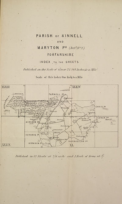
(234) Map - Parish of Kinnell, Farnell (Detached), and Maryton
Thumbnail gallery: Grid view | List view

*
PARISH of KIN NELL
AND
MARYTON P? (MtZmz)
FORFARSHIRE
INDEX ,T0 THE SHEETS
PicblisTi^&d/ the/Scale, of 2T00 or 2S-544-Jnscfaes£o cvMiZt^
Scale of fills Index One Inch to a,Mile
IhblLshecls
ift JJ Sh eet# cut
2/6 each' a tut I Book'' of Areas at 2f
PARISH of KIN NELL
AND
MARYTON P? (MtZmz)
FORFARSHIRE
INDEX ,T0 THE SHEETS
PicblisTi^&d/ the/Scale, of 2T00 or 2S-544-Jnscfaes£o cvMiZt^
Scale of fills Index One Inch to a,Mile
IhblLshecls
ift JJ Sh eet# cut
2/6 each' a tut I Book'' of Areas at 2f
Set display mode to:
![]() Universal Viewer |
Universal Viewer | ![]() Mirador |
Large image | Transcription
Mirador |
Large image | Transcription
Images and transcriptions on this page, including medium image downloads, may be used under the Creative Commons Attribution 4.0 International Licence unless otherwise stated. ![]()
| Ordnance Survey Books of Reference 1855-1882 > Kinellar -- Knockando > (234) Map - Parish of Kinnell, Farnell (Detached), and Maryton |
|---|
| Permanent URL | https://digital.nls.uk/136088493 |
|---|
| Attribution and copyright: |
|
|---|---|

