Kinellar -- Knockando
(200) Map - Parish of Kinnaird
Thumbnail gallery: Grid view | List view
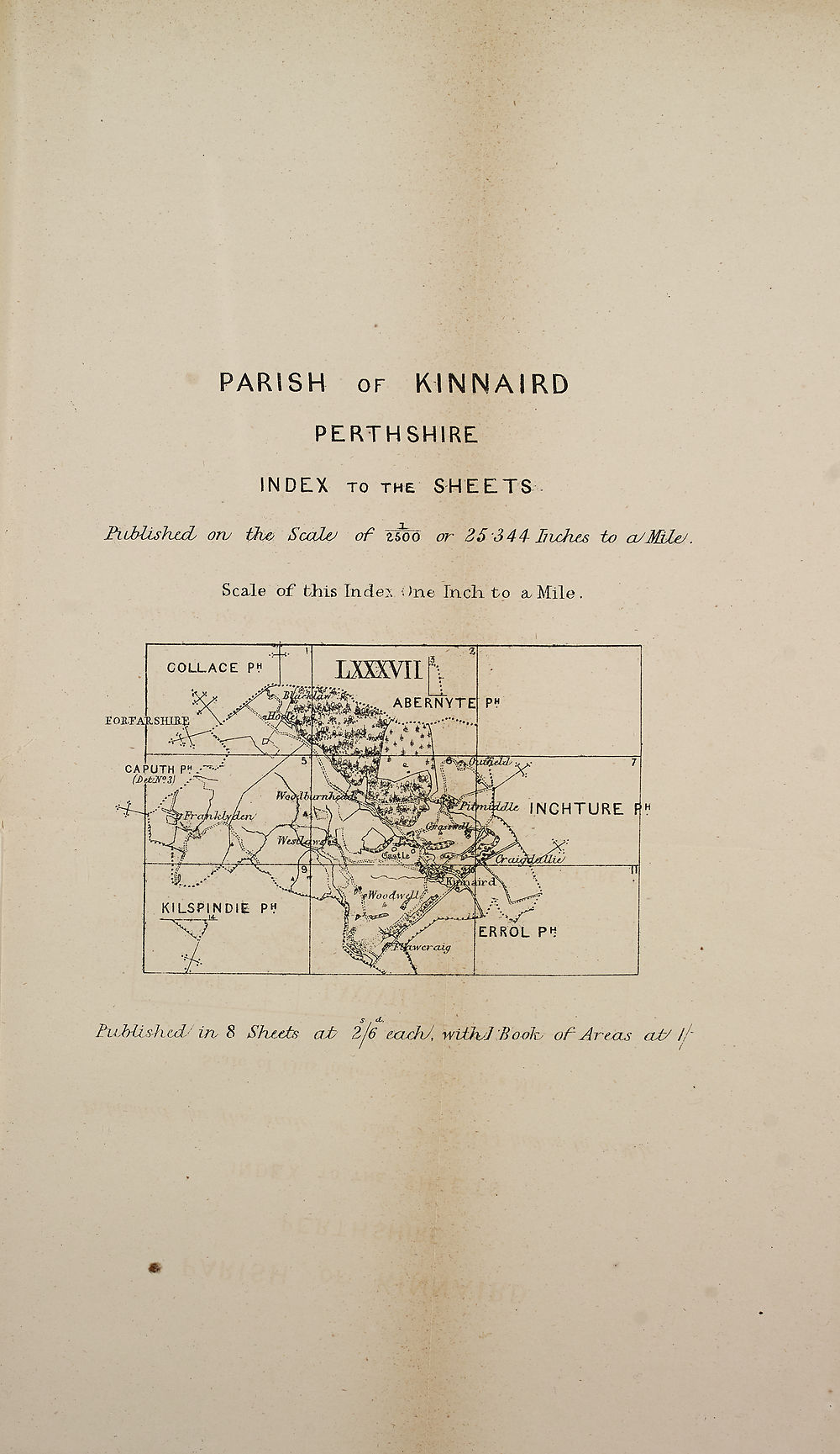
PARISH of KINNAIRD
PERTHSHIRE
INDEX TO THE SHEETS
PiMisKuL orv ih# Scaly of zsoo or 25 344 Inches to a/MIes
Scale of this Index One Inch, to a Mile.
IiLbUshcd/ ire 8 SIvlcIs al 2 6 cctchJ, wifhyJBooJc of Arens cut/ //
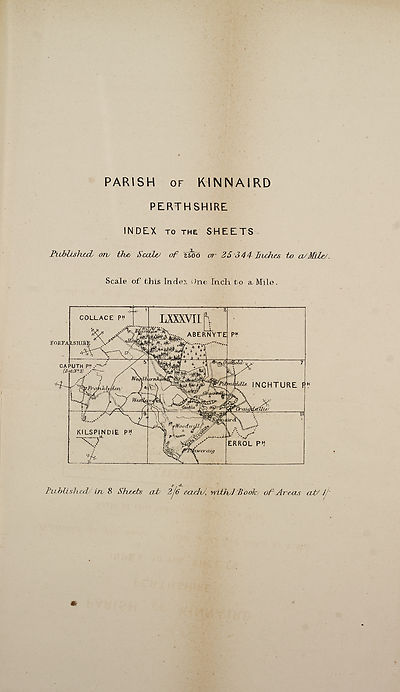
PERTHSHIRE
INDEX TO THE SHEETS
PiMisKuL orv ih# Scaly of zsoo or 25 344 Inches to a/MIes
Scale of this Index One Inch, to a Mile.
IiLbUshcd/ ire 8 SIvlcIs al 2 6 cctchJ, wifhyJBooJc of Arens cut/ //
Set display mode to:
![]() Universal Viewer |
Universal Viewer | ![]() Mirador |
Large image | Transcription
Mirador |
Large image | Transcription
Images and transcriptions on this page, including medium image downloads, may be used under the Creative Commons Attribution 4.0 International Licence unless otherwise stated. ![]()
| Ordnance Survey Books of Reference 1855-1882 > Kinellar -- Knockando > (200) Map - Parish of Kinnaird |
|---|
| Permanent URL | https://digital.nls.uk/136088445 |
|---|
| Attribution and copyright: |
|
|---|---|
| Description | These volumes record acreages of fields and land-use information for each parish in Scotland from 1855-1882. They were compiled with the Ordnance Survey 25 inch to the mile maps for that period, which cover all the inhabited parts of Scotland. Numbered land parcels on these maps, listed consecutively within each parish, are included in the relevant parish Book of Reference. |
|---|---|
| Shelfmark | Map.Ref.C18 |
| Additional NLS resources: | |