Nairn -- Rathen
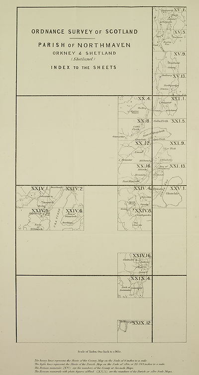
(217) Map - Parish of Northmaven
Download files
Complete book:
Individual page:
Thumbnail gallery: Grid view | List view

Scale of Index, One Inch to a Mile.
lha heavy line# represent the Sheets of the County Map on the Scale of 6 inches to a/ mile'.
The Tight Tines represent the Sheets of theSParislv Map on the Scale of tfoo, or 25:344-itiches to a mile.
The Homan numerals (X V) are The numbers o f the County or Six-inch/ Maps.
The Homan numerals with pTuin -figures afftxed (XV. 1) are the mimhers of the' Parish or 26<To Scale Maps.
Set display mode to:
![]() Universal Viewer |
Universal Viewer | ![]() Mirador |
Large image | Transcription
Mirador |
Large image | Transcription
Images and transcriptions on this page, including medium image downloads, may be used under the Creative Commons Attribution 4.0 International Licence unless otherwise stated. ![]()
| Ordnance Survey Books of Reference 1855-1882 > Nairn -- Rathen > (217) Map - Parish of Northmaven |
|---|
| Permanent URL | https://digital.nls.uk/136086561 |
|---|
| Attribution and copyright: |
|
|---|---|

