Rathven -- Ruthven
(431) Map - Parish of Rothes
Download files
Complete book:
Individual page:
Thumbnail gallery: Grid view | List view
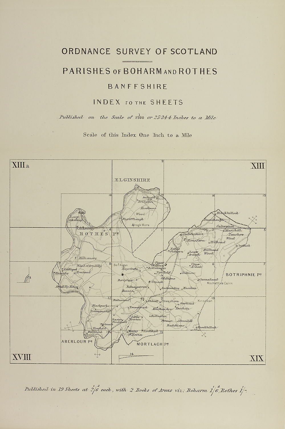
ORDNANCE SURVEY OF SCOTLAND
PARISHES of BOHARM and ROTHES
BANFFSHIRE
INDEX ro the SHEETS
IhcUbish&L
on the Scale' of 2500 or' Zd 344' Inches to a 2fi/c
Scale of tMs Index One Ineli to a Hilo
Jhiblished'trc 29 Sh eets ccb 2Je each , wtih
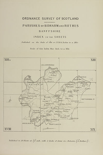
PARISHES of BOHARM and ROTHES
BANFFSHIRE
INDEX ro the SHEETS
IhcUbish&L
on the Scale' of 2500 or' Zd 344' Inches to a 2fi/c
Scale of tMs Index One Ineli to a Hilo
Jhiblished'trc 29 Sh eets ccb 2Je each , wtih
Set display mode to:
![]() Universal Viewer |
Universal Viewer | ![]() Mirador |
Large image | Transcription
Mirador |
Large image | Transcription
Images and transcriptions on this page, including medium image downloads, may be used under the Creative Commons Attribution 4.0 International Licence unless otherwise stated. ![]()
| Ordnance Survey Books of Reference 1855-1882 > Rathven -- Ruthven > (431) Map - Parish of Rothes |
|---|
| Permanent URL | https://digital.nls.uk/136086153 |
|---|
| Attribution and copyright: |
|
|---|---|
| Description | These volumes record acreages of fields and land-use information for each parish in Scotland from 1855-1882. They were compiled with the Ordnance Survey 25 inch to the mile maps for that period, which cover all the inhabited parts of Scotland. Numbered land parcels on these maps, listed consecutively within each parish, are included in the relevant parish Book of Reference. |
|---|---|
| Shelfmark | Map.Ref.C18 |
| Additional NLS resources: | |