Unst -- Yetholm
(351) Map - Parish of Whiteness
Download files
Complete book:
Individual page:
Thumbnail gallery: Grid view | List view
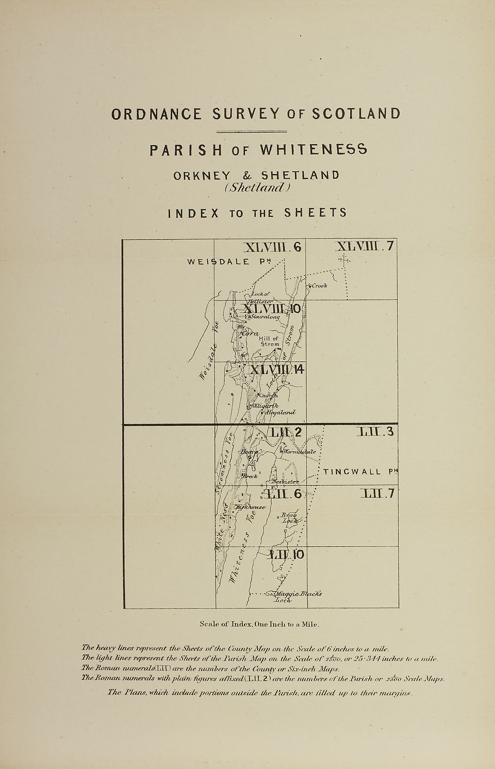
ORDNANCE SURVEY 0FSCOT LAND
PARISH OF WHITENESS
ORKNEY & SHETLAND
(Shetland)
INDEX TO THE S H E E TS
Scale of Judex, One Incli to a Mile.
The heavy lines represent the' Sheets of the County Map on- the Scale off inches to a/ rnile.
The light lines represent the Sheets of the l\irish Jtfap on the Scale of teTTo, or 25*341 inches to a mile.
The Soman mtmeraldXSX) are the numbers of the County or Six-inch Maps.
The Roman numerals with plain, figures affixed (T.TT 2) are the numbers ot the Tarish or tsCo Scale Maps.
The Plans, which uuiude portions outside they Parish, are filled up to their margins.
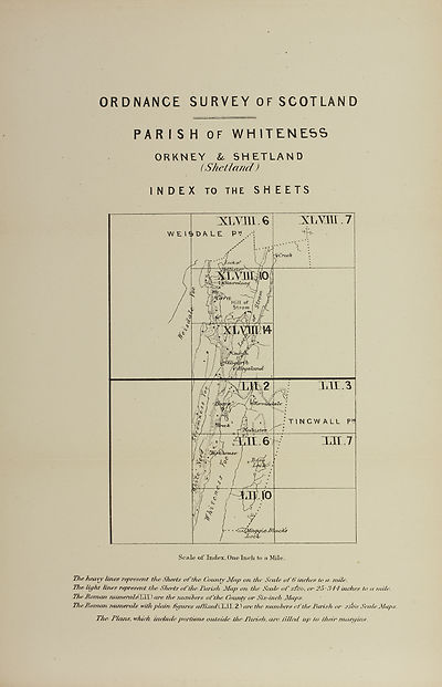
Set display mode to:
![]() Universal Viewer |
Universal Viewer | ![]() Mirador |
Large image | Transcription
Mirador |
Large image | Transcription
Images and transcriptions on this page, including medium image downloads, may be used under the Creative Commons Attribution 4.0 International Licence unless otherwise stated. ![]()
| Ordnance Survey Books of Reference 1855-1882 > Unst -- Yetholm > (351) Map - Parish of Whiteness |
|---|
| Permanent URL | https://digital.nls.uk/136083993 |
|---|
| Attribution and copyright: |
|
|---|---|
| Description | These volumes record acreages of fields and land-use information for each parish in Scotland from 1855-1882. They were compiled with the Ordnance Survey 25 inch to the mile maps for that period, which cover all the inhabited parts of Scotland. Numbered land parcels on these maps, listed consecutively within each parish, are included in the relevant parish Book of Reference. |
|---|---|
| Shelfmark | Map.Ref.C18 |
| Additional NLS resources: | |