Cullen -- Drumoak
(419) Map - Parish of Deerness, Orkney & Shetland (Orkney)
Thumbnail gallery: Grid view | List view
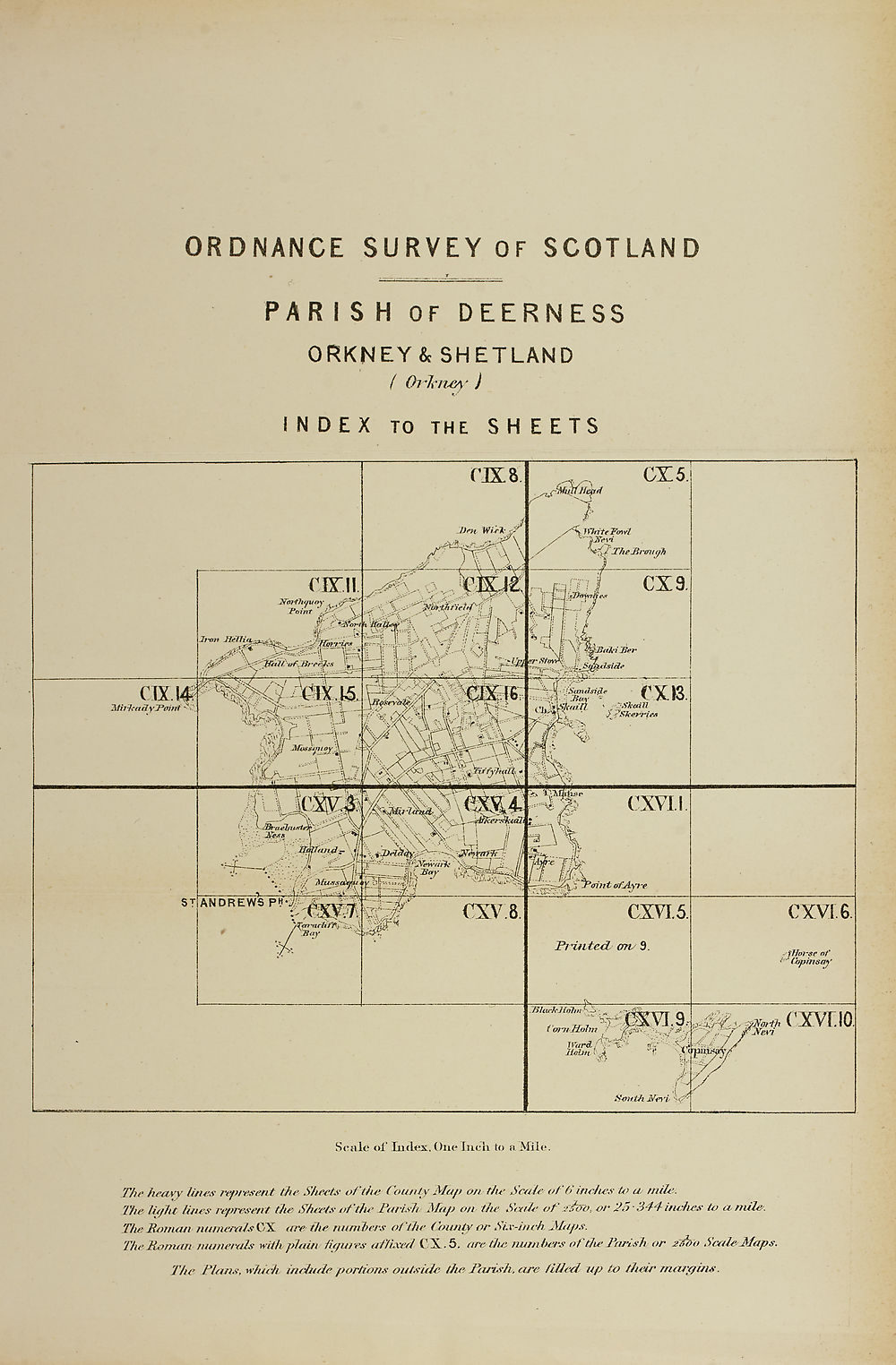
ORDNANCE SURVEY OF SCOTLAND
PARISH OF DEEPNESS
ORKNEY & SHETLAND
( Orkney )
I N DEX To the SH EETS
Scale of Index, One Inch to a Mile.
The heavy lines represent the. Sheets of the County Map on the Scale of S inches to n mile.
The light lines represent the Sheets of the Tarish Map on the Scale of 2 sot), or 23 ~344- inches to a mile.
The Toman numerals (ST. are- the numbers of the County or Six-inch Maps.
The Roman-numerals with plain figures affixed CX. 5. are the numbers of the Tarish or 2ik>o ScaleJSfaps.
The Plans, which include portions outside the Parish, are /Med up to their margins.
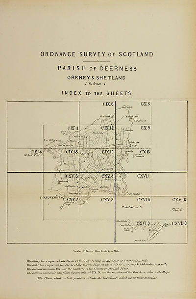
Set display mode to:
![]() Universal Viewer |
Universal Viewer | ![]() Mirador |
Large image | Transcription
Mirador |
Large image | Transcription
Images and transcriptions on this page, including medium image downloads, may be used under the Creative Commons Attribution 4.0 International Licence unless otherwise stated. ![]()
| Ordnance Survey Books of Reference 1855-1882 > Cullen -- Drumoak > (419) Map - Parish of Deerness, Orkney & Shetland (Orkney) |
|---|
| Permanent URL | https://digital.nls.uk/130594530 |
|---|
| Attribution and copyright: |
|
|---|---|
| Description | These volumes record acreages of fields and land-use information for each parish in Scotland from 1855-1882. They were compiled with the Ordnance Survey 25 inch to the mile maps for that period, which cover all the inhabited parts of Scotland. Numbered land parcels on these maps, listed consecutively within each parish, are included in the relevant parish Book of Reference. |
|---|---|
| Shelfmark | Map.Ref.C18 |
| Additional NLS resources: | |