Topographical, statistical, and historical gazetteer of Scotland > Volume 2
(339) Page 325 - MAK
Download files
Complete book:
Individual page:
Thumbnail gallery: Grid view | List view

MAL
325
MAN
claims which the parties whom they so distinguish-
edly benefited might have on their estates.
MALZIE- WATER, a rivulet of Wigtonshire. It
carries oft" the siiperfluent waters of six contiguous
lakes, two of them of considerable extent, in the
parish of JIochrum [which see], and runs 6 miles
southward, but chiefly eastward in that parish and
in Kirkinner to the Bladenoch, J of a mile above
Torbouse.
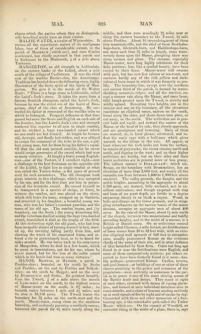
MANGERTON, an old strength in Liddesdale,
on the eastern banks of the Liddel, about a mile
south of the village of Castletown. It was the chief
seat of the warlike Border-clan, the Armstrongs.
Tradition has handed down the following story, highly
illustrative of the fierce spirit of the lairds of Man-
gerton. We give it in the words of Sin Walter
Scott : " There is a large stone in Liddesdale, called
the Laird's Jock's stone. It takes the name from a
furious Scottish champion, called the Laird's Jock,
because he was the eldest son of the Laird of Man-
gerton, chief of the clan of Armstrong. He suc-
ceeded his father in command of the warlike tribe to
which he belonged. Frequent defiances at that time
passed between the Scots and English on each side of
the frontier, but the Laird's Jock's size and strength
rendered him superior to all men in single combat,
and he wielded a huge two-banded sword which
no one could use but himself. At length he became
old, decrepit, and finally bed-ridden, and was obliged
to resign the command of the tribe to his son, a gal-
lant young man, but far from being his father's equal.
Of that the old man seemed sensible, for he never
would resign possession of the sword which had won
so many victories. At length a brave young English-
man — one of the Fosters, if I recollect right — sent
a challenge to the best Scotsman on the opposite side
of the Liddel, to fight him in single combat at what
was called the Turney-holm — a flat space of ground
used for such encounters. The old champion took
great interest in this challenge, which was accepted
by his son, and for the first time put him in posses-
sion of the favourite sword. He caused himself to
be transported in a species of sledge, or litter, to
witness the combat, and was placed on the stone,
which still bears his name, wrapped up in blankets,
and attended by his daughter, a beautiful young wo-
man, who was her father's constant guardian and the
nurse of his old age. The combat begun, and (by
treachery, say the Scots,) the young Armstrong fell,
and the victorious duellist seizing the huge two-handed
sword, brandished it aloft as the trophy of the field.
At this distracting sight the old giant, who had long
been incapable almost of turning himself in bed, start-
ed up, the covering falling partly from .him, and
showing the wreck of his emaciated frame, and ut-
tered a cry so portentously loud, as to be heard for
miles around. He was borne back to his own tower
of Mangerton, where he died in a few hours, which
he spent in lamentations, not for his son, whom he
never named, but for the loss of the noble sword
which in his hands had won so many victories."
MANOR, Mannor, or Manner, a parish in
Peebles-shire ; bounded on the north by Stobo
and Peebles ; on the east by Peebles and Selkirk-
shire; on the south by Megget; and on the west
by Drummelzier and Stobo. Its greatest breadth,
from the Tweed, J of a mile above the mouth
of Lyne-water on the north, to the highest source
of Manor-water on the south, is 8| miles ; its
breadth varies between 1 mile and S;| miles; and
its area is 18,110 acres. The Tweed traces the
boundary for 3£ miles on the north-west and the
north. Manor-water, rising close on the southern
boundary, and uniformly pursuing a northerly course,
traverses the parish for 6J miles nearly along the
middle, and then runs wendingly 2f miles near or
along the eastern boundary to the Tweed, ljf mile
above Peebles. About 1(5 streamlets,, most of them
tiny mountain-rills, and the chief of them Newholm-
hope-burn, Glenrath-burn, and Haddleshope-burn,
not more each than 3} miles in length, come trans-
versely down upon the Manor, ploughing their way
along ravines and glens. The streams, especially
Manor-water, were long highly celebrious for their
fishy produce; but, like a spoiled beauty, have been
ruined by their fame. Manor-water still swarms
with pars, but has now few salmon or sea-trout, and
contains hardly any of the rich yellow and dark-
coloured burn-trout in which it was formerly so pro-
lific. The boundary-line, except over the northern
and narrow third of the parish, is formed by water-
shedding mountain- ridges; and all the interior, ex-
cept a narrow vale along the Manor, and some beau-
tiful haugh-ground upon the Tweed, is strictly and
wildly upland. Excepting two heights, one in the
interior and one on the boundary, all the elevations
constitute an elliptical range, narrow on the south,
broad along the sides, and shorn down into plain, or
cut away, on the north. The acclivities are in gen-
eral bold and rapid; and toward the source of the
Manor, or the head of its vale, they closely approach,
and are precipitous and towering. Many of them
are scarred, or, in local phrase, sclentered, and re-
flect the sun's rays with a brilliance which gives
warmth to the tillage in the vale. All appear, at
least wherever the rock looks out from the surface,
to consist of grey wacke, the strata running north and
south, and dipping to the west; and on their higher
acclivities are heathy, but on their sides and their
lower acclivities are in general more or less grass}'.
The loftiest summit is Dollar-law: which see.
Scrape, on the boundary with Drummelzier, has an
elevation of more than 2,000 feet, and nearly all the
summits rise from between 1,600 to 1,900 feet above
sea-level. The valley-grounds, the haughs, and the
arable heights, amounting in the aggregate to about
1,700 acres, are drained, fully enclosed, and in ex-
cellent cultivation; and though carpeted with clay
and loam of no great depth, are fertile to a degree
surpassing theory in so bleak a region. Wood, in
belts and clumps on the lower grounds, and in strag-
gling detachments up the narrow basins of the minor
streams, occupies an aggregate area of about 400
acres. In the vale of the Manor, about 1J- mile north
of the church, between two mountainous and boldly
ascending heights, and in the midst of a morass, is a
British or Danish camp. On an acclivitous conical
height called Chesters, a mile distant, are fortifications
of loose stones from 26 to 32 feet wide, with an exte-
rior elliptical wall upwards of 650 feet in circumfer-
ence, usually pronounced Roman on the evidence
chiefly of the name of their site, and in utter defiance
of that furnished by their form. Coins not long ago
found in or near the fortifications were English, and
some of them comparatively modem; yet others re-
ported to have been formerly found in it were — has-
tily perhaps — pronounced Roman. Castles, towers,
and peel-houses — or buildings of one or other of these
classes according to the power and resources of the
proprietors — were anciently so numerous in the par-
ish as to prove it one of the most stirring arenas of
the Border feuds and forays. They stood in sight
of each other, crowned with means of raising alarm-
fires, and formed at once individual fortalices able to
resist attacks, and a chain of beacons sending suddenly
up at need signals of fire by night and of smoke by day.
Connected with these and other memorials of a free-
booting age, is the remarkable path called the Thief
Road : which see. On the summit of Woodhill, an
eminence rising in the midst of a plain, there is, says
Set display mode to: Large image | Transcription
Images and transcriptions on this page, including medium image downloads, may be used under the Creative Commons Attribution 4.0 International Licence unless otherwise stated. ![]()
| Gazetteers of Scotland, 1803-1901 > Topographical, statistical, and historical gazetteer of Scotland > Volume 2 > (339) Page 325 - MAK |
|---|
| Permanent URL | https://digital.nls.uk/97498031 |
|---|
| Description | Volume second. I-Z. |
|---|---|
| Attribution and copyright: |
|

