Download files
Complete book:
Individual page:
Thumbnail gallery: Grid view | List view

n
CROM.
321
CROMARTY FRITH.
ment, in 1827. It stands in a. sequestered valley
about 12 miles from Bonar Bridge. Stipend, £12(3.
Population in 1851, 316.
CROLIN. See Croulin.
CROM-, a prefix in a few Scottish descriptive
topographical names, signifying curved or crooked,
— as Cromdale, ' the curved or crooked dale.'
CROM A R, a division of tho district of Mar, in
Aberdeenshire, comprehending the parishes of Coul,
Tarland, Migvy, Logie - Coldstone, and part of
Tulloeh.
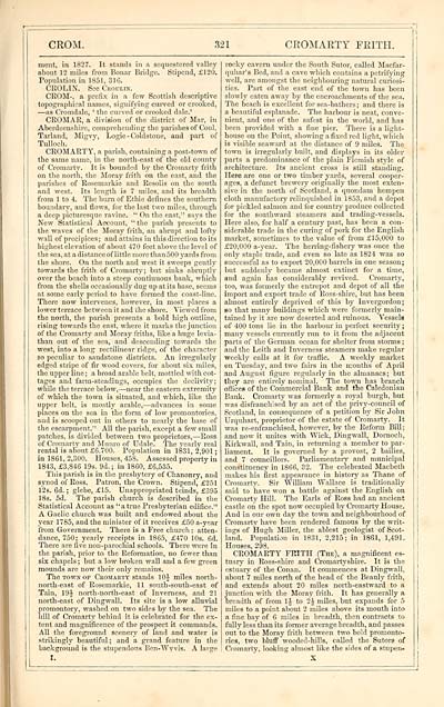
CROMARTY, a parish, containing a post-town of
the same name, in the north-east of the old county
of Cromarty. It is bounded by the Cromarty frith
on the north, the Moray frith on the east, and the
parishes of Rosemarkie and Resolis on the south
and west. Its length is 7 miles, and its breadth
from 1 to 4. The burn of Ethie defines the southern
boundary, and flows, for the last two miles, through
a deep picturesque ravine. " On the east," says the
New Statistical Account, "the parish presents to
the waves of the Moray frith, an abrupt and lofty
wall of precipices; and attains in this direction to its
highest elevation of about 470 feet above the level of
the sea, at a distance of little more than 500 yards from
the shore. On the north and west it sweeps gently
towards the frith of Cromarty; but sinks abruptly
over the beach into a steep continuous bank, which
from the shells occasionally dug up at its base, seems
at some early period to have formed the coast-line.
There now intervenes, however, in most places a
lower terrace between it and the shore. Viewed from
the north, the parish presents a bold high outline,
rising towards the east, where it marks the junction
of the Cromarty and Moray friths, like a huge levia-
than out of the sea, and descending towards the
west, into a long rectilinear ridge, of the character
so peculiar to sandstone districts. An irregularly
edged stripe of fir wood covers, for about six miles,
the upper line ; a broad arable belt, mottled with cot-
tages and farm-steadings, occupies the declivity;
while the terrace below, — near the eastern extremity
of which the town is situated, and which, like the
upper belt, is mostly arable, — advances in some
places on the sea in the form of low promontories,
and is scooped out in others to nearly the base of
the escarpment." All the parish, except a few small
patches, is divided between two proprietors, — Ross
of Cromarty and Munro of Udale. The yearly real
rental is about £6.700. Population in 1831, 2,901 ;
in 1861, 2,300. Houses, 458. Assessed property in
1843, £3,846 19s. 9d. ; in 1860, £6,535.
This parish is in the presbytery of Chanonry, and
synod of Ross. Patron, the Crown. Stipend, £251
12s. 6d. ; glebe, £15. Unappropriated teinds, £395
18s. 5d. The parish church is described in the
Statistical Account as "a true Presbyterian edifice."
A Gaelic church was built and endowed about the
year 1785, and the minister of it receives £50 a-year
from Government. There is a Free church : atten-
dance, 750; yearly receipts in 1865, £470 10s. 6d.
There are five non-parochial schools. There were in
the parish, prior to the Reformation, no fewer than
six chapels ; but a low broken wall and a few green
mounds are now their only remains.
The town op Cromarty stands 1 J miles north-
north-east of Rosemarkie, 11 south-south-east of
Tain, 19A north-north-east of Inverness, and 21
north-east of Dingwall. Its site is a low alluvial
promontory, washed on two sides by the sea. The
hill of Cromarty behind it is celebrated for the ex-
tent and magnificence of the prospect it commands.
All the foreground scenery of land and water is
strikingly beautiful; and a grand feature in the
background is the stupendous Ben-Wyvis. A large.
r.
rocky cavern under the South Sutor, called Macfar-
quhar's Bed, and a cave wbich contains a petrifying
well, are amongst the neighbouring natural curiosi-
ties. Part of the east end of the town has been
slowly eaten away by the encroachments of the sea.
The beach is excellent for sea-bathers; and there is
a beautiful esplanade. The harbour is neat, conve-
nient, and one of the safest in the world, and has
been provided with a fine pier. There is a light-
house on the Point, showing a fixed red light, which
is visible seaward at the distance of 9 miles. The
town is irregularly built, and displays in its older
parts a predominance of the plain Flemish style of
architecture. Its ancient cross is still standing.
Here are one or two timber yards, several cooper-
ages, a defunct brewery originally the most exten-
sive in the north of Scotland, a quondam hempen
cloth manufactory relinquished in 1853, and a depot
for pickled salmon and for country produce collected
for the southward steamers and trading-vessels.
Here also, for half a century past, has been a con-
siderable trade in the curing of pork for the English
market, sometimes to the value of from £15,000 to
£20,000 a-year. The herring-fishery was once the
only staple trade, and even so late as 1824 "was so
successful as to export 20,000 barrels in one season;
but suddenly became almost extinct for a time,
and again has considerably revived. Cromarty,
too, was formerly the entrepot and depot of all the
import and export trade of Ross-shire, but has been
almost entirely deprived of this by Invergordon;
so that many buildings which were formerly main-
tained by it are now deserted and ruinous. Vessels
of 400 tons lie in the harbour in perfect security ;
many vessels currently run to it from the adjacent
parts of the German ocean for shelter from storms ;
and the Leith and Inverness steamers make regular
weekly calls at it for traffic. A weekly market
on Tuesday, and two fairs in the months of April
and August figure regularly in the almanacs ; but
they are entirely nominal. The town has branch
offices of the Commercial Bank and the Caledonian
Bank. Cromarty was formerly a royal burgh, but
was disfranchised by an act of the privy-council of
Scotland, in consequence of a petition by Sir John
Urquhart, proprietor of the estate of Cromarty. It
was re-enfranchised, however, by the Reform Bill ;
and now it unites with Wick, Dingwall, Dornoch,
Kirkwall, and Tain, in returning a member to par-
liament. It is governed by a provost, 2 bailies,
and 7 councillors. Parliamentary and municipal
constituency in 1866, 32. The celebrated Macbeth
makes his first appearance in history as Thane of
Cromarty. Sir William Wallace is traditionally
said to have won a battle against the English on
Cromarty Hill. The Earls of Ross had an ancient
castle on the spot now occupied by Cromarty House.
And in our own day the town and neighbourhood of
Cromarty have been rendered famous by the writ-
ings of Hugh Miller, the ablest geologist of Scot-
land. Population in 1831, 2,215; in 1861, 1,491.
Houses, 298.
CROMARTY FRITH (The), a magnificent es-
tuary in Ross-shire and Cromartyshire. It is the
estuary of the Conan. It commences at Dingwall,
about 7 miles north of the head of the Beauly frith,
and extends about 20 miles north-eastward to a
junction with the Moray frith. It has generally a
breadth of from 1J to 2J miles, but expands for 5
miles to a point about 2 miles above its mouth into
a fine bay of 6 miles in breadth, then contracts to
fully less than its former average breadth, and passes
out to the Moray frith between two bold promonto-
ries, two bluff wooded-hills, called the Sutors of
Cromarty, looking almost like the sides of a stupen-
Set display mode to: Large image | Transcription
Images and transcriptions on this page, including medium image downloads, may be used under the Creative Commons Attribution 4.0 International Licence unless otherwise stated. ![]()
| Gazetteers of Scotland, 1803-1901 > Imperial gazeteer of Scotland, or, Dictionary of Scottish topography > Volume 1 > (431) Page 321 |
|---|
| Permanent URL | https://digital.nls.uk/97464302 |
|---|
| Description | Volume I: Aan-Gordon. |
|---|---|
| Attribution and copyright: |
|

