Download files
Complete book:
Individual page:
Thumbnail gallery: Grid view | List view

BLACKSHIELS.
172
BLAIE-ATHOLE.
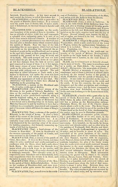
laverock, Dumfries-shire. A low tract around it
and toward the Solway is called Blackshaw flat.
BLACKSHIELS, a hamlet with a post-office in
the parish of Humhie, East Lothian. It is situated
near the north base of Soutra hill, 15 miles south-
east of Edinburgh, on the road thence to Lauder and
Kelso.
BLACKSIDE-END, a mountain on the north-
east boundary of the parish of Som in Ayrshire. It
has an altitude of above 1,500 feet, and commands
a splendid view, embracing parts, it is said, of no
fewer than sixteen different counties. A number of
years ago, a curious phenomenon was observed near
this hill after a thunder-storm which occurred about
the middle of March. Near the base of the hill,
something like an open quarry, which had not been
perceptible on the preceding day, attracted the at-
tention of people in the neighbotirhood, and on going
to the spot they found, to their astonishment, an ex-
cavation in the ground 60 feet long, 40 broad, and
16 in depth. The earth scooped out was not scat-
tered round the pit, but thrown down at one place
at 120 feet distance from the hole or cavity; and
part remained in lumps of from 3 to 6 feet square,
with many stones of some hundred weight. The
earth on the sides and bottom of the pit remained
firm and solid, without rent or aperture. The soil
was what is called hill-moss or black earth, a few
inches in thickness; and under the moss was hard
till, some of it of a red colour, and part of it blue,
without any appearance of rock of any kind. The
excavation was believed to have been effected by
lightning on the preceding day.
BLACKSTON, a station on the Monkland rail-
way, 11 miles north-east of Airdrie.
fiLACKWATEE (The), a head stream of the
Deveron, in the parish of Cabrach, Banffshire. It
rises on the southern margin of that parish, and
runs about 8 miles north-north-eastward, along a
grandly highland valley, to a confluence with • he
Deveron at Dalriach. The Duke of Richmond has
a deer-forest and a shooting-lodge in its basin ; and
Malcolm Canmore is said by tradition to have had a
residence in a remarkably sequestered and romantic
part of its course which still bears the name of King's
haugh.
BLACKWATER (The), a stream of the parish of
Kilmorie, in the island of Arran. It rises a little
south of the centre of the island, and flows about 6
miles south-westward to Drimadown hay. A re-
markably large cairn stands at its foot, — now a good
deal diminished by the carrying away of its stones
for building purposes, — hut formerly measuring up-
wards of 200 feet in diameter.
BLACKWATER (The), a head-stream of the
Connon in Ross-shire. It rises in Strathvaich at
the western extremity of the parish of Contin, and
runs eastward to the Connon at Moy.
BLACKWATER (The), a stream of the parish of
Clyne, Ross-shire. It rises on Ben-Ormin, and runs
about 16 miles southward and south-eastward to a
confluence with the Brora, about half-a-mile above
Loch Brora. Its early course lies through deep
moors which give a dark tinge to its waters ; and
its lower course lies along a deep rooky channel, and
is strikingly romantic. Two cascades occur on it,
respectively near Balnakyle and at Kilcolmkill, both
very magnificent when the stream is in flood; and
the latter is much visited by tourists.
BLACKWATER (The), a tributary of the Ken,
in the parish of Dairy, Kirkcudbrightshire. It rises
on the confines of Dumfries-shire, and runs west-
ward about 6 miles quite across the centre of the
parish.
BLACKWATER (The), a small river in the north-
east of Perthshire. It is a continuation of the Shee,
and unites with the Ardle to form the Ericht.
BLACKWOOD HILL. See Keie.
BLADENOCH (The), a river in Galloway. It
rises in the hills which divide Galloway from Car-
rick, and, after a winding course of 24 miles south-
south-eastward, between Penningham and Wigton
parishes on the left, and Kirkcowan and Kirkinner
parishes on the right, empties itself into the bay of
Wigton. Several islands, once famous for the re-
sort of eagles, are formed in its bed. Good salmon
are found in this stream.
BLADENOCH, a village in the parish of Wigton,
Wigtonshire ; about a mile south-west of the town
of Wigton, within the parliamentary boundaries of
which it is included. There is a large distillery
here. Population, 215.
BLAINSLEE, a village in the north-east ex-
tremity of the parish of Melrose, Roxburghshire.
It stands on the right bank of the Leader, 3 miles
south-south-east of Lauder, on the road thence to
St. Boswells.
BLAIR, any level tract now or formerly abound-
ing in moss or heath. The name is sometimes used
as a prefix — as Blair- Athole, ' the moss-plain of
Athole,' — Blairgowrie, ' the moss-plain of Gowrie.'
BLAIR (Mount), a mountain of very large cir-
cumference, and of about 2,260 feet of altitude above
sea-level, on the mutual border of the parish ot
Alyth, Perthshire, and the parish of Glenisla, For-
farshire. It can easily be ascended on the east and
the west, hut is steep and rugged on the north and
the south. It has two summits, the one fiat and
elongated, and the other precipitous and overhang-
ing the southern verge ; and the latter commands a
gorgeous view from Schihallion to the German
ocean, and lrom Lochnagar to the Lammermoor hills.
See Alyth.
BLAIRADAM, a hamlet with a post-office in th<5
parish of Cleish, Kinross-shire. It stands on the
Kelty water, 4£ miles south-south-east of Kinross,
and has a station on the Kinross-shire railway.
Blairadam House, tire seat of Sir Charles Adam,
stands about a mile to the west. The Keiry Crags,
a romantic spot, described in one of the novels of Sir
Walter Scott as the howff of John Auchtermuchty,
the carrier, may he seen in Blairadam grounds.
BLAIR- ATflOLE, an extensive parish, contain-
ing a post-office hamlet of its own name, in the
north of Perthshire. It comprehends the ancient
parishes of Blair-Athole, Strowan, Lude, and Kil-
maveonaig. It is bounded, on the north, by Inver-
ness-shire and Aberdeenshire, and on other sides by
the parishes of Fortingall, Dull, Moulin, and Kirk-
michael. Its length north-eastward is upwards of
30 miles; and its breadth is about 18 miles. The
watershed of the great backbone of the central
Grampians forms most of the northern boundary ;
the river Tummel, together with its expansion,
Loch Tummel, forms most of the western half of the
southern boundary; the glen of the Garry wends
from the north-west corner south-eastward through
the interior to the most southerly extremity; and
the glens of the Erichkie, the Bruar, the Tilt, and
their several tributaries diversify the rest of the
interior down to Glengarry. Much information
respecting the parish will be found in the articles
Athole, Beuak, Garry, Tilt, and Tummel. Glen-
garry, for 6 miles downward from the church of
Strowan, is a beautiful, well cultivated valley; and
Strath-Tummel runs along the loch of that name,
which is about 2 miles long. Between these two
straths is a stretch of moorland about 4 miles in
breadth. The other straths or glens are screened by
mountains of naked rooks, and by extensive moor-
Set display mode to: Large image | Transcription
Images and transcriptions on this page, including medium image downloads, may be used under the Creative Commons Attribution 4.0 International Licence unless otherwise stated. ![]()
| Gazetteers of Scotland, 1803-1901 > Imperial gazeteer of Scotland, or, Dictionary of Scottish topography > Volume 1 > (272) Page 172 |
|---|
| Permanent URL | https://digital.nls.uk/97462394 |
|---|
| Description | Volume I: Aan-Gordon. |
|---|---|
| Attribution and copyright: |
|

