Topographical, statistical, and historical gazetteer of Scotland > Volume 1
(511) Page 425
Download files
Complete book:
Individual page:
Thumbnail gallery: Grid view | List view

EAR
425
EAS
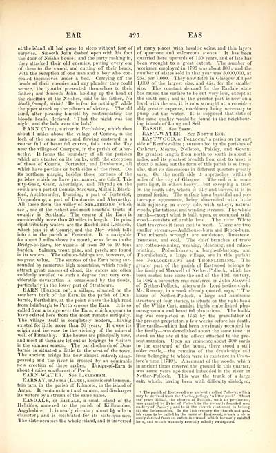
at the island, all tad gone to sleep without fear of
surprise. Smooth John dashed open with his foot
the door of Neish's house; and the party rushing in,
they attacked their old enemies, putting every one
of them to the sword, and cutting off their heads,
with the exception of one man and a boy who con-
cealed themselves under a bed. Carrying off the
heads of their enemies and any plunder they could
secure, the youths presented themselves to their
father ; and Smooth John, holding up the head of
the chieftain of the Neishes, said to his father, Na
biodk fromgh, oirbh ! ' Be in fear for nothing!' while
the piper struck up the pibroch of victory. The old
laird, after pleasing himself by contemplating the
bloody heads, declared, ' That the night was the
•night, and the lads were the lads!'
EARN (The), a river in Perthshire, which rises
about 4 miles aljove the village of Comrie, in the
loch of the same name, and flowing eastward in a
course full of beautiful curves, falls into the Tay
near the village of Caerpow, in the parish of Aber-
nethy. It forms the boundary of all the parishes
which are situated on its banks, with the exception
of those of Comrie, Forteviot, and Dunbarnie, all
which have portions on both sides of the river. On
its northern margin, besides those portions of the
parishes which we have just named, are Crieff, Tri-
nity-Gask, Gask, Aberdalgie, and Rhynd ; on the
south are a part of Comrie, Strowan, Muthill, Black-
ford, Auchterarder, Dunning, a part of Forteviot,
Fot'gandenny, a part of Dunbarnie, and Abernethy.
All these form the valley of Strathearn [which
see], one of the richest and most beautiful tracts of
country in Scotland. The course of the Earn is
considerably more than 30 miles in length. Its prin-
cipal tributary waters are the Ruchill and Lednoch,
which join it at Comrie, and the Moy which falls
into it in the parish of Forteviot. It is navigable
for about 3 miles above its mouth, or as far as to the
Bridge-of-Earn, for vessels of from 30 to 50 tons
burden. Salmon, trout, pike, and perch, are found
in its waters. The salmon-fishings are, however, of
no great value. The sources of the Earn being sur-
rounded by numerous high mountains, which readily
attract great masses of cloud, its waters are often
suddenly swelled to such a degree that very con-
siderable devastation is occasioned by the floods,
particularly in the lower part of Strathearn.
EARN (Bridge of), a village, situated on the
southern bank of the Earn, in the parish of Dun-
barnie, Perthshire, at the point where the high road
from Edinburgh to Perth crosses the Earn. It is so
called from a bridge over the Earn, which appears to
have existed here from the most remote antiquity.
The village itself is completely modern, — having
existed for little more than 50 years. It owes its
origin and increase to the vicinity of the mineral
well of Pitcaithly. The houses are principally new,
and most of them are let out as lodgings to visiters
in the summer season. The parish-church of Dun-
barnie is situated a little to the west of the town.
The ancient bridge has now almost entirely disap-
peared; and the river is crossed by an admirable
new erection of three arches. Bridge-of-Earn is
about 4 miles south-east of Perth.
EARN- WATER. See Eaglesham.
E ARS AY, or Jors a (Lake), a considerable moun-
tain tarn, in the parish of Kilmorie, in the island of
Arran. It contains trout and salmon, and discharges
its waters by a stream of the same name.
EASDALE, or Eisdale, a small island of the
Hebrides, annexed to the parish of Killbrandon,
Argyleshire. It is nearly circular ; about 1£ mile in
diameter ; and is celebrated for its slate-quarries.
The slate occupies the whole island, and is traversed
at many places with basaltic veins, and thin layers
of quartoze and calcareous stones. It lias been
quarried here upwards of 1 50 years, and of late has
been wrought to a great extent. The number of
workmen employed in 1795 was about 300; and the
number of slates sold in that vear was 5,000,000, at
25s. per 1,000. They now fetch in Glasgow .£3 per
1,000 of the largest size, and 45s. for the smaller
size. The constant demand for the Easdale slate
has caused the surface to be cut very low, except at
the south end ; and as the greater part is now on a
level with the sea, it is now wrought at a consider-
ably greater expense, machinery being necessary to
pump out the water. It is supposed that slate of
the same quality would be found in the neighbour-
ing islands of Luing and Seil.
EASSIE. See Essie.
EAST-WATER. See North Esk.
EASTWOOD, or Pollock,* a parish on the east
side of Renfrewshire ; surrounded by the parishes of
Cathcart, Mearns, Neilston, Paisley, and Govan.
Its greatest length from north to south is about 4
miles, and its greatest breadth from east to west is
about 3 miles ; but the form of this parish is so irreg-
ular, that its dimensions in different quarters greatly
vary. On the north side it approaches within .3
miles of the city of Glasgow. The soil is in some
parts light, in others heavy, — but excepting a tract
on the south side, which is tilly and barren, it is in
general fertile. The surface has a beautiful and pic-
turesque appearance, being diversified with little
hills rejoicing on every side, with valleys, natural
woods, plantations, and winding streams. The whole
parish — except what is built upon, or occupied with
wood — consists of arable laud. The river White
Cart traverses it from east to west. There are two
smaller streams, — Auldhouse-burn and Brock-burn.
The minerals wrought are sandstone, limestone,
ironstone, and coal. The chief branches of trade
are cotton-spinning, weaving, bleaching, and calico-
printing. Pollockshaws, a burgh-of-barony, and
Thornliebank, a large village, are in this parish ;
see Pollockshaws and Thornliebank. — The
greater part of the parish of Eastwood belongs to
the family of Maxwell of Nether-Pollock, which has
been seated here since the end of the l-3th century.
In 1682 a baronetcy was conferred on John Maxwell
of Nether-Pollock, afterwards Lord-justice-clerk.
Mr. Ramsay, in a work already quoted, says, " The
house of Nether-Pollock, a large and handsome
structure of four stories, is situate on the right bank
of the White Cart, amidst highly embellished plea-
sure-grounds and beautiful plantations. The build-
ing was completed in 1753 by the grandfather of
the present proprietor, a few weeks before his death.
The castle — which had been previously occupied by
the family — was demolished about the same time : it
stood on the site of the offices attached to the pre-
sent mansion. Upon an eminence about 300 yards
to the eastward of the house, there stood a still
older castle, — the remains of the drawbridge and
fosse belonging to which were in existence in Craw-
ford's time (1710). A remnant of the woods, which
in ancient times covered the ground in this quarter,
was some years ago found imbedded in the river at
Nether- Pollock. This was the trunk of a large
oak, which, having been with difficulty dislodged,
* The parish of Eastwood was anciently called Pol look, which
may be derived from the Gaelic, poling, 'a little pool.' About
the years 1163-5, the church of Pullnuk, with its pertinents,
was granted by Peter of Pollock to the recently founded mo-
nastery of Paisley ; and to it the church continued to belong
till the Reformation. In the 141 li century the church and par-
ish came to be called by the name of Eastwood, which is obvi-
ously derived from an extensive wood which formerly existed
hei'Bj and which was only recently wholly extirpated!
Set display mode to: Large image | Transcription
Images and transcriptions on this page, including medium image downloads, may be used under the Creative Commons Attribution 4.0 International Licence unless otherwise stated. ![]()
| Gazetteers of Scotland, 1803-1901 > Topographical, statistical, and historical gazetteer of Scotland > Volume 1 > (511) Page 425 |
|---|
| Permanent URL | https://digital.nls.uk/97443678 |
|---|
| Description | Volume first. A-H. |
|---|---|
| Attribution and copyright: |
|

