Topographical, statistical, and historical gazetteer of Scotland > Volume 1
(435) Page 353
Download files
Complete book:
Individual page:
Thumbnail gallery: Grid view | List view

DUMFRIES-SHIRE.
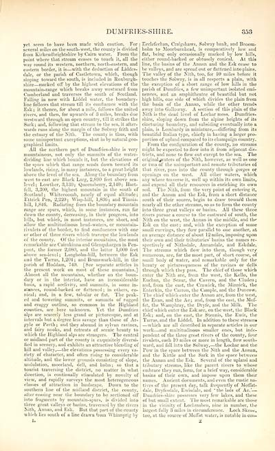
yet seem to have been made with caution. For
several miles on the south-west, the county is divided
from Kirkcudbrightshire by Cairn water. From the
point where that stream ceases to touch it, all the
way round its western, northern, north-eastern, and
eastern border, it is — with the deduction of Liddes-
dale, or the parish of Castletown, which, though
sloping toward the south, is included in Roxburgh-
shire — marked off by the highest elevations of the
mountain-range which breaks away westward from
Cumberland and traverses the south of Scotland.
Falling in now with Liddel water, the boundary-
line follows that stream till its confluence with the
Esk ; it thence, for about a mile, follows the united
rivers, and then, for upwards of 3 miles, breaks due
westward through an open country, till it strikes the
Sark ; and, following that stream to the sea, it after-
wards runs along the margin of the Solway frith and
the estuary of the Nith. The county is thus, with
some unimportant exceptions, shut in by natural geo-
graphical limits.
All the northern part of Dumfries-shire is very
mountainous, not only the summits of the water- i
dividing line which bounds it, but the elevations of |
the spurs which that range sends down toward its
lowlands, rising, in many instances, to a great height
above the level of the sea. Along the boundary from
west to east are Black Larg, 2,890 feet above sea-
level; Lowther, 3,130; Queensberry, 2,140; Hart-
fell, 3,300, the highest mountain in the south of
Scotland ; Whitecoomb, nearly of equal altitude ;
Ettrick Pen, 2,220; Wisp-hill, 1,836; and Tinnis-
hill, 1,846. Radiating from the boundary mountain !
range are spurs, which, in some instances, run far !
down the county, decreasing, in their progress, into '
hills, but which, in most instances, are short, and I
allow the multitudinous head-waters, or mountain- j
rivulets of the border, to find confluences with one
or other of three rivers which traverse the lowlands
of the county. Of the interior mountains, the most
remarkable are Cairnkinna and Glenquhargen in Pen-
pont, the former 2,080, and the latter 1,000 feet
above sea-level; Langholm-hill, between the Esk
and the Tarras, 1,204; and Brunswark-hill, in the
parish of Hoddam, 740. [See separate articles in
the present work on most of these mountains.]
Almost all the mountains, whether on the boun-
dary or in the interior, have an inconsiderable
basis, a rapid acclivity, and summits, in some in-
stances, round-backed or flattened ; in others, co-
nical; and, in a few, tabular or flat. The peak-
ed and towering summits, or summits of rugged
and craggy outline, so common in the Highland
counties, are here unknown. Yet the Dumfries
alps are scarcely less grand or picturesque, and at
intervals but a degree less savage than those of Ar-
gyle or Perth ; and they abound in sylvan ravines,
and fairy nooks, and retreats of scenic beauty to
which the Highland alps are strangers. The central
or midland part of the county is exquisitely diversi-
fied in scenery,, and exhibits an attractive blending of
hill and valley, — the elevations possessing every va-
riety of character, and often rising to considerable
altitude, and the lower grounds consisting of slope,
undulation, moorland, dell, and holm; so that a
tourist traversing the district, no matter in what
direction, is continually stimulated by novelty of
view, and rapidly surveys the most heterogeneous
classes of attraction in landscape. Down to the
southern line of the midland district, the county,
after ceasing near the boundary to be sectioned off
into fragments by mountain-spurs, is divided into
three great valleys or basins, traversed by the rivers
Nith, Annan, and Esk. But that part of the county
which lies south of a line drawn from Whinnyrig by
Ecclefechan, Craigshaws, Solway bank, and Broom-
holm to Moorburnhead, is comparatively low and
flat, being only occasionally marked by low hills,
either round-backed or obtusely conical. At this
line, the basins of the Annan and the Esk cease to
be valleys, and are spread out or flattened into plains.
The valley of the Kith, too, for 10 miles before it
touches the Solway, is in all respects a plain, with
the exception of a short range of low hills in the
parish of Dumfries, a few unimportant isolated emi-
nences, and an amphitheatre of beautiful but not
high hills, one side of whicli divides the plain from
the basin of the Annan, while the other trends
away into Galloway. A section of this plain of the
Nith is the dead level of Lochar moss. Dumfries-
shire, sloping down from the alpine heights of its
cincturing boundary, and subsiding eventually into a
plain, is Lombardy in miniature, — differing from its
beautiful Italian type, chiefly in having a larger pro-
portion of upland compared to its champaign country.
From the configuration of the county, no streams
might be expected to flow into it from adjacent dis-
tricts, and none to flow out except to the sea. The
original praters of the Nith, however, as well as one
or two of the unimportant and remote tributaries of
that river, pass into the county through gorges or
openings on the west. All other waters, which
any where traverse it, well up within its own limits,
and expend all their resources in enriching its own
soil. The Kith, from the very point of entering it,
and the Annan and the Esk, from a short distance
south of their source, begin to draw toward them
nearly all the other streams, so as to form the county
into three great valleys or basins. All these three
rivers pursue a course to the eastward of south, the
Kith on the west, the Annan in the middle, and tho
Esk on the east ; and, with the exception of some
small curvings, they flow parallel to one another, at
an average distance of about 12 miles, imposing upon
their own and their tributaries' basins the names re-
spectively of Kithsdale, Annandale, and Eskdale.
The streams which flow into them, though very
numerous, are, for the most part, of short course, of
small body of water, and remarkable only for the
beauty or picturesqueness of the ravines or dells
through which they pass. The chief of those which
enter the Kith are, from the west, the Kello, the
Euchan, the Scaur, the Cavern, and the Cluden ;
and, from the east, the Crawick, the Minnick, the
Enterkin, the Carron, the Cample, and the Duncow.
The chief which enter the Annan are, from the west,
the Evan, and the Ae; and, from the east, the Mof-
fat, the Wamphray, the Dryfe, and the Milk. The
chief which enter the Esk are, on the west, the Black
Esk; and, on the east, the Stennis, the Ewis, the
Tarras, and the Liddel. In addition to these streams
— which are all described in separate articles in our
work — and multitudinous smaller ones, but inde-
pendent of the three great rivers of the county, four
rivulets, each 10 miles or more in length, flow south-
ward, and fall into the Solway, — the Lochar and rhe
Pow in the space between the Kith and the Annan,
and the Kirtle and the Sark in the space between
the Annan and the Esk. Several of the upland and
tributary streams, like the parent rivers to whose
embrace they run, form, for a brief way, considerable
basins of their own, and impose upon them their
names. Ancient documents, and even the rustic na-
tives of the present day, talk frequently of Moffat-
dale, Dryfesdale, Ewisdale, and 'tbe lads of Ae.' —
Dumfries-shire possesses very few lakes, and these
of but small extent. The most remarkable are those
in the vicinity of Lochmaben, nine in number, the
largest fully 3 miles in circumference. Loch. Skene,
too, at the source of Moffat water, is notable in con-
Set display mode to: Large image | Transcription
Images and transcriptions on this page, including medium image downloads, may be used under the Creative Commons Attribution 4.0 International Licence unless otherwise stated. ![]()
| Gazetteers of Scotland, 1803-1901 > Topographical, statistical, and historical gazetteer of Scotland > Volume 1 > (435) Page 353 |
|---|
| Permanent URL | https://digital.nls.uk/97442766 |
|---|
| Description | Volume first. A-H. |
|---|---|
| Attribution and copyright: |
|

