Topographical, statistical, and historical gazetteer of Scotland > Volume 1
(392) Page 310
Download files
Complete book:
Individual page:
Thumbnail gallery: Grid view | List view

DEE
310
DEE
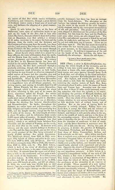
the source of that Dee which carries civilization,
fruitfulness, and commerce, through a great district
of Scotland, waters many a broad acre of wood and
corn, and harbours the shipping of a great commer-
cial city."
About \i mile below the linn, at the farm of
Dallavorar, some signs of cultivation begin to ap-
pear on the banks of the Dee ; but it soon after
enters Mar forest, through which it flows to Castle-
ton of Braemar, [see that article,] a distance
of 11 miles, receiving in its course the Luiand the
Quoich, from the north; and the Inverey and
the Clunie or Cluanadh, from the south, [see these
articles,] and passing Mar lodge on its northern bank.
From Castleton the Dee pursues its course through
the Mar and Invercauld forests to the bridge of Bal-
later. About 1£ mile above which it is joined by a
large affluent, the water of Gairden, from the north,
and the Muick from the south : See articles Bal-
iater, Gairden, and Glenmuick. The scenery
of the Dee, in the Braemar forests, has been de-
scribed in our article Braemar. Passing Pannanich
and Dee castle, the Dee flows eastwards through a
gradually widening, though still narrow valley, re-
ceiving numerous small tributaries on both banks,
and forcing its way through an alluvium composed of
rolled masses of coarse and fine granular, grey and
red granite, gneiss, porphyry, primitive greenstone,
and hornblende. About \i mile below Kincardine
O'Neil, where Potarch bridge crosses the Dee, there
is a magnificent vein of red felspar porphyry, tra-
versing gneiss, and varying in breadth from 6' to 20
feet. Below Potarch, the Dee enters Kincardine-
shire, through which it flows eastward for about
12 miles, receiving in this part of its course the
Aven, sometimes called the Feugh : See article
Birse. From the point where it touches on the
south-west corner of Drumoak parish in Aberdeen-
shire, till its confluence with the sea at Aberdeen,
it forms the dividing line betwixt Aberdeenshire
and Kincardineshire. Its banks, throughout this
distance, are rather tame and unpieturesque, — the
hills lumpish and heath-covered, and presenting few
cliffs, and the haughs narrow, except for the last 5
or 6 miles of its course. Its total length of course
is about 96 miles ; and its tributaries drain nearly
1 ,000 square miles of country. Its mouth forms the
entrance to the harbour of Aberdeen, [see that
article,] which is an artificial basin between New
Aberdeen and the suburb of Footdee, on the north,
and the river Dee on the south. It abounds with
salmon; and the most valuable fishings in Scotland
■ — the Tay and the Spey excepted — are on this river,
the yearly produce of the Dee being estimated at
nearly --£8,000 sterling: See article Aberdeen.
The Midcliingle fishery, from 1815 to 1821, aver-
aged 116-J barrels of salmon and grilse in the year;
but from 1829 to 1834, only 50 barrels. The Cul-
ter fishery averaged, from 1815 to 1821, 23| barrels;
from 1829 to 1835, only 8.}. The llaik fishery,
which is held of the town of Aberdeen under a
charter from the Crown, is the most valuable fishery
on the Dee. It extends from the upper end of Aber-
deen a mile to the northward, and not quite a mile
to the south of the breakwater. It is both a coast
and river fishery. In 1782, there were but 1 barrel
of grilse, and 301 of salmon killed on it; in 1832,
there were 398 barrels of grilse, and 217 of salmon.
In 1835, the total take was 19,194 fish; or 253
barrels; but the average from 1829 to 1835 was 427
barrels.* All the upper fishings on this river have
* A barrel is 400 lbs. Dutch or 436 lbs. imperial English. The
expellie of taking a barrel of saliunu at the Rrtik, in 182*, was
i:t :fc. I{d ; and .if conveying it to the Lundun market, includ-
ing ice aud boxes, £1 Its.
greatly decreased; but there hits be«n an increase
from the beach-fisheries. The alteration on the
harbour has injured the fishings greatly, by render-
ing the water at the mouth of the river compara-
tively stagnant, and by the consequent accumulation
of silt and gas-refuse. The greater part of the sal-
mon shipped at Aberdeen are the produce of the Dee
and Don ; but fish from the Spey and the Findhorn,
and some other rivers, are also shipped here. The
river Dee and adjacent sea-coast is fished by net and
coble, by stake-nets, and bag-nets. It may be fished
by net and coble from top to bottom. There are no
mill-dams upon it. The Dee has much decreased in
size within the last twenty years, owing, doubtless,
in great measure, to the improvement and drainage
of the country. In making a comparison of the soil
on the banks of the Dee and Don, the latter has
manifestly the advantage. Hence the old rhyme :
" A rood o* Don's worth twa o' Dee ;
Unless it be for fish aud tree."
DEE (The), a river in Kirkcudbrightshire, tra-
versing the whole length of the stewartry, and di-
viding it into two nearly equal parts. Its sources
are about a dozen rills, some pursuing an indepen-
dent course, and some passing through Long Loch
or Loch Dee, and all arising in the broad mountain-
range which separates Kircudbrightshire from Car-
rick. The highest, and strictly the parent-stream,
rises about a mile from the boundary, and before
receiving the surplus waters of Loch Dee, flows
circuitously about 6 miles, under the names of Sauch
burn and Cooran lane. Assuming now the name
of the Dee, it flows 17 miles north-eastward, receiv-
ing numerous rills from the uplands in its course,
and dividing the parishes of Minigaff, Girthon, and
Balmaghie on the south, from that of Kells on the
north. Over the whole of this distance it is a petty
stream, winding its way among broad flats of heath,
or hills destitute both of verdant beauty and of
grandeur. But at the point of leaving Kells its
character is entirely changed. Falling there into
Loch Ken, it usurps the titles and the tributes of
the larger and beautiful river by which that lake is
formed ; and thence it rolls proudly along to the sea,
rich in the wealth of waters, and gay in the dress of
its surrounding scenery. Over a distance of 9 or 10
miles it describes the arc of a circle, bending round
from the direction of south-east to that of south-
west; and the latter direction it maintains over 13
miles, till it falls into the sea. During this part of
its progress, it divides the parishes of Balmaghie,
Tongueland, Twineham, and Borgue on the west,
from those of Dairy, Crossmichael, Kelton, and
Kirkcudbright, on the east. After falling into Loch
Ken, it expands over a distance of 5 miles into three
successive elongated lakes, of about | of a mile of
average breadth. Its course is afterwards rapid,
chiefly over a rocky bottom, and beneath steep and
rugged banks adorned with copsewood and planta-
tion. Opposite the church of Tongueland it tumbles
over a declivity of rocks, and forms a series of foam-
ing and impetuous cataracts. A little below, it is
spanned by a magnificent bridge of one arch of 110
feet, whence a fine view is obtained of the falls.
This bridge is constructed of huge blocks of free-
stone from the island of Arran, and was built by
the gentlemen of the stewartry at an expense of
about £7,000. Three quarters of a mile farther
down, the Dee receives the waters of the Tarff, and
becomes considerably widened. Two miles further,
it sweeps past the burgh of Kirkcudbright; and
thence over a distance of 5 miles, till it loses itself in
the Solway frith, forms an estuary at first J of a mile,
and afterwards 1J mile, of average breadth. Its
Set display mode to: Large image | Transcription
Images and transcriptions on this page, including medium image downloads, may be used under the Creative Commons Attribution 4.0 International Licence unless otherwise stated. ![]()
| Gazetteers of Scotland, 1803-1901 > Topographical, statistical, and historical gazetteer of Scotland > Volume 1 > (392) Page 310 |
|---|
| Permanent URL | https://digital.nls.uk/97442250 |
|---|
| Description | Volume first. A-H. |
|---|---|
| Attribution and copyright: |
|

