Download files
Complete book:
Individual page:
Thumbnail gallery: Grid view | List view

VI INTRODUCTION.
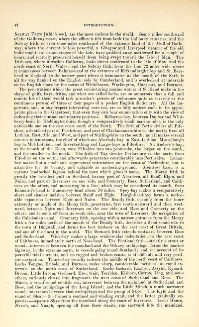
Solway Frith [which see], are the most curious in the world. Some miles southward
of the Galloway coast, where the efflux is felt from both the Galloway estuaries, and the
Solway frith, or even some miles southward of the extreme land of the Mull of Gallo-
way, where the current is less powerful, a Glasgow and Liverpool steamer of the old
build might, in certain stages of the tide, have paddled away northward for a couple of
hours, and scarcely preserved herself from being swept toward the Isle of Man. The
Irish sea, where it washes Galloway, looks direct southward to the Isle of Man, and the
north coast of North Wales ; and the Solway frith, from the line 22 miles wide where
it commences between Balmae-head at the entrance of Kirkcudbright bay and St. Bees-
head in England, to the narrow point where it terminates at the mouth of the Sark, is
all the way flanked on the English side by Cumberland, and is overlooked at intervals
on its English shore by the towns of Whitehaven, Workington, Maryport, and Bowness.
The penetrations which the great encincturing marine waters of Scotland make in the
shape of gulfs, bays, friths, and what are called lochs, are so numerous that a full and
minute list of them would task a reader's powers of endurance quite as severely as the
continuous perusal of three or four pages of a pocket English dictionary. All the im-
portant, and, in any respect interesting ones too, are so fully noticed each in its appro-
priate place in the Gazetteer, that even they can bear enumeration only with the view of
indicating their mutual and relative positions. Belhaven-bay, between Dunbar and Whit-
berry-head in Haddingtonshire, though a comparatively small marine inlet, is the only
noticeable one on the east coast south of the Forth. The frith of Forth divides all Fife-
shire, a detached part of Perthshire, and part of Clackmannanshire on the north, from all
Lothian, East, Mid, and West, and part of Stirlingshire on the south ; and it makes several
interior indentations, the chief of which are Aberlady-bay in East-Lothian, Musselburgh
bay in Mid-Lothian, and Inverkeithing and Largo-bays in Fifeshire. St. Andrew's-bay,
at the mouth of the Eden, cuts Fifeshire into two peninsulse, the larger on the south,
and the smaller on the north. The frith of Tay divides Forfarshire on the north from
Fifeshire on the south, and afterwards penetrates considerably into Perthshire. Lunan-
bay makes but a small and segmentary indentation on the coast of Forfarshire, but is
attractive for its beauty, and valuable as anchoring-ground. Montrose basin is a
curious landlocked lagoon behind the town which gives it name. The Moray frith is
greatly the broadest gulf in Scotland, having part of Aberdeen, all Banff, Elgin, and
Nairn, and part of Inverness on one side, and Cromarty, Ross, Sutherland, and Caith-
ness on the other, and measuring in a line, which may be considered its mouth, from
Kinnaird's-head to Duncansby-head about 70 miles. Spey-bay makes a comparatively
short and slender incision between Banff and Elgin. Burgh-head-bay forms a notice-
able expansion between Elgin and Nairn. The Beauly frith, opening from the inner
extremity or angle of the Moray frith, penetrates, first south-westward and then west-
ward, between Nairn and Inverness on the one side, and Ross and Cromarty on the
other ; and it sends off from its south side, near the town of Inverness, the navigation of
the Caledonian canal. Cromarty frith, opening with a narrow entrance from the Moray
frith a few miles north of the mouth of the Beauly frith, describes a demi-semicircle to
the town of Dingwall, and forms the best harbour on the east coast of Great Britain,
and one of the finest in the world. The Dornoch frith extends westward between Ross
and Sutherland. Wick-bay makes a large semicircular indentation, on the east coast
of Caithness, immediately north of Noss-head. The Pentland frith — strictly a strait or
sound — intervenes between the mainland and the Orkney archipelago, forms the marine
highway, in the extreme north, to vessels going round Scotland ; and, on account of its
powerful tidal currents, and its rugged and broken coasts, is of difficult and very peril-
ous navigation. Thurso-bay broadly indents the middle of the north coast of Caithness.
Lochs Tongue, Eribole, and Durness, make sharp, considerable incisions, at rapid in-
tervals, on the north coast of Sutherland. Lochs Inchard, Laxford, Assynt, Eynard,
Broom, Little Broom, Greinord, Ewe, Gair, Torriden, Kishorn, Carron, Ling, and some
others, curiously cleave into fragments the west coast of Sutherland and Ross. The
Minch, a broad sound or little sea, intervenes between the mainland at Sutherland and
Ross, and the archipelago of the Long Island ; and the Little Minch, a much narrower
sound, intervenes between that archipelago and the group of Skye. The Kyle and the
sound of Sleat — the former a confined and winding strait, and the latter gradually ex-
pansive — separate Skye from the mainland along the coast of Inverness. Lochs Hourn,
Nevish, and Nuagh, opening off from these straits, run. eastward into the mainland.
Set display mode to: Large image | Transcription
Images and transcriptions on this page, including medium image downloads, may be used under the Creative Commons Attribution 4.0 International Licence unless otherwise stated. ![]()
| Gazetteers of Scotland, 1803-1901 > Topographical, statistical, and historical gazetteer of Scotland > Volume 1 > (18) Page vi |
|---|
| Permanent URL | https://digital.nls.uk/97437762 |
|---|
| Description | Volume first. A-H. |
|---|---|
| Attribution and copyright: |
|

