Gazetteer of Scotland > Volume 2
(528) Page 1006
Download files
Complete book:
Individual page:
Thumbnail gallery: Grid view | List view

1006
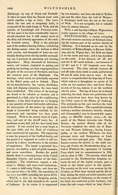
WIGTONSHIRE.
Edinburgh, by way of Perth and Dunkeld
It takes its name from the Danish word wrick,
which signifies a bay or inlet. The town,
which lies low and is irregularly built, is
composed of the royal burgh of Wick, and the
suburbs of Louisburgh and Pulteney-town.
Of late years it has been considerably improv-
ed and extended, but it still retains much of
the dirty and slovenly appearance of the smal-
ler Scottish towns. Wick is the principal
seat of the northern herring fishery ; and during
the fishing season, when the harbour is filled
with vessels, and thousands of boats are con-
tinually floating across the bay and the surround-
ing sea, it presents an animating and bustling
appearance. Many thousands of fishermen,
curers, and women, employed in gutting and
packing the herrings, are then congregated from
all parts of the sea coast of Scotland, and from
the remotest parts of the Highlands. The
herrings, when cured, are principally exported
to the Baltic ports, and to Ireland. There
are no manufactories, but various distilleries,
rope, and shipping companies, &c. have lately
been established. The refuse of the herrings
are found to be valuable as manure, and is
purchased at a high price by the neighbouring
farmers ; it has been of great use in bringing
a vast quantity of waste land under cultivation.
In consequence of the estates by which the
burgh is surrounded being entailed, its im-
provement and extension has been much
cramped. Wick is the county town of Caith-
ness, and seat of the sheriff court, &c. A
handsome county hall, jail, &c. have lately been
erected. It was erected into a royal burgh in
the year 1589, and the Earls of Caithness
were constituted its superiors. The superiority
is now the property of the Stafford family, and
the power it is supposed to confer is still ex-
ercised by a direct interference in the election
of magistrates. The burgh is governed by a
provost, two bailies, a dean of guild, treasurer,
and seven councillors. Besides the parish
church, there is a meeting house of the United
Secession Church, and another of the Inde-
pendents. The inhabitants support a sub-
scription library, and some local institutions.
A market is held every Friday, and there are
four annual fairs. — In 1821, the population of
the town was 2900, including the parish 6713.
WICK, a river in the foregoing parish,
which rises in the high grounds in the parish
of Latheron. In its course it is augmented
by two streams ; one from the loch of Toftin.
gal, and the other from the loch of Watten :
it discharges itself into the sea at the town
of Wick. It is not navigable, but is valuable
from its salmon fisheries.
WIG, a safe bay in Loch Ryan, Wigtonshire,
nearly opposite to the village of Cairn.
WIGTONSHIRE, a county occupying
the south-western extremity of Scotland, form-
ing the western part of the ancient district of
Galloway. It is bounded on the east by the
stewartry of Kirkcudbright, or Eastern Gallo-
way, also by Wigton bay ; the Irish sea limits
it on the south and west ; and it has. Ayrshire
on the north. It lies between 54° 36' 45",
and 55° 3' 40" north latitude ; and between 4*
15' 50' and 5° 7' 10" longitude west from
Greenwich. The shire extends between 28
and 29 miles from north to south, and between
30 and 31 miles from east to west. In this
extent is comprehended the large bay of Luce,
which indents it throughout an extent of 15
miles on the southern side ; and Loch Ryan,
an arm of the sea, indents it on the northern
side 8| miles. The bay of Luce, by so deeply
indenting the land, forms two peninsulae, and
these projections have been long known by
the Celtic name of the Rhinns of Galloway.
The peninsula on the east receives the local
name of the Machers. The superficial contents
(taking a medium calculation betwixt Ainslie
and Arrowsmith,) may be deemed 484 square
miles, or 309,760 statute acres At the
epoch of the Roman intrusion into North-
Britain, the ancient British tribe of the
Novantes inhabited the whole site of East-
ern and Western Galloway ; having Leuco-
phibia, or the modern Whithorn, for their
principal town, and Rerigonium, or Loch
Ryan, for their principal port. The Anglo-
Saxons overran the district in the sixth cen-
tury, and Oswie, the Northumbrian king, set-
tled at Whithorn the episcopate of Candida
Casa, which had its commencement in 723,
and its close in 790. The anarchy which had
prevailed in the Northumbrian kingdom, to-
wards the end of the eighth century, gave a
shock to the Saxon power in this quarter.
The country on the west was overrun by the
Cruithne, or Picts from Ireland and the Isle of
Man, during the ninth and tenth centuries, and
hence the name of Galloway, or the county of
the Gael, was conferred on the territory; and
hence the rude usages which so long charac
Set display mode to: Large image | Transcription
Images and transcriptions on this page, including medium image downloads, may be used under the Creative Commons Attribution 4.0 International Licence unless otherwise stated. ![]()
| Gazetteers of Scotland, 1803-1901 > Gazetteer of Scotland > Volume 2 > (528) Page 1006 |
|---|
| Permanent URL | https://digital.nls.uk/97437158 |
|---|
| Description | Volume II: Glenbanchor to Zetland. |
|---|---|
| Attribution and copyright: |
|
| Description | By Robert Chambers and William Chambers. Glasgow: Blackie & Son, 1838. 2 volumes. |
|---|---|
| Shelfmark | NF.1461.g.7 |
| Additional NLS resources: | |

