Ordnance gazetteer of Scotland
(1451) Page 1443
Download files
Complete book:
Individual page:
Thumbnail gallery: Grid view | List view

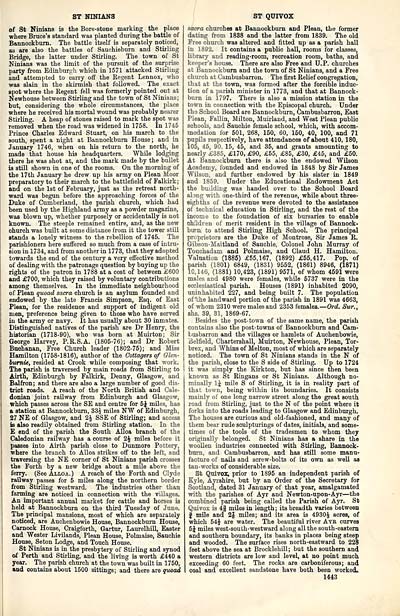
ST NINIANS
of St NinianB is the Bore-stone marking the place
where Bruce's standard was planted during the battle of
Bannockburn. The battle itself is separately noticed,
as are also the battles of Sauchieburn and Stirling
Bridge, the latter under Stirling. The town of St
Ninians was the limit of the pursuit of the surprise
party from Edinburgh which in 1571 attacked Stirling
and attempted to carry off the Regent Lennox, who
was slain in the skirmish that followed. The exact
spot where the Regent fell was formerly pointed out at
Newhouse between Stirling and the town of St Ninians;
but, considering the whole circumstances, the place
where he received his mortal wound was probably nearer
Stirling. A heap of stones raised to mark the spot was
removed when the road was widened in 1758. In 1746
Prince Charles Edward Stuart, on his march to the
south, spent a night at Bannockburn House ; and in
January 1746, when on his return to the north, he
made that house his headquarters. While lodging
there he was shot at, and the mark made by the bullet
is still shown in one of the rooms. On the morning of
the 17th January he drew up his army on Plean Moor
preparatory to their march to the battlefield of Falkirk;
and on the 1st of February, just as the retreat north-
ward was begun before the approaching forces of the
Duke of Cumberland, the parish church, which had
been used by the Highland army as a powder magazine,
was blown up, whether purposely or accidentally is not
known. The steeple remained entire, and, as the new
ohurch was built at some distance from it the tower still
stands a lonely witness to the rebellion of 1745. The
parishioners here suffered so much from a case of intru-
sion in 1734, and from another in 1773, that they adopted
towards the end of the century a very effective method
of dealing with the patronage question by buying up the
rights of the patron in 1788 at a cost of between £600
and £700, which they raised by voluntary contributions
among themselves. In the immediate neighbourhood
of Plean quoad sacra church is an asylum founded and
endowed by the late Francis Simpson, Esq. of East
Plean, for the residence and support of indigent old
men, preference being given to those who have served
in the army or navy. It has usually about 30 inmates.
Distinguished natives of the parish are Dr Henry, the
historian (1718-90), who was born at Muirton; Sir
George Harvey, P.R.S.A. (1805-76); and Dr Robert
Buchanan, Free Church leader (1802-75); and Miss
Hamilton (1758-1816), author of the Cottagers of Glen-
bwrnie, resided at Crook while composing that work.
The parish is traversed by main roads from Stirling to
Airth, Edinburgh by Falkirk, Denny, Glasgow, and
Balfron; and there are also a large number of good dis-
trict roads. A reach of the North British and Cale-
donian joint railway from Edinburgh and Glasgow,
which passes across the SE and centre for 5J miles, has
a station at Bannockburn, 33^ miles NW of Edinburgh,
27 NE of Glasgow, and 2J SSE of Stirling; and access
is also readily obtained from Stirling station. In the
E end of the parish the South Alloa branch of the
Caledonian railway has a course of 2J miles before it
passes into Airth parish close to Dunmore Pottery,
where the branch to Alloa strikes off to the left, and
traversing the NE corner of St Ninians parish crosses
the Forth by a new bridge about a mile above the
ferry. (See Alloa.) A reach of the Forth and Clyde
railway passes for 5 miles along the northern border
from Stirling westward. The industries other than
fanning are noticed in connection with the villages.
An important annual market for cattle and horses is
held at Bannockburn on the third Tuesday of June.
The principal mansions, most of which are separately
noticed, are Auchenbowie House, Bannockburn House,
Carnock House, Craigforth, Gartur, LaurelhilL Easter
and Wester Livilands, Plean House, Polmaise, Sauchie
House, Seton Lodge, and Touch House.
St Ninians is in the presbytery of Stirling and synod
of Perth and Stirling, and the living is worth £440 a
year. The parish church at the town was built in 1750,
and contains about 1500 sittings; and there are quoad
ST QUIVOX
sacra churches at Bannockburn and Plean, the former
dating from 1888 and the latter from 1839. The old
Free church was altered and fitted up as a parish hall
in 1892. It contains a public hall, rooms for classes,
library and reading-room, recreation room, baths, and
keeper's house. There are also Free and U.P. churches
at Bannockburn and the town of St Ninians, and a Free
church at Cambusbarron. The first Relief congregation,
that at the town, was formed after the forcible induc-
tion of a parish minister in 1773, and that at Bannock-
burn in 1797. There is also a mission station in the
town in connection with the Episcopal church. Under
the School Board are Bannockburn, Cambusbarron, East
Plean, Fallin, Milton, Muirland, and West Plean public
schools, and Sauchie female school, which, with accom-
modation for 501, 268, 150, 60, 150, 40, 100, and 71
pupils respectively, have attendances of about 410, 180,
105, 45, 90, 15, 45, and 35, and grants amounting to
nearly £385, £170, £90, £55, £85, £30, £45, and £50.
At Bannockburn there is also the endowed Wilson
Academy, founded and endowed in 1848 by Sir James
Wilson, and further endowed by his sister in 1849
and 1859. Under the Educational Endowment Act
the bu'lding was handed over to the School Board
aling with one-third of the revenue, while about three-
eighths of the revenue were devoted to the assistance
of technical education in Stirling, and the rest of the
income to the foundation of six bursaries to enable
children of merit resident in the village of Bannock-
burn, to attend Stirling High School. The principal
proprietors are the Duke of Montrose, Sir James R.
Gibson-Maitland of Sauchie, Colonel John Murray of
Touchadam and Polmaise, and Claud H. Hamilton.
Valuation (1885) £55,167, (1892) £55,417. Pop. of
parish (1801) 6849, (1831) 9552, (1861) 8946, (1871)
10,146, (1881) 10,423, (1891) 9571, of whom 4591 were
males, and 4980 were females, while 5737 were in the
ecclesiastical parish. Houses (1891) inhabited 2090,
uninhabited 227, and being built 7. The population
of ';he landward portion of the parish in 1891 was 4663,
of whom 2310 were males and 2353 females. — Ord. Sur.,
shs. 39, 31, 1869-67.
Besides the post-town of the same name, the parish
contains also the post-towns of Bannockburn and Cam-
busbarron and the villages or hamlets of Auchenbowie,
Belfield, Chartershall, Muirton, Newhouse, Plean, Tor-
brex, and Whins of Melton, most of which are separately
noticed. The town of St Ninians stands in the N of
the parish, close to the S side of Stirling. Up to 1724
it was simply the Eirkton, but has since then been
known as St Ringans or St Ninians. Although no-
minally 1J mile S of Stirling, it is in reality part of
that town, being within its boundaries. It consists
mainly of one long narrow street along the great south
road from Stirling, just to the N of the point where it
forks into the roads leading to Glasgow and Edinburgh.
The houses are curious and old-fashioned, and many of
them bear rude sculpturings of dates, initials, and some-
times of the tools of the tradesmen to whom they
originally belonged. St Ninians has a share in the
woollen industries connected with Stirling, Bannock-
burn, and Cambusbarron, and has still some manu-
facture of nails and screw-bolts of its own as well as
tan-works of considerable size.
St Quivox, prior to 1895 an independent parish of
Kyle, Ayrshire, but by an Order of the Secretary for
Scotland, dated 31 January of that year, amalgamated
with the parishes of Ayr and Newton-upon-Ayr — the
combined parish being called the Parish of Ayr. St
Quivox is 4f miles in length ; its breadth varies between
f mile and 2 J miles; and its area is 4930 J acres, of
which 54J are water. The beautiful river Atb curves
5J miles west-south-westward along all the south-eastern
and southern boundary, its banks in places being steep
and wooded. The surface rises north-eastward to 228
feet above the sea at Brocklehill; but the southern and
western districts are low and level, at no point much
exceeding 60 feet. The rocks are carboniferous; and
coal and excellent sandstone have both been worked,.
1443
Set display mode to: Large image | Transcription
Images and transcriptions on this page, including medium image downloads, may be used under the Creative Commons Attribution 4.0 International Licence unless otherwise stated. ![]()
| Gazetteers of Scotland, 1803-1901 > Ordnance gazetteer of Scotland > (1451) Page 1443 |
|---|
| Permanent URL | https://digital.nls.uk/97410658 |
|---|

