Ordnance gazetteer of Scotland
(634) Page 626 - GAI
Download files
Complete book:
Individual page:
Thumbnail gallery: Grid view | List view
GAIR LOCH
(1881) 4594, (1891) 4181, of whom 3852 were Gaelic-
speaking; of ecclesiastical parish (1871) 2426, (1881)
2277, (1891) 2071; of registration district (1881) 4479,
(1891) 4090, of whom 2773 were in the southern division.
— Ord. Stir., shs. 91, 92, 81, 82, 100, 1881-82. J. H.
Dixon's Gairloch (1888).
Qair Loch, Dumbartonshire. See Gare Loch.
Gairlochy, a hamlet in Eilmallie parish, Inverness-
shire, at the foot of Loch Lochy, 3 miles WNW of Spean
Bridge. It has a post office under Spean Bridge.
Gairn, a small river of Crathie and Glenmuick par-
ishes, SW Aberdeenshire, rising, on the eastern side
of Ben Avon, at 3550 feet above sea-level, and thence
winding 20 miles east-south-eastward along a mountain
glen called from it Glensairn, till, after a total descent
of 2810 feet it falls into the Dee at a point If mile
NW of Ballater. The Bridge of Gairn, on the line of
road from Aberdeen to Castleton, spans it J mile above
its mouth, and here is a post office under Ballater. —
Ord. Sur. shs. 75, 65, 1876-70.
Gairney Bridge, a farm at the NE verge of Cleisli
parish, Kinross-shire, on the left bank of Gairney Water,
If mile SSE of Kinross. In a public house here, on
the site of the farmstead stables, Ebenezer Erskine and
the three other fathers of the Secession formed them-
selves into a presbytery, 15 Dec. 1733; and on the site
of the farmhouse itself, the young poet Michael Bruce
(1746-67) taught a small school in 1765-66.— Ord. Sur.,
sh. 40, 1867.
Gairney Water, a burn of Glenmuick and Aboyne
parishes, SW Aberdeenshire, rising at an altitude of
2500 feet, and running 5| miles north-north-eastward,
through Glentanner Forest, till, after a descent of 1880
feet, it falls into Tanner Water at a point 5J miles SW
of Aboyne village. — Ord. Sur. sh. 66, 1871.
Gairney Water, a rivulet partly of Perthshire, but
chiefly of Kinross-shire. Rising among the hills of the
western portion of Fossoway parish, it runs 3J miles
east-south-eastward, and then proceeds 4f miles east-
by-northward, chiefly along the boundary between
Cleish parish on the right and Fossoway and Kinross
parishes on the left, till it falls into Loch Leven 2 miles
SE of Kinross town.— Ord. Sur., sh. 40, 1867.
Gairnside. See Glengairn.
Gairsay, an island of Evie and Rendall parish, Ork-
ney, 1J mile E of the nearest part of Orkney main-
land, and 1J NW of Shapinshay. It measures 2 miles
in greatest length, and 1£ mile in greatest breadth; con-
sists chiefly of a conical hill of considerable altitude ;
rises steeply on the W side; includes, on the E and on
the S, some low, fertile, well-cultivated land; contains,
close to the S shore, remains of a fine old mansion, once
the seat of Sir William Craigie; and has a public school
and a small harbour, called Millburn, perfectly sheltered
on all sides, mainly by Gairsay itself, and partly by a
small island in the harbour's mouth. Pop. (1891) 33.
Gaitnip, a range of coast crags in the S of Kirkwall
parish, Orkney, on the E side of the upper part of Scapa
Bay. Several caverns penetrate it, all formed by the
disintegrating action of the sea; and one, like a narrow
winding tunnel, over 300 feet long, and from 12 to 20
feet high, is beautifully studded with stalactites.
Galashiels, a parliamentary burgh and parish of Sel-
kirkshire. The town is situated on both banks of the
river Gala, about a mile above the confluence of that
river with the Tweed, and is 4 miles WNW of Melrose,
6 N of Selkirk, 18 ESE of Peebles, and 32 SSE of Edin-
burgh by road. It is a station on the Waverley section
of the North British railway, and from it diverge branch
lines to Selkirk and Peebles. The name, from Gala and
shiels or shielings, signifying shepherds' huts, appears to
have designated originally a small village, on the site
of what is now called the old or high town, which
had found its nucleus in the baronial seat of Gala, on
the S bank of the river. This Gallowschel was a place
of considerable antiquity, and is traditionally said to
have contained a hunting-seat of the Scottish monarchs.
Its name appears in a charter of the early part of the
14th century; it is mentioned as containing a tower of
626
Arms of Galashiels.
GALASHIELS
Earl Douglas in 1416; and it figures in documents
relating to the marriage of James IV. with the Princess
Margaret of England. The old peel tower, known as
' Hunters' Ha',' stood till the end of the 18th century;
and ivy -clad ruins of the tolbooth, whose vane bore date
1669, were demolished in the summer of 1880. The de-
cay of the village has been arrested by the prosperity of
the modern town, and its site is now occupied by numer-
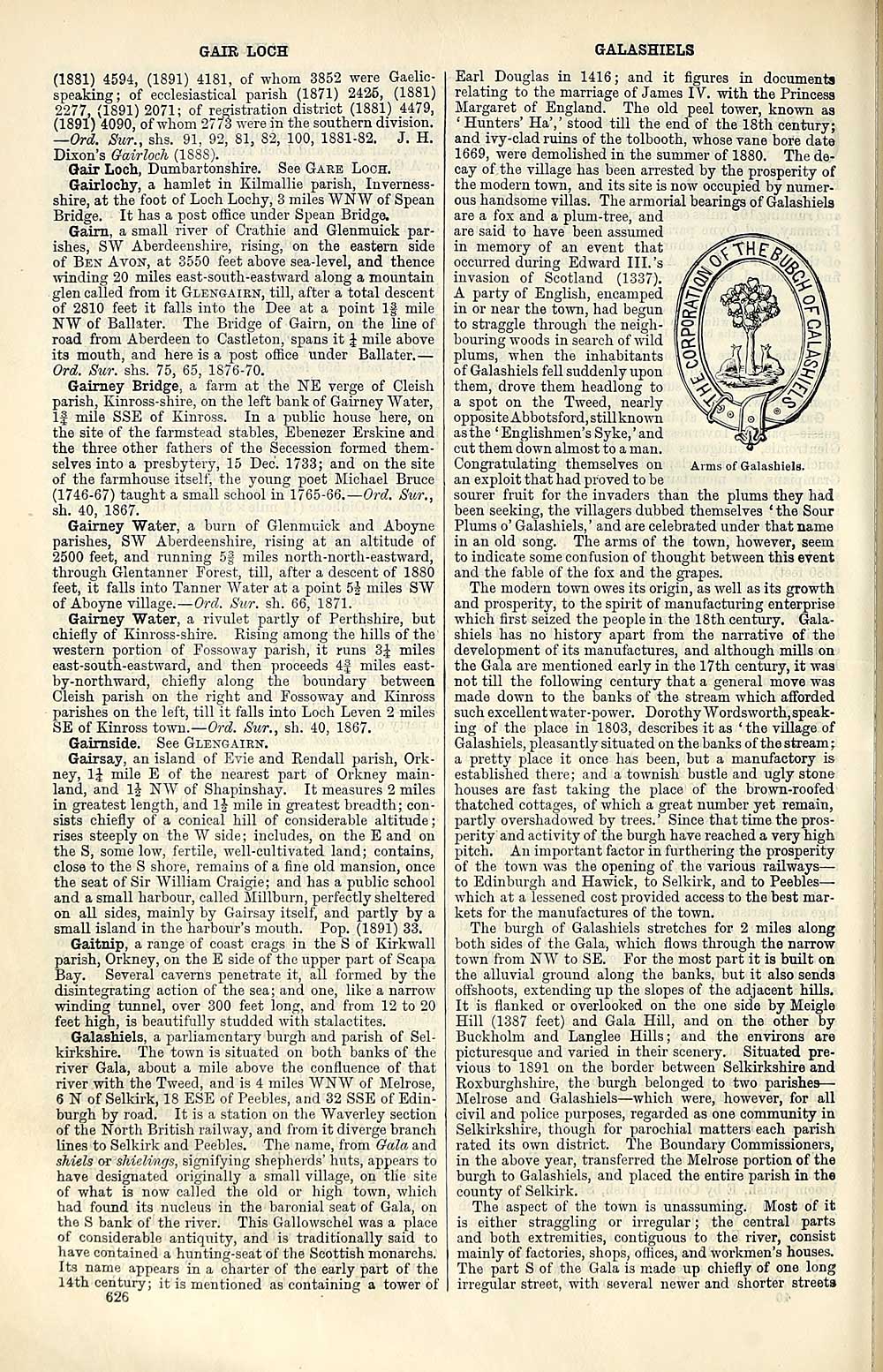
ous handsome villas. The armorial bearings of Galashiels
are a fox and a plum-tree, and
are said to have been assumed
in memory of an event that
occurred during Edward III.'s
invasion of Scotland (1337).
A party of English, encamped
in or near the town, had begun
to straggle through the neigh-
bouring woods in search of wild
plums, when the inhabitants
of Galashiels fell suddenly upon
them, drove them headlong to
a spot on the Tweed, nearly
opposite Abbotsford.still known
as the ' Englishmen's Syke,' and
cut them down almost to a man.
Congratulating themselves on
an exploit that had proved to be
sourer fruit for the invaders than the plums they had
been seeking, the villagers dubbed themselves ' the Sour
Plums o' Galashiels, ' and are celebrated under that name
in an old song. The arms of the town, however, seem
to indicate some confusion of thought between this event
and the fable of the fox and the grapes.
The modern town owes its origin, as well as its growth
and prosperity, to the spirit of manufacturing enterprise
which first seized the people in the 18th century, Gala-
shiels has no history apart from the narrative of the
development of its manufactures, and although mills on
the Gala are mentioned early in the 17th century, it was
not till the following century that a general move was
made down to the banks of the stream which afforded
such excellentwater-power. Dorothy Wordsworth,speak-
ing of the place in 1803, describes it as ' the village of
Galashiels, pleasantly situated on the banks of the stream ;
a pretty place it once has been, but a manufactory is
established there ; and a townish bustle and ugly stone
houses are fast taking the place of the brown-roofed
thatched cottages, of which a great number yet remain,
partly overshadowed by trees. ' Since that time the pros-
perity and activity of the burgh have reached a very high
pitch. An important factor in furthering the prosperity
of the town was the opening of the various railways —
to Edinburgh and Hawick, to Selkirk, and to Peebles —
which at a lessened cost provided access to the best mar-
kets for the manufactures of the town.
The burgh of Galashiels stretches for 2 miles along
both sides of the Gala, which flows through the narrow
town from NW to SE. For the most part it is built on
the alluvial ground along the banks, but it also sends
offshoots, extending up the slopes of the adjacent hills.
It is flanked or overlooked on the one side by Meigle
Hill (1387 feet) and Gala Hill, and on the other by
Buckholm and Langlee Hills ; and the environs are
picturesque and varied in their scenery. Situated pre-
vious to 1S91 on the border between Selkirkshire and
Roxburghshire, the burgh belonged to two parishes —
Melrose and Galashiels — which were, however, for all
civil and police purposes, regarded as one community in
Selkirkshire, though for parochial matters each parish
rated its own district. The Boundary Commissioners,
in the above year, transferred the Melrose portion of the
burgh to Galashiels, and placed the entire parish in the
county of Selkirk.
The aspect of the town is unassuming. Most of it
is either straggling or irregular ; the central parts
and both extremities, contiguous to the river, consist
mainly of factories, shops, offices, and workmen's houses.
The part S of the Gala is made up chiefly of one long
irregular street, with several newer and shorter streets
(1881) 4594, (1891) 4181, of whom 3852 were Gaelic-
speaking; of ecclesiastical parish (1871) 2426, (1881)
2277, (1891) 2071; of registration district (1881) 4479,
(1891) 4090, of whom 2773 were in the southern division.
— Ord. Stir., shs. 91, 92, 81, 82, 100, 1881-82. J. H.
Dixon's Gairloch (1888).
Qair Loch, Dumbartonshire. See Gare Loch.
Gairlochy, a hamlet in Eilmallie parish, Inverness-
shire, at the foot of Loch Lochy, 3 miles WNW of Spean
Bridge. It has a post office under Spean Bridge.
Gairn, a small river of Crathie and Glenmuick par-
ishes, SW Aberdeenshire, rising, on the eastern side
of Ben Avon, at 3550 feet above sea-level, and thence
winding 20 miles east-south-eastward along a mountain
glen called from it Glensairn, till, after a total descent
of 2810 feet it falls into the Dee at a point If mile
NW of Ballater. The Bridge of Gairn, on the line of
road from Aberdeen to Castleton, spans it J mile above
its mouth, and here is a post office under Ballater. —
Ord. Sur. shs. 75, 65, 1876-70.
Gairney Bridge, a farm at the NE verge of Cleisli
parish, Kinross-shire, on the left bank of Gairney Water,
If mile SSE of Kinross. In a public house here, on
the site of the farmstead stables, Ebenezer Erskine and
the three other fathers of the Secession formed them-
selves into a presbytery, 15 Dec. 1733; and on the site
of the farmhouse itself, the young poet Michael Bruce
(1746-67) taught a small school in 1765-66.— Ord. Sur.,
sh. 40, 1867.
Gairney Water, a burn of Glenmuick and Aboyne
parishes, SW Aberdeenshire, rising at an altitude of
2500 feet, and running 5| miles north-north-eastward,
through Glentanner Forest, till, after a descent of 1880
feet, it falls into Tanner Water at a point 5J miles SW
of Aboyne village. — Ord. Sur. sh. 66, 1871.
Gairney Water, a rivulet partly of Perthshire, but
chiefly of Kinross-shire. Rising among the hills of the
western portion of Fossoway parish, it runs 3J miles
east-south-eastward, and then proceeds 4f miles east-
by-northward, chiefly along the boundary between
Cleish parish on the right and Fossoway and Kinross
parishes on the left, till it falls into Loch Leven 2 miles
SE of Kinross town.— Ord. Sur., sh. 40, 1867.
Gairnside. See Glengairn.
Gairsay, an island of Evie and Rendall parish, Ork-
ney, 1J mile E of the nearest part of Orkney main-
land, and 1J NW of Shapinshay. It measures 2 miles
in greatest length, and 1£ mile in greatest breadth; con-
sists chiefly of a conical hill of considerable altitude ;
rises steeply on the W side; includes, on the E and on
the S, some low, fertile, well-cultivated land; contains,
close to the S shore, remains of a fine old mansion, once
the seat of Sir William Craigie; and has a public school
and a small harbour, called Millburn, perfectly sheltered
on all sides, mainly by Gairsay itself, and partly by a
small island in the harbour's mouth. Pop. (1891) 33.
Gaitnip, a range of coast crags in the S of Kirkwall
parish, Orkney, on the E side of the upper part of Scapa
Bay. Several caverns penetrate it, all formed by the
disintegrating action of the sea; and one, like a narrow
winding tunnel, over 300 feet long, and from 12 to 20
feet high, is beautifully studded with stalactites.
Galashiels, a parliamentary burgh and parish of Sel-
kirkshire. The town is situated on both banks of the
river Gala, about a mile above the confluence of that
river with the Tweed, and is 4 miles WNW of Melrose,
6 N of Selkirk, 18 ESE of Peebles, and 32 SSE of Edin-
burgh by road. It is a station on the Waverley section
of the North British railway, and from it diverge branch
lines to Selkirk and Peebles. The name, from Gala and
shiels or shielings, signifying shepherds' huts, appears to
have designated originally a small village, on the site
of what is now called the old or high town, which
had found its nucleus in the baronial seat of Gala, on
the S bank of the river. This Gallowschel was a place
of considerable antiquity, and is traditionally said to
have contained a hunting-seat of the Scottish monarchs.
Its name appears in a charter of the early part of the
14th century; it is mentioned as containing a tower of
626
Arms of Galashiels.
GALASHIELS
Earl Douglas in 1416; and it figures in documents
relating to the marriage of James IV. with the Princess
Margaret of England. The old peel tower, known as
' Hunters' Ha',' stood till the end of the 18th century;
and ivy -clad ruins of the tolbooth, whose vane bore date
1669, were demolished in the summer of 1880. The de-
cay of the village has been arrested by the prosperity of
the modern town, and its site is now occupied by numer-
ous handsome villas. The armorial bearings of Galashiels
are a fox and a plum-tree, and
are said to have been assumed
in memory of an event that
occurred during Edward III.'s
invasion of Scotland (1337).
A party of English, encamped
in or near the town, had begun
to straggle through the neigh-
bouring woods in search of wild
plums, when the inhabitants
of Galashiels fell suddenly upon
them, drove them headlong to
a spot on the Tweed, nearly
opposite Abbotsford.still known
as the ' Englishmen's Syke,' and
cut them down almost to a man.
Congratulating themselves on
an exploit that had proved to be
sourer fruit for the invaders than the plums they had
been seeking, the villagers dubbed themselves ' the Sour
Plums o' Galashiels, ' and are celebrated under that name
in an old song. The arms of the town, however, seem
to indicate some confusion of thought between this event
and the fable of the fox and the grapes.
The modern town owes its origin, as well as its growth
and prosperity, to the spirit of manufacturing enterprise
which first seized the people in the 18th century, Gala-
shiels has no history apart from the narrative of the
development of its manufactures, and although mills on
the Gala are mentioned early in the 17th century, it was
not till the following century that a general move was
made down to the banks of the stream which afforded
such excellentwater-power. Dorothy Wordsworth,speak-
ing of the place in 1803, describes it as ' the village of
Galashiels, pleasantly situated on the banks of the stream ;
a pretty place it once has been, but a manufactory is
established there ; and a townish bustle and ugly stone
houses are fast taking the place of the brown-roofed
thatched cottages, of which a great number yet remain,
partly overshadowed by trees. ' Since that time the pros-
perity and activity of the burgh have reached a very high
pitch. An important factor in furthering the prosperity
of the town was the opening of the various railways —
to Edinburgh and Hawick, to Selkirk, and to Peebles —
which at a lessened cost provided access to the best mar-
kets for the manufactures of the town.
The burgh of Galashiels stretches for 2 miles along
both sides of the Gala, which flows through the narrow
town from NW to SE. For the most part it is built on
the alluvial ground along the banks, but it also sends
offshoots, extending up the slopes of the adjacent hills.
It is flanked or overlooked on the one side by Meigle
Hill (1387 feet) and Gala Hill, and on the other by
Buckholm and Langlee Hills ; and the environs are
picturesque and varied in their scenery. Situated pre-
vious to 1S91 on the border between Selkirkshire and
Roxburghshire, the burgh belonged to two parishes —
Melrose and Galashiels — which were, however, for all
civil and police purposes, regarded as one community in
Selkirkshire, though for parochial matters each parish
rated its own district. The Boundary Commissioners,
in the above year, transferred the Melrose portion of the
burgh to Galashiels, and placed the entire parish in the
county of Selkirk.
The aspect of the town is unassuming. Most of it
is either straggling or irregular ; the central parts
and both extremities, contiguous to the river, consist
mainly of factories, shops, offices, and workmen's houses.
The part S of the Gala is made up chiefly of one long
irregular street, with several newer and shorter streets
Set display mode to: Large image | Transcription
Images and transcriptions on this page, including medium image downloads, may be used under the Creative Commons Attribution 4.0 International Licence unless otherwise stated. ![]()
| Gazetteers of Scotland, 1803-1901 > Ordnance gazetteer of Scotland > (634) Page 626 - GAI |
|---|
| Permanent URL | https://digital.nls.uk/97400854 |
|---|
| Description | A graphic and accurate description of every place in Scotland. Edited by Francis H. Groome. New ed., with census appendix 1901. Edinburgh: T.C. and E.C. Jack, 1901. This edition contains all the printed matter of the large 6 vol. edition, the revisions made in 1895 and subsequent partial revisions. Copy lacks title page. |
|---|---|
| Shelfmark | Map.Ref.C18 |
| Additional NLS resources: | |
| Attribution and copyright: |
|
| Description | 20 volumes of the most popular descriptive gazetteers of Scotland, providing a comprehensive geographical encyclopaedia of Scotland in the 19th century. Principal places in Scotland, including towns, counties, castles, glens, antiquities and parishes, are listed alphabetically. Each entry includes detailed historical and geographical information about each place. |
|---|---|