Ordnance gazetteer of Scotland
(632) Page 624
Download files
Complete book:
Individual page:
Thumbnail gallery: Grid view | List view

FYRISH
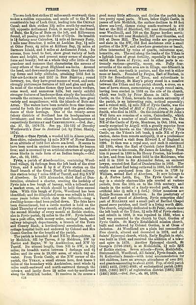
The sea-loch first strikes 27 miles south-westward; then
makes a sudden expansion, and sends off to the N the
considerable bay of Loch Gilp, leading into the Crinan
Canal; and then strikes 13£ miles south-by-eastward,
till, opposite Ardlamont Point, it merges in the Sound
of Bute, the Kyles of Bute on the left, and Kilbrennan
Sound, all passing into the Firth of Clyde. Its breadth
is If furlong near Cairndow, 1§ mile at Inverary Ferry,
1 mile near Strachur, 2 miles at Lachlan Bay, 1J mile
at Otter Ferry, 4J miles at Kilfinan Bay, 2£ miles at
Bannore Island, and 5 miles at Ardlamont Point. Its
screens, from head to foot, show great variety of both
shore and height, and present many scenes of singular
force and beauty; but as a whole they offer little of the
grandeur and romance that characterise the screens of
many others of the great Highland sea-lochs. Around
the head, and downwards past Inverary, they have strik-
ing forms and lofty altitudes, attaining 2955 feet in
Ben-an-Lochain and 2557 in Ben Bheula ; round
Inverary, too, they have great masses of wood, and some
strongly picturesque features of hill and glen and park.
In most of the reaches thenee they have much verdure,
some wood, and numerous hills, but rarely exhibit
stronger features of landscape than simply the beautiful ;
towards the entrance, however, they combine, into great
variety and magnificence, with the islands of Bute and
Arran. The waters have been notable from time imme-
morial for both the prime quality and the great abun-
dance of their herrings. One of the twenty -seven
fishery districts of Scotland has its headquarters at
Inverary; and two others have their headquarters at
respectively Rothesay and Campbeltown. — Ord. Sur.,
shs. 37, 29, 1876-73. See pp. 124-132 of Dorothy
Wordsworth's Tour in Scotland (ed. by Princ. Shairp,
1874).
Fyrish or Cnoc Fyrish, a wooded hill in Alness parish,
Ross-shire, culminating 1J mile NNW of Novar House
at an altitude of 1483 feet above sea-level. It seems to
have been used in ancient times as a station for beacon
fires; and is crowned by an artificial structure of upright
stono blocks in rude form of an Indian temple. — Ord.
Sur., sh. 93, 1881.
Fyvie, a parish of Aberdeenshire, containing Wood-
head village, 2 J furlongs from the left bank of the river
Ythan, and 3 miles E by S of Fyvie station on the
Banff branch of the Great North of Scotland railway,
this station being 7 miles SSE of Turriff, and 31J NNW
of Aberdeen. In 1673 Alexander, third Earl of Dun-
fermline, obtained a charter, erecting the lordship of
Fyvie into a free burgh of barony, with a tolbooth and
a market cross, at which should be held three annual
fairs. With this burgh of Fyvie, Woodhead has been
identified; and its dilapidated cross was rebuilt in 1846,
some years before which date the tolbooth — long a
dwelling-house — liad been pulled down. The fairs have
been discontinued, but a cattle market is held on the
third Thursday of every month at Fyvie station, and on
the second Monday of every month at Rothie station,
also in Fyvie parish, 3J miles to the SW. Fyvie besides
has a post office, with money order, savings' bank, and
railway telegraph departments, a branch of the Town
and County Bank, a horticultural association, and a
cottage hospital built and endowed by Colonel and Mrs
Cosmo Gordon for the benefit of the parish.
The parish is bounded N and NE by Monquhitter, E
by Methlick, SE by Tarves, S by Meldrum, SW by
Daviot and Rayne, W by Auchterless, and NW by
Turriff. Its utmost length, from NE to SW, is 10J
miles; its breadth varies between 7 furlongs and 6£
miles; and its area is 29,650 acres, of which 64f are
water. From Towie Castle, at the NW corner of the
parish, the Ythan, a small stream here, first traces 2
miles of the boundary with Auchterless, next winds 8J
miles south-eastward and north-eastward through the
interier, and lastly flows 2| miles east-by-northward
along the Metblick border. It receives in its course a
624
FYVIE
good many little affluents, and divides the parish into
two pretty equal parts. Where, below Gight Castle, it
passes off into Methlick, the surface declines to 88 feet
above sea-level, thence rising south-westward to 499
feet at the Hill of Blairfowl, 691 near Stoneyfield, 629
near Waulkmill, and 700 on the Rayne border; north-
westward to 466 near Monkshill, 587 near Gourdas, and
585 at Deers Hill. The leading rocks are greywacke
and slate in the SW, Old Red sandstone over a small
portion of the NW, and elsewhere greenstone or basalt,
often intersected by veins of quartz, calcareous spar,
hematite, etc. The soil along the banks of the Ythan is
a lightish loam of great fertility, especially in the part
called the Howe of Fyvie; and in other parts is ex-
tremely various — gravelly, mossy, etc. Fully four-
sevenths of the entire area are in tillage, one-fifteenth is
under wood, one-tenth is pasture, and the rest is either
moss or heath. Founded by Fergus, Earl of Buchan, in
1179 for Benedictines of Tiron, and subordinate to
Arbroath Abbey, St Mary's priory stood in a meadow
between the Ythan and the parish church, a cross, on a
base of hewn stones, surmounting a rough round cairn,
having been erected in 1868 on the site of its church,
which was built by Prior Mason in 1470. Gight
Castle, on the Ythan, towards the eastern extremity of
the parish, is an interesting ruin, noticed separately;
and a ruined mill, 1£ mile NE of Fyvie Castle, was the
scene of the ballad of Mill o' Tifty's Annie, or Agnes
Smith, who died in 1673. On the outskirts of St John's
Well farm are remains of a cairn, Cairnchedly, which
has yielded a number of small earthen urns. To the
NE of the Castle of Fyvie, Montrose, in Oct. 1644, was
nearly surprised by Argyll with a greatly superior force
— an episode known as the ' Skirmish of Fyvie. ' This
Castle, on the Ythan's left bank, \ mile NE of Fyvie
station, dates from remote antiquity, it or a predecessor
having received a visit from Edward I. of England in
1296. It then was a royal seat, and such it continued
till 1380, when the Earl of Carrick (later Robert III.)
made it over to his cousin, Sir James de Lindsay. From
him it passed in 1390 to Sir Henry Preston, his brother-
in-law, and from him about 1433 to the Meldrums, who
sold it in 1596 to Sir Alexander Seton, an eminent
lawyer, created first Earl of Dunfermline in 1605. The
fourth and last Earl being outlawed in 1690, his forfeited
estate was purchased from the Crown in 1726 by
William, second Earl of Aberdeen. It now belongs to
A. J. Forbes Leith, Esq. The Fyvie Castle of to-
day is a stately chateau-like pile erected at various
periods, from the 13th on to the 18th century; and
stands in the midst of a finely-wooded park, with an
artificial lake (J mile x £ furl.) Other mansions are
Rothie-Norman and Kinbroon. In the presbytery of
Turriff and synod of Aberdeen, Fyvie comprises chief
part of Millbeex and a small part of Barthol Chapel
quoad sacra parishes, and itself is a living worth £880.
The church, originally dedicated to St Peter, stands near
the left bank of the Ythan, If mile SE of Fyvie station;
and rebuilt in 1808, it was repaired in 1885, when a
hall was presented to the church by Capt. Gordon of
Fyvie Castle. St Mary's Established mission church,
built and endowed by Colonel Gordon, is at Cross of
Jackston. At Woodhead are a plain but commodious
Free church, altered and decorated in 1878, and All
Saints' Episcopal church, which, Early English in style,
was built in 1849, and received the addition of a tower
and spire in 1870. Another Episcopal church, St
George's (1796-1848), is at Meiklefolla, If mile SSE
of Rothie station. Seven schools — Fyvie, Meiklefolla,
Steinmanhill, Woodhead, All Saints', Fyvie female, and
St Katherine's female — with total accommodation for
938 children, have an average attendance of over 580,
and grants amounting to about £600. Pop. of civil parish
(1881) 4403, (1891) 4049; of ecclesiastical parish (1883J
3235, (1891) 2977; of registration district (1881) 3317
(1891) 3050.— Ord. Sur., sh. 86, 1876.
Set display mode to: Large image | Transcription
Images and transcriptions on this page, including medium image downloads, may be used under the Creative Commons Attribution 4.0 International Licence unless otherwise stated. ![]()
| Gazetteers of Scotland, 1803-1901 > Ordnance gazetteer of Scotland > (632) Page 624 |
|---|
| Permanent URL | https://digital.nls.uk/97400830 |
|---|

