Ordnance gazetteer of Scotland > Volume 4
(229) Page 443 - KIR
Download files
Complete book:
Individual page:
Thumbnail gallery: Grid view | List view
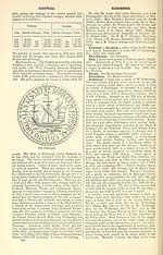
KIRRIEMUIR
KIRTLE WATER
factories have been erected. The weavers, in some years,
particularly in 1S26 and 1841, suffered severely from a
great fall of wages ; and often have had to struggle with
poverty and privation ; but they have manfully breasted
every difficulty, and are admitted throughout the county
to be expert and skilful operatives. Among them have
been men of marked intelligence. One, David Sands,
who flourished in 1760, invented a method of weaving
double cloth for the use of stay-makers, and wove and
finished in the loom three seamless shirts. The manu-
facture began to assume importance about the middle of
the last century, and so early as 1792 produced osna-
burgs and coarse linens to the yearly value of £30,000.
It turned out annually, before the close of the century,
1,SOO,000 yards of stamped linen ; and year by year the
produce has increased till now it reaches between
10,000,000 and 15,000,000 yards, whilst giving employ-
ment inthetown and neighbourhood to over 2000 weavers.
The feud of the weavers of Kirriemuir and the sutors of
Forfar has been already noticed under the latter town.
Kirriemuir is a burgh of barony, under the Earl of
Home ; but, as a burgh, it has neither property, revenue,
nor debt. A baron bailie, appointed by the superior,
up to the year 1875 was the only magistrate, and pre-
sided as judge in a police and barony court. In 1875
the General Police and Improvement (Scotland) Act
was adopted, and the affairs of the town have since been
managed by the commissioners appointed under it.
The magistrates of police now preside in the police
court ; but the baron bailie still presides in the barony
court held in connection with certain of the fairs.
A sheriff small debt court sits on the third Monday
of January, March, May, July, September, and Novem-
ber ; and the district justices of peace hold courts as
occasion requires. Burgh valuation (1S83) £8635, Is. 6d.
Pop. of entire town (1831) 4014, (1861) 4686, (1871)
4145, (1SS1) 4390, of whom 2493 were females, whilst
2937 were in Kirriemuir proper or the police burgh
and 1453 in the Southmuir suburb.
The parish consists of two mutually detached sections,
lying lj mile asunder at the narrowest, and separated
one from another by a strip of Kingoldrum — the main
or Strathmore division containing the town, and the
north-western or Grampian division. The latter,
bounded N, NE, and E by Cortachy, S by Kingoldrum,
SW by Lintrathen, and Nff by Glenisla, has an ut-
most length from Nff to SE of 11 miles, with an ut-
most width of 4J miles ; whilst the main body is bounded
N by Cortachy, NE by Tannadice, E by Oathlaw, SE
by Forfar and Glamis, S by Glamis, SW by Airlie, and
W and Nff by Kingoldrum, having an almost equal ex-
treme length and breadth from N to S and from E to
W of 5| and 5J miles. The area of the whole is 35,65SJ
acres, of which 20,630f belong to the north-western
division, and 56« are water. Proses Water, rising in
the north-western extremity of the Grampian section on
the western slope of Mayar at an altitude of 2750 feet,
runs 12g miles through the interior, and then 3 furlongs
along the Kingoldrum border ; during this course it re-
ceives the tribute of sixteen burns. Where it quits this
section, the surface declines to 690 feet above sea-level,
thence rising north-westward to 2196 feet at Cat Law,
1998 at Corwham, 2302 at Broom Hill, 3105 at Driesh,
and 3043 at Mayar. of which the three first culminate
on the south-western, and the two last on the northern,
boundary. After flowing 2| miles south-south-eastward
along the mutual border of Cortachy and Kingoldrum,
Prosen Water winds 2J miles east-by-southward along
all the Cortachy boundary of the main division of
Kirriemuir, till it falls into the South Esk, which itself
runs 2 miles east-south-eastward along all the Tanna-
dice border, and which from the interior is joined by
Caeity Burn, first tracing 1J mile of the north-western
boundary, and next flowing 5j miles eastward across
the northern interior. The southern is drained by
Gairie Burn, winding 6§ miles south-south-eastward,
till it passes off into Glamis on its way to Dean Water,
and itself fed by Dairsie Burn, which traces 3 miles of
the south-western and southern boundary. In the ex-
treme S the surface sinks to 190, along the South Esk
in the NE to 295, feet above sea-level ; and between
these points it rises to 631 feet at the Hill of Kirriemuir,
| 513 at Cloisterbank, and 1018 at Culhawk Hill. The
[ principal rocks of the Grampian section are mica slate,
hornblende slate, and gneiss ; those of the Strathmore
section are mainly Devonian, with occasional protru-
sions of trap. Limestone has been quarried and calcined.
The soil of the arable tracts of the Grampian section is
partly thin and light, partly mossy, and generally wet ;
that in considerable belts on both the northern and
southern borders of the Strathmore section is sandy ;
and that of the central and larger portions of the same
section is mostly a black mould on a subsoil of so-called
'morter.' Of the north-western division, at least five-
sixths are waste, and one-thirty-sixth is under wood ;
of the main body one-eighth is under plantations in fine
arrangements of eluinps and groves, eleven-sixteenths
are regularly or occasionally in tillage, and nearly all
the rest of the area is chiefly pasture and partly moss,
the Mosses of Kinnordy and Balloch being constantly
used for supplies of peat. Extant antiquities are tumuli
and uninseribed monumental stones ; querns, arrow-
heads, battle-axes, and two canoes or currachs have
been discovered from time to time ; and not so long
ago two ponderous rocking-stones stood a little NW
of the hill that overlooks the town. Inverquharity
Castle is noticed by itself. Within this parish several
skirmishes were fought arising out of the Ogilvies'
feuds ; and the Battle of Arbroath (1446) must have
been a grievous blow to Kirriemuir. Mansions, noticed
separately, are Kinnordy, Shielhill, Logie, and Balna-
both ; and 7 proprietors hold each an annual value of
£500 and upwards, 14 of between £100 and £500, 17 of
from £50 to £100, and 98 of from £20 to £50. The
north-western division has formed, since 1874, the
quoad sacra parish of Glenprosen ; the south-eastern
division, also in the presbytery of Forfar and synod of
Angus and Mearns, is divided ecclesiastically between
Kirriemuir proper and Kirriemuir South Church, the
former a living worth £346. Five pre-Pieforrnation
chapels, besides the parish church, were in Kirriemuir —
one in the town, near a plot of ground called in old
writs the Kirkyard ; one in Glenprosen, which con-
tinued to be used till the erection of the modern mission
church there ; one at a place called Chapeltown, 3J
miles N by W of the town ; one at Kilnhill, 2 miles
E by N of the town ; and one near Ballinshae, 3 miles
ESE, the site of which, still enclosed with a wall, was
used as a family burying-place. Four public schools —
Carroch, Glenprosen, Padanaram, and Roundyhill —
with respective accommodation for 50, 50, 60, and 80
children, had (1881) an average attendance of 50, 50,
61, and 68, and grants of £33, 14s. 6d. , £35, 6s. , £41, 12s. ,
and £50, 16s. Valuation (1S57) £21,850, (1883) £31,910,
8s. 7d., phis £1762 for railway. Pop. (1801) 4421,
(1831) 6425, (1S61) 7359, (1871) 6420, (1881) 6616, of
whom 3740 were in Kirriemuir proper, 2701 in Kirrie-
muir South Parish, and 175 in Glenprosen. — Ord. Sur.,
shs. 56, 57, 65, 1S68-70.
Eirroughtree or Kirouchtree (Celt, caer-l/chtred,
'fort of Uchtred '), a mansion, with finely wooded
grounds, in Minnigaff parish, W Kirkcudbrightshire,
1 mile NE of Newton-Stewart. Its owner, Capt. John
Maxwell Heron-Maxwell (b. 1836 : sue. 1870), Liberal
M.P. for the county since 1880, holds 12,300 acres in the
shire, valued at £3452 per annum. — Ord. Sur. , sh. 4, 1857.
Kirtle -Bridge, a village in the SE corner of Middlebie
parish, Dumfriesshire, on the right bank of Kirtle
Water. It has a station on the Caledonian railway at
the junction of the Solway railway, 54 miles NNE of
Annan and 3J ESE of Ecclefechan, under which there
is a post and railway telegraph office. Kirtle Established
chapel, in Annan parish, near the village, was built at
a cost of £500.
Kirtlefoot. See Kirtle Water.
Kirtle Water, a stream of SE Dumfriesshire, formed,
in the extreme N of Middlebie parish, by the confluence of
two head-streams, of which Winterhope Burn, rising at an
443
Set display mode to: Large image | Transcription
Images and transcriptions on this page, including medium image downloads, may be used under the Creative Commons Attribution 4.0 International Licence unless otherwise stated. ![]()
| Gazetteers of Scotland, 1803-1901 > Ordnance gazetteer of Scotland > Volume 4 > (229) Page 443 - KIR |
|---|
| Permanent URL | https://digital.nls.uk/97383094 |
|---|
| Attribution and copyright: |
|
|---|---|
| Description | A survey of Scottish topography, statistical, biographical, and historical. Edited by Francis H. Groome. Edinburgh: Thomas C. Jack, 1884-85. "General survey": v.6, 134 p. at end. |
|---|---|
| Shelfmark | Map.Ref.C18 |
| Additional NLS resources: | |
| Description | 20 volumes of the most popular descriptive gazetteers of Scotland, providing a comprehensive geographical encyclopaedia of Scotland in the 19th century. Principal places in Scotland, including towns, counties, castles, glens, antiquities and parishes, are listed alphabetically. Each entry includes detailed historical and geographical information about each place. |
|---|---|