Ordnance gazetteer of Scotland > Volume 3
(263) Page 193
Download files
Complete book:
Individual page:
Thumbnail gallery: Grid view | List view

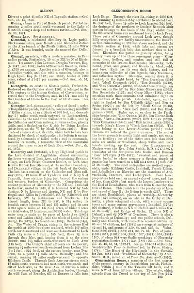
GLENN7
Etive at a poiut 4.^ miles NE of Taynuilt station. — Ord.
Sur., sh. 45, 1876.
Glenny, a burn in Port of Meuteith parish, Perthshire,
running 2 miles south-south-westward to the Lake of
Meuteith along a deep and tortuous ravine. — Ord. Sur.,
sh. 3S, 1S71.
Glenny Law. See Abernyte.
Glenochil, a celebrated distillery in Logie parish,
Clackmannanshire, near Menstrie and Glenochil station
on the Alva branch of the North British, li mile WSW
of Alva. It was founded, under the name of the ' Dolls,'
in 1760.
Glenogil, an estate, with a modern mansion, in Tan-
nadice parish, Forfarshire, 10 miles NE by N of Kirrie-
muir. Its owner, John Leveson Douglas Stewart, Esq.
(b. 1S42 ; sue. 1867), holds 5524 acres in the shire, valued
at £510 per annum. Another estate of Glenogil, also in
Tannadice parish, and also with a mansion, belongs to
Hugh Lyon, Esq. (b. 1812 ; sue. 1866), holder of 2100
acres, valued at £1472 per annum. — Ord. Sicr., sh. 57,
1868.
Glenogilvie, an estate in Glamis parish, Forfarshire.
Bestowed on the Ogilvies about 1163, it belonged in the
17th century to the famous Graham of Claverhouse, re-
verted then to the Douglases, and, in 1871, was sold by
the Countess of Home to the Earl of Strathmore. See
Glamis.
Glenogle (Gael, glcann-eagal, 'valley of dread'), a glen
ofBalquhiJder parish, Perthshire, commencingJmileSSE
of Killin station, at an altitude of 980 feet, and descend-
ing 3;^ miles south-south-eastward to Lochearnhead.
Traversed by the road from Callander to Killin, and by
the Callander and Oban railway, it forms a close, gloomy
defile, and is Hanked on the E side by Beinn Leathan
(2312 feet), on the W by Meall Sgliata (2250). Hun-
dreds of runnels streak its cliffs, which look to have been
shattered by shock of earthquake ; its bottom is encum-
bered by thousands of fallen rocks ; and it commands,
towards its mouth, a romantic view of the mountains
around the upper waters of Loch Earn. — 07-d. Sur., sh.
46, 1872.
Glenorchy and Innishail, a large Highland parish in
the Lorn district of Argyllshii'e, almost surrounding
the lower waters of Loch Awe, and containing Bunawe
village, on Loch Etive ; Cladich hamlet, on Loch Awe ;
King's House Inn (Glencoe), at the northern boundary ;
and Dalmally village, on the left bank of the Orchy.
The last has a station on the Callander and Oban rail-
way (1880), 12 miles W of Tyndrum and 9 E by S of
Taynuilt, these stations Ij'iug just beyond the eastern
and western borders of Glenorchy. Comprising the
ancient parishes of Glenorchv to the NE and Innishail
to the SW, united in 161S, it is bounded NW by Ard-
chattan, N by Lismore and Appiu, NE and E by For-
tingall and Killin in Perthshire, SE by Kilmorich and
Inverary, SW by EOehrenan and Muckairn. Its
utmost length, from NE to SW, is 31J miles ; its
breadth varies between 5J and 13§ miles ; and its area
is 231 square miles or 147,876J acres, of which 6 acres
are tidal water, 37 foreshore, and 5898* water. This large
water area is made up by parts of Lochs Awe (2865J
acres) and Laidon (3564), and the whole of Lochs Tulla
(697J), Ba (612J), Na h-achlaise (183i), Dochard (844),
etc. The Water of Tulla, rising in the extreme E of
the parish at 2700 feet above sea-level, winds lOf miles
north-north-westward and west-south-westward to Loch
Tulla (2J miles x 5 furl. ; 555 feet), flows Ig mile
through that lake, and, issuing from it as the river
Opxhy, runs 164 miles south-westward to Loch Awe
(lis feet). The Orchy's chief affluents are the Lochy',
running 8J miles west-south-westward from Lochan Bhe
(6x1 furl. ; 822 feet), at the eastern border, near Tyn-
drum, to a point li mile above Dalmally ; and the
Stkae, running SJ miles south-westward to opposite
Kilchuru Castle. 'Through Loch Awe our stream steals
4| miles south-westward and west-north-westward; and
out of Loch Awe, as the river Awe, it hurries 5 miles
north-westward, along the Ardcbattan border, through
the wild Pass of Brander, till at Bunawe it falls into
GLENORMISTON HOUSE
Loch Etive. Through the river Ba, rising at 2300 feet,
and running 4^ miles east-by-northward to isleted Loch
Ba (957 feet), thence IJ mile to Loch Laidon (924 feet),
the drainage of the northern or desolate Rannoch Muip
portion belongs to the basin of the Tay ; whilst from
the SE several burns run southward towards Loch Fyne.
Tliose parts of Glenorchy around Loch Awe, though
hilly everywhere, are hardly mountainous, the Bunawe
section culminating at 899 feet above sea-level, and the
Cladich section at 1846, while lake and stream are
fringed by a broadish belt that nowhere rises to 500
feet. Elsewhere the parish is grandly alpine, being
mainly made up of the three convergent glens — ' Glen-
strae, deep, hollow, and sombre, and still full of
memories of the lawless MacGregors ; Glenorchy, rock-
bound, green, and grand ; and Glenlochy, bleak, cold,
and bare. Each has its own dark history, and its
home-spun collection of clan legends, fairy traditions,
and fatherless myths.' Glenstrae, coming down it, is
flanked, on the right hand, by *Ben Lurachan (2346
feet), *Meall Copagach (2656), *Ben Eunaich (3242),
and *Ben Chochail (3216), offshoots these of huge Ben
Cruachan ; on the left by Ben Mhio-Mhonaidh (2602),
Ben Donachain (2127), and Creag Mhor (1162), where
asterisks mark those summits that culminate right on
the confines of the parish. Glenlochy, again, on the
right is flanked by Ben Udlaidh (2529) and Ben na
Sroine (2070) ; on the left by *ileall Odhar (2046),
*Ben Chuirn (2878), *Ben Loy (3708), and Ben Bhal-
gairean (20S5). Higher up, on or close to the Perth-
shire border, rise *Ben Odhae (2948), Ben Bhreac-liath
(2633), *Ben-a-Chaisteil (2897), Ben Doran (3523),
*Ben Ckeaohan (3540), and *Ben Achalladee, (3399) ;
towards King's House is *Clach Leathan (3602). The
rocks belong to tlie Lower Silurian period ; under
Bunawe are noticed the granite quarries. The soil of
the lower grounds is mostly light and sandy, not want-
ing in fertility ; but of the entire area less than 3000
acres are arable or woodland, sheep walks and deer-
forests making up the rest. (See Blackmount. )
Natives were the Rev. John Smith, D.D. (1747-1S07),
translator of the Scriptures into Gaelic, and Duncan
'Ban' M'Intyi-e (1724-1812), 'sweetest and purest of
Gaelic bards,' to whose memory a Grecian temple of
granite has been reared on a hill (544 feet), 1 j mile SW
of Dalmally. The chief antiquities are noticed separ-
ately, under Kilchurn Castle, Innishail, Fraoch-Eilean,
and Achallader ; as likewise are the mansions of Ard-
vrecknish, Inverawe, and Inchdrynich. Four lesser
proprietors hold each an annual value of more, and Jive
of less, than £500 ; but much the largest landowner is
the Earl of Breadalbane, who takes from Glenorchy the
title of Baron. This parish is in the presbytery of Lorn
and synod of ArgyU. ; the living is worth £297. There
are three Established places of worship — Glenorchy
(1811 ; 570 sittings), on an islet in the Orchy at Dal-
mally, a plain octagonal church, with stumpy square
tower and many curious gravestones ; Innishail (1773 ;
250 sittings), 9 furlongs NE of Cladich and 5 miles SW
of Dalmally ; and Bridge of Orchy, 12 miles NE of
Dalmally and Oj NNW of Tyndrum. There is also a
Free church at Dalmally ; and two public schools, Dal-
mally and Cladich, mth respective accommodation for
63 and 36 children, had (1881) an average attendance of
42 and 12, and grants of £59, 8s. and £25, 9s. Valua-
tion (1860) £9184, (1882) £14,163, 7s. 9d. Pop. of parish
(1801) 1851, (1831) 1806, (1861) 1307, (1871) 1054, (1881)
1105, of whom 948 were Gaelic-speaking ; of Glenorchy
registration district (1871) 752, (1881) 76\.— Ord. Sur.,
shs. 45, 46, 53, 54, 1872-77. See pp. 134-184 of Dorothy
Wordsworth's Tour in Scotland (ed. by Princ. Shairp,
1874) ; 'The Heart of the Highlands' in the CornUll
for Jan. 1881 ; and ' Traditions of Glenorchy,' by Arch.
Smith, M.D., in vol. vii. oiProcs. Soc. Ants. Scotl. (1870).
Glenormiston House, a mansion of the first quarter
of the present century in Innerleithen parish, Peebles-
shire, within 4 mile of the Tweed's left bank, and 2
miles NW of Innerleithen village. The estate, which
extends from the Tweed to the top of Lee Pen (1647
193
Set display mode to: Large image | Transcription
Images and transcriptions on this page, including medium image downloads, may be used under the Creative Commons Attribution 4.0 International Licence unless otherwise stated. ![]()
| Gazetteers of Scotland, 1803-1901 > Ordnance gazetteer of Scotland > Volume 3 > (263) Page 193 |
|---|
| Permanent URL | https://digital.nls.uk/97379610 |
|---|
| Attribution and copyright: |
|
|---|---|

