Ordnance gazetteer of Scotland > Volume 1
(182) Page 146
Download files
Complete book:
Individual page:
Thumbnail gallery: Grid view | List view

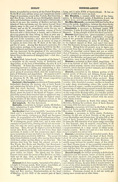
BENLOY
ficence, is equalled by no view in all the United Kingdom.
To the N are seen sublime arrays and tumultuous assem-
blages of mountains, away to Ben Vorlich, Ben Cruachan,
and Ben Nevis ; to the E are seen Stirlingshire, Lanark-
shire, and the Lothians, away to the heights of Edinburgh ;
to the S are seen the counties of Renfrew and Ayr, the
islands of Bute and Arran, and the waters beyond these
islands, away to the coast of Ireland and the Atlantic
Ocean ; and on the W, immediately under the eye, are
seen the waters, islands, and western screens of Loch
Lomond with a distinctness, a beauty, and a fulness of
grouping greater far than belong to them as seen any-
where from the lake's own bosom. Granite is the princi-
pal rock of the mountain ; mica slate also is plentiful ;
and quartzite occurs near the top in masses so large as
to appear, in views from the "VV shore of the lake, like
patches of snow. Among Ben Lomond's memories, the
most curious, perhaps, is its ascent in 1796 by the Rev.
Charles Simeon and James Alexander Haldane, who, ' on
the top, impressed by the grandeur of the surrounding
scenery, kneeled down and solemnly consecrated their
future lives to the service of Almighty God. ' — Orel. Sur. ,
sh. 38, 1871.
Benloy (Gael, beinn-laoigh, ' mountain of the fawns '),
a mountain on the mutual border of Perthshire and
Argyllshire, at the head of Strathfillan, 6J miles E by S
of Dalmally. It forms the western extremity of a chain
extending eastward to Eillin, and culminating in Ben-
more, and is itself the loftiest and most graceful of the
great group of mountains which stud the neighbouring
parts of Perthshire and Argyllshire. Its summit is 3708
feet above sea-level, and four streams flow from its slopes
in directions E, W, SE, and SW toward respectively
Lochs Tay, Awe, Lomond, and Fyne.
BenLoyalorBen Laoghal, a mountain in Tongue parish,
Sutherland, flanking the western side of Loch Loyal,
and culminating 5J miles S by W of Tongue village at
2504 feet above sea-level. Composed of syenite, it
spreads 2 miles westward from the mid shore of Loch
Loyal, across the head of the Strath of Tongue ; curves
gracefully upward from rounded loins to splintered sum-
mit, terminating in 4 massive peaks, the highest stand-
ing in advance of the others ; and as to contour', is the
most picturesque of any of the Highland mountains.
Ben Luighach. See Ben Liughach.
Benlundie, a mountain in Golspie parish, SE Suther-
land, culminating 3 miles WKW of Golspie village at
1464 feet above sea-level.
Ben Macdhui (Gael, bemn-muc-dubh, ' mountain of the
black sow '), a mountain of SW Aberdeenshire on the
verge of the county, contiguous to Banff and Inverness
shires, 11 geographical miles TOW of Castleton of Brae-
mar. One of the Cairngorms, it culminates 3 miles S by
W of Cairngorm proper (40S4 feet), and is near other
summits not much lower, forming strictly not one moun-
tain, but only one amid a group of summits on a com-
mon base. Thus, though the highest point in Scotland
except Ben Nevis, and only 110 feet lower than that
mountain, it makes a far less conspicuous figure than
many mountains of only one-half or one-third its height.
Its altitude above sea-level is 4296 feet. The ascent (18
miles) from Castleton is made, after passing Derry Lodge
(13S6 feet), either up Glen Derry or up Glen Lui. The
glorious view from the broad flat summit extends to
Ben Wyvis, Ben Nevis, and Ben Glo ; but Benabourd,
on the E, shuts out the prospect of the German Ocean.
Red granite is the prevailing rock, and numbers of rare
minerals, particularly the fine rock crystals called Cairn-
gorm stones, are found. The Queen and the Prince
Consort twice made the ascent of Ben Macdhui on 7 Oct.
1859 and 24 Aug. 1860, as described on pp. 136-139
of the Queen's Journal (ed. 1877). — Orel. Sur., sh. 64,
1874.
Benmagh(Gael. beinnmagha, ' mountain of the plain'),
a height in Torosay parish, Mull island, Argyllshire, at
the head of Loch Buy, 14 miles WSW of Oban.
Ben Mhanarch, a mountain on the mutual border of
Luss and Row parishes, Dumbartonshire, at the head
of Glenluss, 11- mile ESE of the nearest part of Loch
146
BENMORE-ASSYNT
Long, and 3 miles NNE of Garelochhead. It has an
altitude of 2328 feet above sea-level.
Ben Mheadoin, a summit (3883 feet) of the Cairn-
gorms, in Kirkmichael parish, S Banffshire, J mile SE
of Loch Aven, and 2 miles SE of Cairngorm proper.
Ben Mhic-Mhonaidh, a mountain(2602 feet) in the Wof
Glenorchy parish, Argyllshire, between the rivers Orchy
and Strae, 9J miles ENE of the summit of Ben Cruachan.
Benmholach, a mountain in Fortingal parish, NW
Perthshire, 5 miles E of Loch Ericht, and 4J N of Loch
Rannoch. It has a height of 2758 feet above sea-level.
Benmore (Gael, oeinn-mor, ' great mountain'), a moun-
tain in the W of Mull island, Argyllshire, occupying
most of the peninsula between Loch-na-Keal and Loch
Scridain, and culminating 21 miles W of Oban. It
is the highest summit in Mull, and only 7 feet lower
than Ben Lomond, having an altitude of 3185 feet above
sea-level. Rising from low ground, so as to figure con-
spicuously from base to summit, it exhibits a beautiful
outline, of somewhat conical figure, and not so unlike
that of Vesuvius ; it terminates in a crateriform summit ;
and it commands an extensive and diversified view over
most of the Hebrides and great part of the mainland of
Argyllshire, away to the N of Ireland.
Benmore, a mountain in Rum island, Argyllshire. It
rises to an altitude of 2367 feet above sea-level, has a
sharp peaked summit, adjoins other mountains of lower
altitude, which also have peaked summits, and is almost
perpetually shrouded in mist.
Benmore, a mountain in the Kilrnun portion of the
united parish of Dunoon and Kilmun, Cowal, Argyll-
shire. Its abrupt summit is 1| mile W of Loch Eck,
and has an altitude of 2433 feet above sea-level. Deep
fissures cleave its sides ; one of them shaped like a mighty
corridor, with chambered recesses ; another so formed as
to make sharp reverberating echoes, like sounds from
great sheets of copper ; another so profound that a stone
thrown into it takes about a minute to reach the bottom.
Benmore House, 4 miles SE of the mountain's summit,
on the verge of the Eachaig valley, is a very fine modern
castellated mansion, with picture gallery and with beau-
tiful grounds, that strikingly contrast with the moun-
tain's alpine scenery.
Benmore, a mountain in South Uist island, Outer
Hebrides, flanking the northern shore of Loch Eynort,
and rising 2035 feet above sea-level.
Benmore, a mountain (1750 feet) in the Park or Forest
district of Lochs parish, Lewis island, Outer Hebrides,
Ross-shire, 19 miles SSW of Stornoway.
Benmore, a mountain in Killin parish, Perthshire,
flanking the SE side of Loch Tubhair, at the pass be-
tween Strathfillan and Glendochart, 8J miles NE of the
head of Loch Lomond, and 10J SW of Killin village.
It forms the NE extremity of an alpine range extending
to Ben Lomond ; rises, in majestic conical form, to an
altitude of 3843 feet above sea-level ; and constitutes a
conspicuous feature in a large extent of loftily moun-
tainous country. It was once part of a deer forest, but
is now occupied as a sheep-walk.
Benmore, a mountain range in Glenshiel parish, Ross-
shire, extending from near the head of Loch Duich,
about 13 miles east-south-eastward into junction with
the Inverness-shire mountains of Glen Moriston. A
middle range between the parallel ranges of Ben Attow
and Maol Cheann-dearg, it has pyramidal summits cul-
minating in Sgurr Fhuaran at 3505 feet above sea-level ;
and, together with the neighbouring ranges, it forms a
surpassingly fine piece of alpine scenery.
Benmore-Assynt, the loftiest mountain in Sutherland,
culminates near the western border of Creich parish at
3273 feet above sea-level ; but projects into Assynt a
western shoulder, Coinne-mheall or Coniveall, 3234 feet
high. Standing at the watershed between the German
and Atlantic Oceans, 4 £ miles ESE of Assynt hamlet, it
is one of the oldest mountains in the British Isles, being
composed of Silurian quartzite and traps ; and it figures
conspicuously, in various directions, to a considerable
distance. Ptarmigan abound on it, and are easily got
during snow-storms and at other times.
Set display mode to: Large image | Transcription
Images and transcriptions on this page, including medium image downloads, may be used under the Creative Commons Attribution 4.0 International Licence unless otherwise stated. ![]()
| Gazetteers of Scotland, 1803-1901 > Ordnance gazetteer of Scotland > Volume 1 > (182) Page 146 |
|---|
| Permanent URL | https://digital.nls.uk/97370950 |
|---|
| Attribution and copyright: |
|
|---|---|

