Ordnance gazetteer of Scotland > Volume 1
(134) Page 102 - AYR
Download files
Complete book:
Individual page:
Thumbnail gallery: Grid view | List view
AYR
and South-Western ; and in 1871 was vested in that
company at 7 per cent. Another and longer reach, in
continuation of the Maybole proper, and called the May-
bole and Girvan, extends 12J miles southward and south-
south-westward from Maybole to Girvan. Authorised in
1856 on a capital of £68,000 in shares and £22,600 on
loan, it was opened in 1S60, and became amalgamated in
1865 with the Glasgow and South-Western.
Ayr, Head of. See Head of Ayr.
Ayr, Newton upon. See Newton-ttpon-Ayr.
Ayr Road, a railway station in Lanarkshire, on the
Lesmahagow branch of the Caledonian railway, 1J mile
SE of Larkhall.
Ayr Road. See Cumnock.
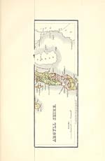
Ayrshire, a maritime county of SW Scotland. It is
bounded N by Renfrewshire, NE by Renfrew and Lanark
shires, E by Lanark and Dumfries shires, SE by Kirk-
cudbrightshire, S by Wigtownshire, W by the North
Channel and the Firth of Clyde. Its outline resembles
that of a broad crescent, convex to the E, concave to the
W. Its boundaries all round the landward sides are
mainly artificial, i.e., though partly formed by water-
sheds, rivulets, and lakes, are principally capricious or
conventional. Its length, from Kelly Burn, on the
boundary with Renfrewshire on the N, to Galloway
Burn on the boundary with Wigtownshire on the S, is
60 miles in a direct line, but 90 miles by the public road,
the difference being chiefly due to the curvature of the
coast ; its breadth increases from 3^ miles at the northern,
and 6^ at the southern, extremity to 28 eastward from Head
of Ayr; and its area comprises 722, 229 J acres of land,
6075J of foreshore, and 6957 of water — in all 1149 square
miles. The rivers Irvine and Doon, the former running
westward, the latter north -north -westward, cut the entire
area into three sections, Cunninghame in the N, Kyle in
the middle, Carrick in the S. These sections, if the
entire area be represented as 52, have the proportions of
respectively 13, 19, and 20. The first and the second
are predominantly lowland, while the third is predomi-
nantly upland. Cunninghame and Kyle also in a main
degree have the form of an amphitheatre, rich in inner
beauty, and all looking across to the grand western moun-
tain-screen of the Firth of Clyde ; while Carrick, in a
considerable degree, is a tumbling assemblage of brae
and hill and mountain, with only close views in vale or
glen, and outward views from seaboard vantage grounds.
Yet the three sections somewhat fuse into one another in
landscape character, and have peculiarities of feature
each within itself. The north-western section of Cun-
ninghame, lying like a broad wedge between Renfrew-
shire and the Firth of Clyde, southward to the vicinity
of Farland Head, is mainly a mass of lofty hills, with
intersecting narrow vales, and has mostly a rocky coast.
The rest of Cunninghame is principally a pleasant diver-
sity of hill and dale and undulation, declining to the
Bay of Ayr and to the river Irvine ; yet rises in the
extreme SE into high moors contiguous to those around
Drumclog in Lanarkshire, and dominated within its own
limits by the conspicuous cone of Loudon Hill (900 feet).
The upper part of Kyle, to the average breadth of 9 or
10 miles, all round from the sources of the river Irvine
to the source of the river Doon in Loch Doon, is mostly
moorish, and contains a large aggregate both of high
bleak plateau and of lofty barren mountain. In the N
is Distinkhorn (1258 feet), to E and S of which rise
Blackside (1342), Dibblon Hill (1412), Middlefield Law
(1528), Priesthill Height (1615), etc. Cairn Table, on
the boundary with Lanarkshire, 2J miles SE of Muir-
kirk, has an altitude of 1944 feet ; Wardlaw hill, 2^
miles WSW of Cairn Table, has an altitude of 1630 feet;
Blacklorg, on the Dumfriesshire boundary, 6$ miles SSE
of New Cumnock, has an altitude of 2231 feet ; and
Blackcraig Hill, 1J mile N by W of Blacklorg, has an
altitude of 229S feet. All the section S and SW of New
Cumnock, to within 2| miles of Dalmellington, also lies
within the basin of the river Nith, and is separated by
lofty watersheds from the rest of the county. The
middle and the western parts of Kyle are traversed
through the centre by the river Ayr, dividing them into
102
AYRSHIRE
Kyle-Stewart on the N and King's Kyle on the S ; they
form, in a general view, to within about 4 miles of
the coast, a continuous hanging plain, little diversified
except by deep beds of streams, and by swelling knolls
and hillocks ; they terminate in a flatfish fertile sea-
board ; and, to a large aggregate of their extent, they
are richly embellished with culture and with wood. A
graphic writersays, respecting all Kyle: 'The hill-country,
towards the east, is bleak, marshy, uncultivated, and
uninteresting ; and on that side, except at one or two
places, the district was formerly impervious. In advan-
cing from these heights to the sea, the symptoms of
fertility and the beneficial effects of cultivation rapidly
multiply; but there is no "sweet interchange of hill
and valley," no sprightliness of transition, no bold and
airy touches either to surprise or delight. There is little
variety, or even distinctness of outline, except where
the vermiculations of the rivers are marked by deep
fringes of wood waving over the shelvy banks, or where
the multitudinous islands and hills beyond the sea exalt
their colossal heads above the waves, and lend an ex-
terior beauty to that heavy continuity of flatness, which,
from the higher grounds of Kyle, appears to pervade
nearly the whole of its surface. The slope, both here
and in Cunninghame, is pitted with numberless shallow
depressions, which are surmounted by slender promin-
ences, rarely swelling beyond the magnitude of hillocks
or knolls. Over this dull expanse the hand of art has
spread some exquisite embellishments, which in a great
measure atone for the native insipidity of the scene, but
which might be still farther heightened by covering
many of these spaces with additional woods, free from
the dismal intermixture of Scotch fir. ' Carrick contains
several fine long narrow valleys, and numerous strips of
low ground ; but is mainly occupied by the western
parts of the mountain ranges which extend across Scot-
land from the German Ocean, at the mutual border of
Haddington and Berwick shires, through the south-
eastern wing of Edinburghshire, Selkirkshire, Peebles-
shire, the S of Lanarkshire, the NW of Dumfriesshire,
the SE wing of Kyle, and the N of Kirkcudbrightshire,
to the Firth of Clyde and the North Channel, along the
whole seaboard of Carrick. These mountains are frequently
designated the Southern Highlands of Scotland. Many
of their summits around the sources of the rivers Tweed,
Annan, and Clyde have altitudes of from 2000 to 2764
feet above the level of the sea ; and their chief summits
within Carrick have altitudes of from 1000 to 2520 feet;
the latter being the height of Shalloch on Minnoch in
Barr parish, the loftiest summit of Ayrshire. Keirs
Hill, 4J miles WNW of Dalmellington, is 1005 feet
high; Dersalloch Hill, 2 miles S of Keirs Hill, 1179
feet ; Strawarren Fell, 6 miles E by S of Ballantrae,
1040 feet; Altimeg Hill, 4 miles SSE of Ballantrae,
1270 feet ; and Beneraird, nearly midway between
Altimeg Hill and Strawarren Fell, 1435 feet. Most
of Carrick is bleak and moorish ; but many parts have
rich scenery, ranging from the beautiful to the romantic
or the wild.
The climate of Ayrshire generally resembles that of
the other western parts of Scotland. The winds blow
from the SW for more than two-thirds of the year ; the
rains are often copious, and sometimes of long duration.
The principal streams, besides the Irvine, the Ayr, and
the Doon, are the Garnock, in W of Cunninghame, re-
ceiving the Rye, the Caaf, the Dusk, and the Lugton,
and running to the Irvine, at the Irvine's mouth ; the
Annick, in the E centre of Cunninghame, running to the
Irvine, 2J miles E of Irvine town ; the Kilmarnock, in
the E of Cunninghame, formed by the confluence of the
Fenwick and the Craufurdland, and running to the
Irvine at Kilmarnock town ; the Cessnock, in the N
of Kyle, running to the Irvine 2 miles W of Galston ;
the Greenock, the Garpel, and the Lugar in the E of
Kyle, running to the Ayr ; the Nith, in the SE of Kyle,
receiving the Afton, and running into Dumfriesshire ;
the Girvan, in the N of Carrick, running to the Firth of
Clyde at Girvan town ; and the Stinchar, in the S of
Carrick, receiving the Duisk, and running to the Firth
and South-Western ; and in 1871 was vested in that
company at 7 per cent. Another and longer reach, in
continuation of the Maybole proper, and called the May-
bole and Girvan, extends 12J miles southward and south-
south-westward from Maybole to Girvan. Authorised in
1856 on a capital of £68,000 in shares and £22,600 on
loan, it was opened in 1S60, and became amalgamated in
1865 with the Glasgow and South-Western.
Ayr, Head of. See Head of Ayr.
Ayr, Newton upon. See Newton-ttpon-Ayr.
Ayr Road, a railway station in Lanarkshire, on the
Lesmahagow branch of the Caledonian railway, 1J mile
SE of Larkhall.
Ayr Road. See Cumnock.
Ayrshire, a maritime county of SW Scotland. It is
bounded N by Renfrewshire, NE by Renfrew and Lanark
shires, E by Lanark and Dumfries shires, SE by Kirk-
cudbrightshire, S by Wigtownshire, W by the North
Channel and the Firth of Clyde. Its outline resembles
that of a broad crescent, convex to the E, concave to the
W. Its boundaries all round the landward sides are
mainly artificial, i.e., though partly formed by water-
sheds, rivulets, and lakes, are principally capricious or
conventional. Its length, from Kelly Burn, on the
boundary with Renfrewshire on the N, to Galloway
Burn on the boundary with Wigtownshire on the S, is
60 miles in a direct line, but 90 miles by the public road,
the difference being chiefly due to the curvature of the
coast ; its breadth increases from 3^ miles at the northern,
and 6^ at the southern, extremity to 28 eastward from Head
of Ayr; and its area comprises 722, 229 J acres of land,
6075J of foreshore, and 6957 of water — in all 1149 square
miles. The rivers Irvine and Doon, the former running
westward, the latter north -north -westward, cut the entire
area into three sections, Cunninghame in the N, Kyle in
the middle, Carrick in the S. These sections, if the
entire area be represented as 52, have the proportions of
respectively 13, 19, and 20. The first and the second
are predominantly lowland, while the third is predomi-
nantly upland. Cunninghame and Kyle also in a main
degree have the form of an amphitheatre, rich in inner
beauty, and all looking across to the grand western moun-
tain-screen of the Firth of Clyde ; while Carrick, in a
considerable degree, is a tumbling assemblage of brae
and hill and mountain, with only close views in vale or
glen, and outward views from seaboard vantage grounds.
Yet the three sections somewhat fuse into one another in
landscape character, and have peculiarities of feature
each within itself. The north-western section of Cun-
ninghame, lying like a broad wedge between Renfrew-
shire and the Firth of Clyde, southward to the vicinity
of Farland Head, is mainly a mass of lofty hills, with
intersecting narrow vales, and has mostly a rocky coast.
The rest of Cunninghame is principally a pleasant diver-
sity of hill and dale and undulation, declining to the
Bay of Ayr and to the river Irvine ; yet rises in the
extreme SE into high moors contiguous to those around
Drumclog in Lanarkshire, and dominated within its own
limits by the conspicuous cone of Loudon Hill (900 feet).
The upper part of Kyle, to the average breadth of 9 or
10 miles, all round from the sources of the river Irvine
to the source of the river Doon in Loch Doon, is mostly
moorish, and contains a large aggregate both of high
bleak plateau and of lofty barren mountain. In the N
is Distinkhorn (1258 feet), to E and S of which rise
Blackside (1342), Dibblon Hill (1412), Middlefield Law
(1528), Priesthill Height (1615), etc. Cairn Table, on
the boundary with Lanarkshire, 2J miles SE of Muir-
kirk, has an altitude of 1944 feet ; Wardlaw hill, 2^
miles WSW of Cairn Table, has an altitude of 1630 feet;
Blacklorg, on the Dumfriesshire boundary, 6$ miles SSE
of New Cumnock, has an altitude of 2231 feet ; and
Blackcraig Hill, 1J mile N by W of Blacklorg, has an
altitude of 229S feet. All the section S and SW of New
Cumnock, to within 2| miles of Dalmellington, also lies
within the basin of the river Nith, and is separated by
lofty watersheds from the rest of the county. The
middle and the western parts of Kyle are traversed
through the centre by the river Ayr, dividing them into
102
AYRSHIRE
Kyle-Stewart on the N and King's Kyle on the S ; they
form, in a general view, to within about 4 miles of
the coast, a continuous hanging plain, little diversified
except by deep beds of streams, and by swelling knolls
and hillocks ; they terminate in a flatfish fertile sea-
board ; and, to a large aggregate of their extent, they
are richly embellished with culture and with wood. A
graphic writersays, respecting all Kyle: 'The hill-country,
towards the east, is bleak, marshy, uncultivated, and
uninteresting ; and on that side, except at one or two
places, the district was formerly impervious. In advan-
cing from these heights to the sea, the symptoms of
fertility and the beneficial effects of cultivation rapidly
multiply; but there is no "sweet interchange of hill
and valley," no sprightliness of transition, no bold and
airy touches either to surprise or delight. There is little
variety, or even distinctness of outline, except where
the vermiculations of the rivers are marked by deep
fringes of wood waving over the shelvy banks, or where
the multitudinous islands and hills beyond the sea exalt
their colossal heads above the waves, and lend an ex-
terior beauty to that heavy continuity of flatness, which,
from the higher grounds of Kyle, appears to pervade
nearly the whole of its surface. The slope, both here
and in Cunninghame, is pitted with numberless shallow
depressions, which are surmounted by slender promin-
ences, rarely swelling beyond the magnitude of hillocks
or knolls. Over this dull expanse the hand of art has
spread some exquisite embellishments, which in a great
measure atone for the native insipidity of the scene, but
which might be still farther heightened by covering
many of these spaces with additional woods, free from
the dismal intermixture of Scotch fir. ' Carrick contains
several fine long narrow valleys, and numerous strips of
low ground ; but is mainly occupied by the western
parts of the mountain ranges which extend across Scot-
land from the German Ocean, at the mutual border of
Haddington and Berwick shires, through the south-
eastern wing of Edinburghshire, Selkirkshire, Peebles-
shire, the S of Lanarkshire, the NW of Dumfriesshire,
the SE wing of Kyle, and the N of Kirkcudbrightshire,
to the Firth of Clyde and the North Channel, along the
whole seaboard of Carrick. These mountains are frequently
designated the Southern Highlands of Scotland. Many
of their summits around the sources of the rivers Tweed,
Annan, and Clyde have altitudes of from 2000 to 2764
feet above the level of the sea ; and their chief summits
within Carrick have altitudes of from 1000 to 2520 feet;
the latter being the height of Shalloch on Minnoch in
Barr parish, the loftiest summit of Ayrshire. Keirs
Hill, 4J miles WNW of Dalmellington, is 1005 feet
high; Dersalloch Hill, 2 miles S of Keirs Hill, 1179
feet ; Strawarren Fell, 6 miles E by S of Ballantrae,
1040 feet; Altimeg Hill, 4 miles SSE of Ballantrae,
1270 feet ; and Beneraird, nearly midway between
Altimeg Hill and Strawarren Fell, 1435 feet. Most
of Carrick is bleak and moorish ; but many parts have
rich scenery, ranging from the beautiful to the romantic
or the wild.
The climate of Ayrshire generally resembles that of
the other western parts of Scotland. The winds blow
from the SW for more than two-thirds of the year ; the
rains are often copious, and sometimes of long duration.
The principal streams, besides the Irvine, the Ayr, and
the Doon, are the Garnock, in W of Cunninghame, re-
ceiving the Rye, the Caaf, the Dusk, and the Lugton,
and running to the Irvine, at the Irvine's mouth ; the
Annick, in the E centre of Cunninghame, running to the
Irvine, 2J miles E of Irvine town ; the Kilmarnock, in
the E of Cunninghame, formed by the confluence of the
Fenwick and the Craufurdland, and running to the
Irvine at Kilmarnock town ; the Cessnock, in the N
of Kyle, running to the Irvine 2 miles W of Galston ;
the Greenock, the Garpel, and the Lugar in the E of
Kyle, running to the Ayr ; the Nith, in the SE of Kyle,
receiving the Afton, and running into Dumfriesshire ;
the Girvan, in the N of Carrick, running to the Firth of
Clyde at Girvan town ; and the Stinchar, in the S of
Carrick, receiving the Duisk, and running to the Firth
Set display mode to: Large image | Transcription
Images and transcriptions on this page, including medium image downloads, may be used under the Creative Commons Attribution 4.0 International Licence unless otherwise stated. ![]()
| Gazetteers of Scotland, 1803-1901 > Ordnance gazetteer of Scotland > Volume 1 > (134) Page 102 - AYR |
|---|
| Permanent URL | https://digital.nls.uk/97370374 |
|---|
| Attribution and copyright: |
|
|---|---|
| Description | A survey of Scottish topography, statistical, biographical, and historical. Edited by Francis H. Groome. Edinburgh: Thomas C. Jack, 1884-85. "General survey": v.6, 134 p. at end. |
|---|---|
| Shelfmark | Map.Ref.C18 |
| Additional NLS resources: | |
| Description | 20 volumes of the most popular descriptive gazetteers of Scotland, providing a comprehensive geographical encyclopaedia of Scotland in the 19th century. Principal places in Scotland, including towns, counties, castles, glens, antiquities and parishes, are listed alphabetically. Each entry includes detailed historical and geographical information about each place. |
|---|---|