Ordnance gazetteer of Scotland > Volume 1
(122) Page 90
Download files
Complete book:
Individual page:
Thumbnail gallery: Grid view | List view

AUCHTERMUCHTY
i miles SW, are 1471 and 1713 feet high. It was
the birthplace of the Rev. John Glas (1698-1773), founder
of the sect of Glasites ; but it is better known, by the
famous old ballad of The Wife of Auchtermuchty , wrongly
ascribed to James V. There are a town-hall ; the Vic-
toria Hall, erected in 1865 for lectures, concerts, and
public meetings; a post office, with money order, sav-
ings' bank, and telegraph departments ; branches of the
Bank of Scotland and Union Bank ; a savings' bank, and
8 insurance agencies ; gas-works ; 3 hotels ; a choral union ;
and agricultural and horticultural societies. Places
of worship are the parish church (built 1780 ; enlarged
1838; and seating 900), a Free church, and 2 U.P.
churches (North and South) ; and the Madras Esta-
blished school and North and South public schools,
with respective accommodation for 127, 194, and 135
children, had (1879) an average attendance of 103, 129,
and 102, and grants of £80, 15s., £121, 5s. 6d., and
£86, 9s. The industrial works comprise a printing
office, a bleachfield, an extensive distillery, 2 malt kilns,
a scale-beam and weighing-machine factory, 3 sawmills,
and 5 linen factories. The weaving of diapers, hucka-
backs, sheetings, etc. (chiefly by handloom), has long
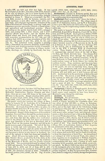
Seal of Auchtermuchty.
been the staple industry, but since 1S17 has been carried
on less by resident manufacturers than for houses in
Kirkcaldy, Dunfermline, Dundee, Glasgow, and Aber-
deen ; there are now some 600 looms in the town, and
200 more in the parish. Burgh valuation (1881) £2506.
Pop. of royal burgh (1S71) 1082, (1881) 824; of town
(1841) 2394, (1861) 2438, (1871) 2195, (1881) 1673.
The parish, which also contains the village of Dun-
shelt, is bounded N by Perthshire, E by Collessie, S
by Falkland and Strathmiglo, W by Strathmiglo and
Abernethy. Its length from NW to SE is 4J miles ; its
greatest breadth from E to W is 2| miles ; and its area
is 3533 acres, of which 3J are water. Three streams
flow eastward — Beggar's Burn along most of the northern
boundary, Barroway Burn through the southern interior,
and the river Eden, near or upon the southern bor-
der ; and from this last the surface rises north-west-
ward to the Ochils — from 137 feet above sea-level at a
point near Dunshelt to 554 feet at Mairsland, 898 in
Pitlour Wood on the western boundary, and 843 in the
north-western angle of the parish. The soil of the low-
lands is fertile and well cultivated, that in the SE
being deep rich alluvium, part of a plain that formerly
was often flooded in winter, but is now as well-drained
and luxuriant a district as any almost in Scotland ; the
soil of the uplands is light, but sharp and valuable for
grass. About 220 acres are under wood. Myres Castle
(Mrs Tyndall Bruce), £ mile S by E of the town, is the
only considerable mansion. It was long the residence
of the Moncrieffs of Beedie, and was greatly enlarged
about 1828. Two proprietors hold each an annual value
of £500 and upwards, 12 of between £100 and £500, 12
of from £50 to £100, and 36 of from £20 to £50.
Auchtermuchty is in the presbytery of Cupar and synod
of Fife ; the minister's income is £465. Valuation of
landward portion (1881) £8497, 15s. 6d. Pop. of entire
90
AUGUSTUS, FORT
parish (1811) 2403, (1841) 3352, (1871) 2958, (1881)
2322.— Ord. Sur., sh. 40, 1867.
Auchterneed, a hamlet in Fodderty parish, Ross and
Cromarty shires, which furnishes lodgings to visitors at
the neighbouring Strathpeffer Spa.
Auchtertool (Gael, uachtar-tuill, ' above the hollow'),
a village and a parish of SW Fife. The village stands 3
miles S of Cardenden station, and 4J W of Kirkcaldy ;
it has a post office under the latter and a large distillery.
Pop., including the neighbouring hamlet of Newbigging
(1871) 331.
The parish is hounded N by Auchterderran, NE by
Abbotshall, E and SE by Kinghorn, S and SW by Aber-
dour, and NW by Beath. Its length from ENE to WSW
varies between 1| mile and 3§ miles, its breadth between
7 furlongs and 1| mile ; and its area is 2755j acres, of
which 17J are water. The surface rises westward to the
Cullalo Hills, attaining 420 feet above sea-level near the
ruined baronial mansion of Hallyards in the E, 430
at 2 furlongs S of the village, 556 at 3 furlongs NW
of the church, 526 at Pilkhambrae in the SW, and
438 in the NW, 7 furlongs ENE of Cowdenbeath
station. These heights, which fall off steeply to the
S, command fine eastward views of the Isle of May,
the Bass, and North Berwick Law. Two streams flow
eastward, Doonachy Burn through the interior, and
Bottom Burn along the southern boundary ; in the E,
near Hallyards, is Carmilla Loch (2x1 furl. ) ; and the
south-western corner of Loch Gelly lies within the
northern border. Trap, sandstone, and limestone have
all been quarried, and coalpits opened in the NW angle
of the parish ; its soils are variously loam, clayey, and
mossy. Two proprietors hold each an annual value of
£500 and upwards, 1 holds between £100 and £500, 1
between £50 and £100, and 3 hold between £20 and
£50. Auchtertool is in the presbytery of Kirkcaldy and
synod of Fife. The church, f mile WSW of the village,
was repaired in 1833, and seats 280 ; the minister's in-
come is £223. A public school, with acco mm odation
for 99 children, had (1879) an average attendance of 63,
and a grant of £50, 7s. Valuation (1881) £7788,
lis. 5d. Pop. (1831) 527, (1861) 609, (1871) 529, (1881)
706.— Ord. Sur., sh. 40, 1867.
Auchtertyre, a hamlet in Newtyle parish, Forfarshire,
| mile W of Newtyle village. Near it are traces of a
small square camp, supposed to have been formed by
Montrose's army during the civil wars.
Auchtow. See Achtow.
Auckingill. See Attohingill.
Augustus, Fort (Gael. Cilla-chuimcin, 'the cell or
church of Cumin,' probably the ' Cumineus albus ' who
was abbot of Iona 657-669), a village in Boleskine-
and-Abertarff parish, Inverness-shire, at the head of Loch
Ness, and on the right bank of the Caledonian Canal,
by which it is 33£ miles SE of Inverness, and 31J NW
of Fort William. It has a post office under Inverness,
with money order, savings' bank, and telegraph depart-
ments, a first-class hotel, and a fair on the Monday before
the second Wednesday of June. There are an Established
mission church, a Free church, and St Peter's Catholic
church (1840) ; a board school, with accommodation for
100 children, had (1879) an average attendance of 51, and
a grant of £53. Pop., mostly Gaelic-speaking, of the
village, 530 ; of registration district of Fort Augustus
or Abertarff (1871) 897, (1881) 872.
To overawe the disaffected clans, a barrack was built
in 1716 on the peninsula beyond the village, with the
Oich salmon river on its NW, and the Tarff on its SE side,
in front the deep waters of Loch Ness. As strengthened
and enlarged in 1730 by General Wade, who named it
Fort Augustus out of compliment to William Augustus,
Duke of Cumberland, it was a square work, capable of
accommodating 300 men, with a bastion at each angle
mounting 12 six-pounders, and with a ditch, covert way,
and glacis. In March 1746 it was taken and dismantled
by the insurgents after a two days' siege, a shell from a
neighbouring height having caused the explosion of its
powder magazine ; in May its eponymous hero, Cumber-
land, formed a camp at it, to which, among other prisoners,
Set display mode to: Large image | Transcription
Images and transcriptions on this page, including medium image downloads, may be used under the Creative Commons Attribution 4.0 International Licence unless otherwise stated. ![]()
| Gazetteers of Scotland, 1803-1901 > Ordnance gazetteer of Scotland > Volume 1 > (122) Page 90 |
|---|
| Permanent URL | https://digital.nls.uk/97370230 |
|---|
| Attribution and copyright: |
|
|---|---|

