Download files
Complete book:
Individual page:
Thumbnail gallery: Grid view | List view
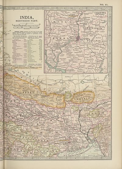
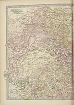
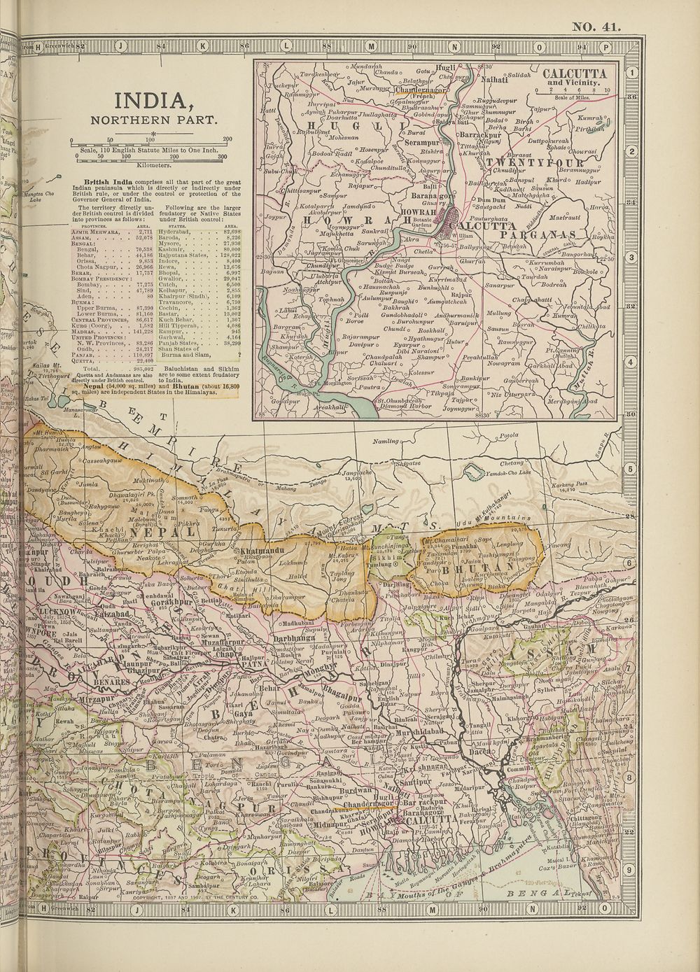
NO. 41
IfpJIlIPl
INDIA,
NORTHERN PART.
Seale, 110 English Statute Miles to One Inch.
0 50 100 200 300
°M ^
,.w Jlangtza Cho
I . Lake
■4
l25'37^
British India comprises all that part of the great
Indian peninsula which is directly or indirectly under
British rule, or under the control or protection of the
Governor General of India.
The territory directly un- Following are the larger
der British control is divided feudatory or Native States
into provinces as follows: under British control:
PROVINCES. AREA. STATES. AREA.
Ajmir Merwara, . 2,711 Hyderabad, . . . 82,698
Assam 62,078 Baroda, 8,226
Bengal: Mysore, 27,936
Bengal, .... 70,538 Kashmir, .... 80,000
Behar, .... 44,186 Rajputana States, . 128,022
Orissa, .... 9,853 Indore, 8,400
Chota Nagpur, . . 26,966 Rewa, 12,676
Berar, 17,737 Bhopal, 6,997
Bombay Presidency : Gwalior, 29,047
Bombay, .... 77,275 Cutch, ..... 6,500
Sind, 47,789 Kolhapur, .... 2,855
Aden, 80 Khairpur (Sindh), . 6,109
Burma : Travancore, . . . 6,730
Upper Burma, . . 87,390 Cochin, 1,362
Lower Burma, . . 81,160 Bastar, 13,002
Central Provinces, 86,617 Kuch Behar, . . . 1,307
Kurg (Coorg), . . 1,582 Hill Tipperah, . . . 4,086
Madras, 141,228 Rampur, 945
United Provinces : Garhwal, .... 4.164
N. W. Provinces, . 83,286 Panjab States, . . . 38,299
Oiidh, 24,217 Shan States of
Panjab, 110,897 Burma and Siam, ?
Quetta, 22,400
19 796 Total, . . 985,002 Baluchistan and Sikhim
Tirthapuri Quetta and Andamans are also are to some extent feudatory
directly under British control. to India.
^ Nepal (54,000 sq. miles) and Bhutan (about 16,800
4 sq. miles) are independent States in the Himalayas.
Kailas ML
( ^ —-ZZ^^JBIndirasahiuv (ff^c
h> u o \l\ p-- ^*^ti
%\cBUjbulJfaut \ ) SaBurai
S Mohesnan 1 i v
C (/y.r Serampur
~ 0C 'SqKcm,
CALCUTTA
and Vicinity.
2 4 6 8 10
olluggudevpur ' Scale of Mile..
SamnudguA Tamur
°Ghur Shutnnugur 1
Bodat o Birgh
\ LSerha BaJhi ^
Barrackpuf
JNilgunj
TittagMcr
Khuraah
^ kKotalparru Jamdyfndo
-v / Akabifr'pur |°
Joypurv .HV4) /W R Ar
Bara pa go);
Ghusj ry^
iowrai
\ Kumrah°l
J^lTBirtgis/uu
DuttyoJcureah \ /
ihaie o( . /
v Ohotcrasi /
■rasat \ \ I
T W K.A T Y F-0 U
Chnudippr LBeramnuggur
iafi BTSpUl i 0KhTd0 Badipur
Squsun
'Ba\' __ ,
adihaihi
, _ Mattehgacha
Dim DunT^O-Cl V
°Sautgachi \r> HrtrdctS
o . 1
Pctuiurahata ■$/ Mctzirauti
xipynyggur _ ..J
° McyukheUa SanTcrai^
urghata
CUTTA €
P A ini
Zk
, R YQhurfdh
Budge Budge Gurrpqh
~ism2it BurseahQ "
0Boitah^^ s Ku'rrimatad
c Hausnachah © Bunhufrhli o \ ^XSanarpur
;A 7 R»*Punje \ Raj p u?
'Aulumpur o .. V. \ ,
^ Bangorliay^
Baughin ^Jiumgatcheah \ | >Ss^ Chap
Bakhrah f )
° Poili Gundobhadoli ° Andhurtnanick j Mullung
Boroe o Burohunpur ^Baruipu\f
Chundi o Roskhali^
Rajarampur o Hyathnugur^.^
Davipur o Eyarpur 0 of ^
‘pur 0 Dibi Naraioni '
.ChandpaJah ^Shampur *
Chaluari
Pevahtulla,
Nowagram
Jolessur
Sorfssah0 k<Bankipur ^
ligton n— ;
Tikpajd ojr(-s
'St.OhunbdKeali- / Tajpilro
AreaJchalif\ Harbor j0ynug,jur,x
88i30'
autra c
° Kurrumbah
\ oNarainpur
> Tawrdah
auraai
Sausun ^
° Biz U^turpari-^.
-88;-
Set display mode to:
![]() Universal Viewer |
Universal Viewer | ![]() Mirador |
Large image | Transcription
Mirador |
Large image | Transcription
Images and transcriptions on this page, including medium image downloads, may be used under the Creative Commons Attribution 4.0 International Licence unless otherwise stated. ![]()
| Encyclopaedia Britannica > New volumes of the Encyclopædia Britannica > Volume 34, Maps > (175) |
|---|
| Permanent URL | https://digital.nls.uk/193918422 |
|---|
| Attribution and copyright: |
|
|---|---|
| Shelfmark | EB.18 |
|---|---|
| Description | Ten editions of 'Encyclopaedia Britannica', issued from 1768-1903, in 231 volumes. Originally issued in 100 weekly parts (3 volumes) between 1768 and 1771 by publishers: Colin Macfarquhar and Andrew Bell (Edinburgh); editor: William Smellie: engraver: Andrew Bell. Expanded editions in the 19th century featured more volumes and contributions from leading experts in their fields. Managed and published in Edinburgh up to the 9th edition (25 volumes, from 1875-1889); the 10th edition (1902-1903) re-issued the 9th edition, with 11 supplementary volumes. |
|---|---|
| Additional NLS resources: |
|