Encyclopaedia Britannica > Volume 21, ROT-Siam
(159) Page 149
Download files
Complete book:
Individual page:
Thumbnail gallery: Grid view | List view
149
S A G-
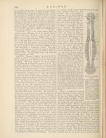
soups. That intended for exportation is mixed into a
paste with water and rubbed through sieves into small
grains, from the size of a coriander seed and larger, whence
it is known according to size as pearl sago, bullet sago,
&c. A large proportion of the sago imported into Europe
comes from Borneo, and the increasing demand has led
to a large extension of sago-palm planting along the marshy
river banks of Sarawak.
Various palms, in addition to the two above named, yield sago,
but of an inferior quality. Among them may be mentioned the
Gomuti palm (Arenga saccharifera), the Kittul palm (Garyoto urens),
the cabbage palm (Corypha umbraculifera),besides Gorypha Gebanga,
llaphiajlabelliformis, Phoenix farinifera, and Metroxylon filare—el\
East Indian palms—and Mauritia Jlexuosa and Guilielma speciosa,
two South-American species. The imports of sago into the United
Kingdom for 1884 amounted to 346,188 cwt., valued at £195,680,
the whole of which, excepting less than 300 tons, is entered as coming
from the Straits Settlements.
SAGUNTUM, an ancient city of Hispania Tarraco-
nensis, was situated near the mouth of the river Pallantias
(Paktncia). It was the centre of a fertile district and was
a rich trading place in early times, but owes its celebrity
to the desperate resistance it made to Hannibal (see vol.
xi. p. 441). The Romans restored the city and made it a
colony; later writers speak of its figs, which were esteemed
at Rome, and of its earthenware, which enjoyed a certain
reputation. The most important remains are those of the
theatre.
The modern Sagunto or Murviedro (muri veteres), 18
miles by rail from Valencia on the line to Tarragona, is
now about 3 miles from the sea; the population within
the municipal boundaries was 6287 in 1877.
SAHARA is the great desert region which stretches
•> across the continent of Africa eastwards from the Atlantic
n' for a considerable distance on both sides of the Tropic of
Cancer, and is generally distinguished by aridity of soil,
absence of running water, dryness of atmosphere, and
comparative scarcity of vegetable and animal life. The
physical limits of this region are in some directions marked
with great precision, as in part of Morocco and Algeria,
where the southern edge of the Atlas range looks out on
what has almost the appearance of a boundless sea, and
forms, as it were, a bold coast-line, whose sheltered bays
and commanding promontories are occupied by a series of
towns and villages—Tizgi, Figig, Laghouat, &c. In other
directions the boundaries are vague, conventional, and dis¬
puted. This is especially the case towards the south,
where the desert sometimes comes to a close as suddenly
as if it had been cut off with a knife, but at other times
merges gradually and irregularly into the well-watered and
fertile lands of the Sudan (Soudan). While towards the
east the valley of the Nile at first sight seems to afford
a natural frontier, the characteristics of what is usually
called the Nubian or Arabian desert are so identical in
most respects with those of the Sahara proper that some
authorities extend this designation over the whole country
to the shores of the Red Sea. The desert, indeed, does
not end with Africa, but is prolonged eastwards through
Arabia towards the desert of Sind. As the Nubian region
has been described under the heading Nubia (vol. xvii. p.
610), attention will in the present article be confined to
the desert country west of the Nile valley. Even as
thus defined the Sahara is estimated to have an area of
3,565,565 square miles, or nearly as much as all Europe
minus the Scandinavian peninsula and Iceland ; but, while
Europe supports a population of 327,000,000, the Sahara
probably does not contain more than 2,500,000,—a figure,
however, which is sufficiently startling to those who think
of it as an uninhabitable expanse of sand. The sea-like
aspect of certain portions of the Sahara has given rise to
much popular misconception, and has even affected the
ideas and phraseology of scientific writers. Instead of
-S A H
being a boundless plain broken only by wave-like mounds
of sand hardly more stable and little less dangerous than
the waves of ocean, the Sahara is a region of the most
varied surface and irregular relief, ranging in altitude from
100 feet below to some 5000 or 6000 or even it may be
8000 feet above the sea-level, and, besides sand-dunes and
oases, containing rocky plateaus, vast tracts of loose stones
and pebbles, ranges of hills of the most dissimilar types,
and valleys through which abundant watercourses must
once have flowed.
The culminating points of the Sahara are probably the
summits of the Ahaggar (Hoggar), a great mountain
plateau, not inferior to the Alps in the area which it
covers, crossing the Tropic of Cancer about 5° and 6° E.
long., almost midway between the Atlantic and the valley
of the Nile. In its central mass rise with red steep cliffs
two peaks, Watellen and Hikena, which Duveyrier believes
to be volcanic like those of Auvergne. The height of
this country has not been ascertained by direct European
observation, but may be gathered from the fact that
according to the Tuareg the snow lies for three months
of the year, from December to March. To the north¬
west, and separated from ti e Atakor-’n-Ahaggar by a
wide plain, rises the Muydir plateau, lying nearly east
and west for a distance of about 200 miles. Its north¬
eastern extremity is extended towards Timassinin by the
Irawen Mountains, which in their turn are separated by
a narrow valley from the Tasili plateau (strictly Tasili of
the Asjer or Asgar). This great plateau stretches south¬
east for 300 miles parallel with the Atakor-’n-Ahaggar
(from which it is separated by the Amadghor and Adamar
plains), and then the line of elevation is continued by low
ridges to the Tummo or War Mountains, and so onwards
to the highland country of Tibesti or Tu, whose highest
point, Tusidde, is 7880 feet above the sea-level, while its
south-eastern eminences gradually die away in the direction
of Wadai and Darfor (Darfur). About midway between
Tibesti and the Niger rises the isolated mountain mass of
Air or Asben, in which Dr Erwin von Bary1 discovered
the distinct volcanic crater of Teginjir with a vast lava-bed
down its eastern side. By some this country is assigned
to the Sudan, as it lies within the limit of the tropical
rains; but the districts farther south have all the character¬
istics of the desert. The low but extensive plateau of
Adghagh lies between Air and the Niger. Away to the
north-east, in the country of Fezzan {q.v.), are the dark
mountains of Jebel es-Sbda, which are continued south-east
towards Kufra by the similar range of the Haruj ; and in
the extreme south-west at no great distance from the
Atlantic is the hilly country of Adrar (Aderer).
Nearly all the rest of the Sahara consists in the main
of undulating surfaces of rock (distinguished as hammada),
vast tracts of water-worn pebbles (serir), and regions of
sandy dunes (variously called maghter, erg or areg, igidi
and in the east rhart), which, according to M. Pomel,
occupy about one-ninth or one-tenth of the total area.
The following is the general distribution of the dunes.
From the Atlantic coast to the south of Cape Blanco a
broad belt extends north-east for a distance of about 1300
miles, with a breadth varying from 50 to 300 miles. This
is usually called the Igidi or Gidi, from the Berber word
for dunes. Eastward it is continued to the south of
Algeria and Tunis by the Western Erg and the Eastern
Erg, separated by a narrow belt at Golea. To the south
of the Eastern Erg (which extends as far north as the
neighbourhood of the Lesser Syrtis) the continuity of the
sandy tract is completely broken by the Hammada al-
Homra (or Red Rock Plateau), but to the south of this
region lie the dunes of Edeyen, which, with slight inter-
1 Zeitschrift fur Erdkunde, 1880.
S A G-
soups. That intended for exportation is mixed into a
paste with water and rubbed through sieves into small
grains, from the size of a coriander seed and larger, whence
it is known according to size as pearl sago, bullet sago,
&c. A large proportion of the sago imported into Europe
comes from Borneo, and the increasing demand has led
to a large extension of sago-palm planting along the marshy
river banks of Sarawak.
Various palms, in addition to the two above named, yield sago,
but of an inferior quality. Among them may be mentioned the
Gomuti palm (Arenga saccharifera), the Kittul palm (Garyoto urens),
the cabbage palm (Corypha umbraculifera),besides Gorypha Gebanga,
llaphiajlabelliformis, Phoenix farinifera, and Metroxylon filare—el\
East Indian palms—and Mauritia Jlexuosa and Guilielma speciosa,
two South-American species. The imports of sago into the United
Kingdom for 1884 amounted to 346,188 cwt., valued at £195,680,
the whole of which, excepting less than 300 tons, is entered as coming
from the Straits Settlements.
SAGUNTUM, an ancient city of Hispania Tarraco-
nensis, was situated near the mouth of the river Pallantias
(Paktncia). It was the centre of a fertile district and was
a rich trading place in early times, but owes its celebrity
to the desperate resistance it made to Hannibal (see vol.
xi. p. 441). The Romans restored the city and made it a
colony; later writers speak of its figs, which were esteemed
at Rome, and of its earthenware, which enjoyed a certain
reputation. The most important remains are those of the
theatre.
The modern Sagunto or Murviedro (muri veteres), 18
miles by rail from Valencia on the line to Tarragona, is
now about 3 miles from the sea; the population within
the municipal boundaries was 6287 in 1877.
SAHARA is the great desert region which stretches
•> across the continent of Africa eastwards from the Atlantic
n' for a considerable distance on both sides of the Tropic of
Cancer, and is generally distinguished by aridity of soil,
absence of running water, dryness of atmosphere, and
comparative scarcity of vegetable and animal life. The
physical limits of this region are in some directions marked
with great precision, as in part of Morocco and Algeria,
where the southern edge of the Atlas range looks out on
what has almost the appearance of a boundless sea, and
forms, as it were, a bold coast-line, whose sheltered bays
and commanding promontories are occupied by a series of
towns and villages—Tizgi, Figig, Laghouat, &c. In other
directions the boundaries are vague, conventional, and dis¬
puted. This is especially the case towards the south,
where the desert sometimes comes to a close as suddenly
as if it had been cut off with a knife, but at other times
merges gradually and irregularly into the well-watered and
fertile lands of the Sudan (Soudan). While towards the
east the valley of the Nile at first sight seems to afford
a natural frontier, the characteristics of what is usually
called the Nubian or Arabian desert are so identical in
most respects with those of the Sahara proper that some
authorities extend this designation over the whole country
to the shores of the Red Sea. The desert, indeed, does
not end with Africa, but is prolonged eastwards through
Arabia towards the desert of Sind. As the Nubian region
has been described under the heading Nubia (vol. xvii. p.
610), attention will in the present article be confined to
the desert country west of the Nile valley. Even as
thus defined the Sahara is estimated to have an area of
3,565,565 square miles, or nearly as much as all Europe
minus the Scandinavian peninsula and Iceland ; but, while
Europe supports a population of 327,000,000, the Sahara
probably does not contain more than 2,500,000,—a figure,
however, which is sufficiently startling to those who think
of it as an uninhabitable expanse of sand. The sea-like
aspect of certain portions of the Sahara has given rise to
much popular misconception, and has even affected the
ideas and phraseology of scientific writers. Instead of
-S A H
being a boundless plain broken only by wave-like mounds
of sand hardly more stable and little less dangerous than
the waves of ocean, the Sahara is a region of the most
varied surface and irregular relief, ranging in altitude from
100 feet below to some 5000 or 6000 or even it may be
8000 feet above the sea-level, and, besides sand-dunes and
oases, containing rocky plateaus, vast tracts of loose stones
and pebbles, ranges of hills of the most dissimilar types,
and valleys through which abundant watercourses must
once have flowed.
The culminating points of the Sahara are probably the
summits of the Ahaggar (Hoggar), a great mountain
plateau, not inferior to the Alps in the area which it
covers, crossing the Tropic of Cancer about 5° and 6° E.
long., almost midway between the Atlantic and the valley
of the Nile. In its central mass rise with red steep cliffs
two peaks, Watellen and Hikena, which Duveyrier believes
to be volcanic like those of Auvergne. The height of
this country has not been ascertained by direct European
observation, but may be gathered from the fact that
according to the Tuareg the snow lies for three months
of the year, from December to March. To the north¬
west, and separated from ti e Atakor-’n-Ahaggar by a
wide plain, rises the Muydir plateau, lying nearly east
and west for a distance of about 200 miles. Its north¬
eastern extremity is extended towards Timassinin by the
Irawen Mountains, which in their turn are separated by
a narrow valley from the Tasili plateau (strictly Tasili of
the Asjer or Asgar). This great plateau stretches south¬
east for 300 miles parallel with the Atakor-’n-Ahaggar
(from which it is separated by the Amadghor and Adamar
plains), and then the line of elevation is continued by low
ridges to the Tummo or War Mountains, and so onwards
to the highland country of Tibesti or Tu, whose highest
point, Tusidde, is 7880 feet above the sea-level, while its
south-eastern eminences gradually die away in the direction
of Wadai and Darfor (Darfur). About midway between
Tibesti and the Niger rises the isolated mountain mass of
Air or Asben, in which Dr Erwin von Bary1 discovered
the distinct volcanic crater of Teginjir with a vast lava-bed
down its eastern side. By some this country is assigned
to the Sudan, as it lies within the limit of the tropical
rains; but the districts farther south have all the character¬
istics of the desert. The low but extensive plateau of
Adghagh lies between Air and the Niger. Away to the
north-east, in the country of Fezzan {q.v.), are the dark
mountains of Jebel es-Sbda, which are continued south-east
towards Kufra by the similar range of the Haruj ; and in
the extreme south-west at no great distance from the
Atlantic is the hilly country of Adrar (Aderer).
Nearly all the rest of the Sahara consists in the main
of undulating surfaces of rock (distinguished as hammada),
vast tracts of water-worn pebbles (serir), and regions of
sandy dunes (variously called maghter, erg or areg, igidi
and in the east rhart), which, according to M. Pomel,
occupy about one-ninth or one-tenth of the total area.
The following is the general distribution of the dunes.
From the Atlantic coast to the south of Cape Blanco a
broad belt extends north-east for a distance of about 1300
miles, with a breadth varying from 50 to 300 miles. This
is usually called the Igidi or Gidi, from the Berber word
for dunes. Eastward it is continued to the south of
Algeria and Tunis by the Western Erg and the Eastern
Erg, separated by a narrow belt at Golea. To the south
of the Eastern Erg (which extends as far north as the
neighbourhood of the Lesser Syrtis) the continuity of the
sandy tract is completely broken by the Hammada al-
Homra (or Red Rock Plateau), but to the south of this
region lie the dunes of Edeyen, which, with slight inter-
1 Zeitschrift fur Erdkunde, 1880.
Set display mode to:
![]() Universal Viewer |
Universal Viewer | ![]() Mirador |
Large image | Transcription
Mirador |
Large image | Transcription
Images and transcriptions on this page, including medium image downloads, may be used under the Creative Commons Attribution 4.0 International Licence unless otherwise stated. ![]()
| Encyclopaedia Britannica > Encyclopaedia Britannica > Volume 21, ROT-Siam > (159) Page 149 |
|---|
| Permanent URL | https://digital.nls.uk/193629346 |
|---|
| Attribution and copyright: |
|
|---|---|
| Shelfmark | EB.17 |
|---|---|
| Description | Ten editions of 'Encyclopaedia Britannica', issued from 1768-1903, in 231 volumes. Originally issued in 100 weekly parts (3 volumes) between 1768 and 1771 by publishers: Colin Macfarquhar and Andrew Bell (Edinburgh); editor: William Smellie: engraver: Andrew Bell. Expanded editions in the 19th century featured more volumes and contributions from leading experts in their fields. Managed and published in Edinburgh up to the 9th edition (25 volumes, from 1875-1889); the 10th edition (1902-1903) re-issued the 9th edition, with 11 supplementary volumes. |
|---|---|
| Additional NLS resources: |
|