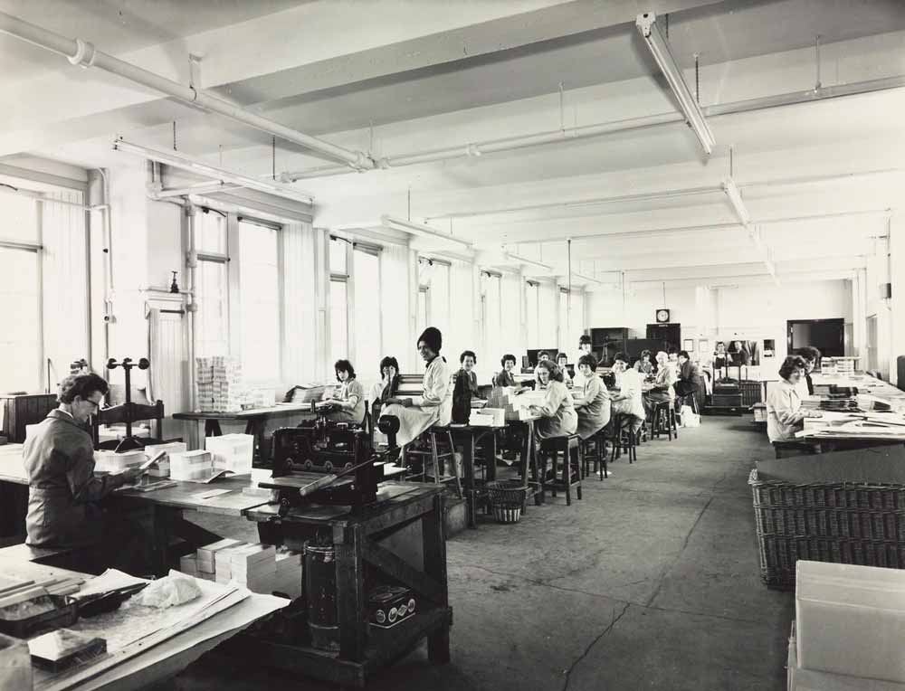
Map Mounting Room
The map mounting room was home to Bartholomew's bindery. The staff in this department were responsible for the finishing stages of map and atlas production.
Here (and in the Map Processes Room on the first floor), maps could be mounted on cloth, dissected, trimmed, folded, varnished and have their covers added. Throughout Bartholomew's history this was a predominantly female department.
More about map finishing processes


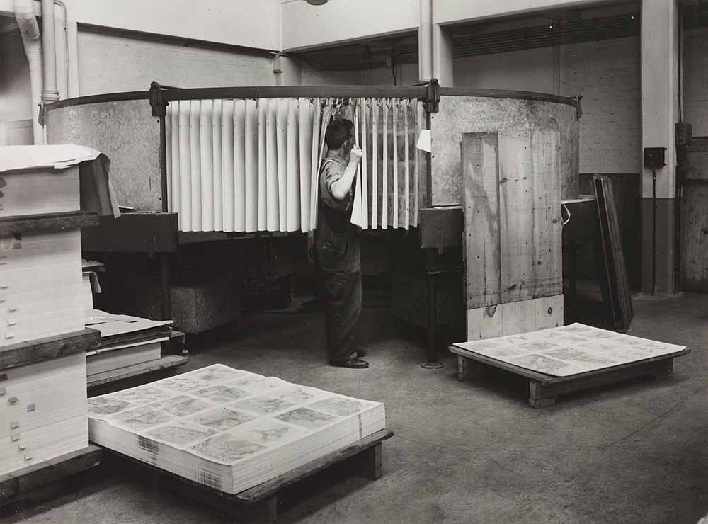
Airing paper
Airing paper helped to limit the problems of heat and humidity during and after the printing process. As the paper was wetted during printing, it was essential that it was dried before each map could be finished.
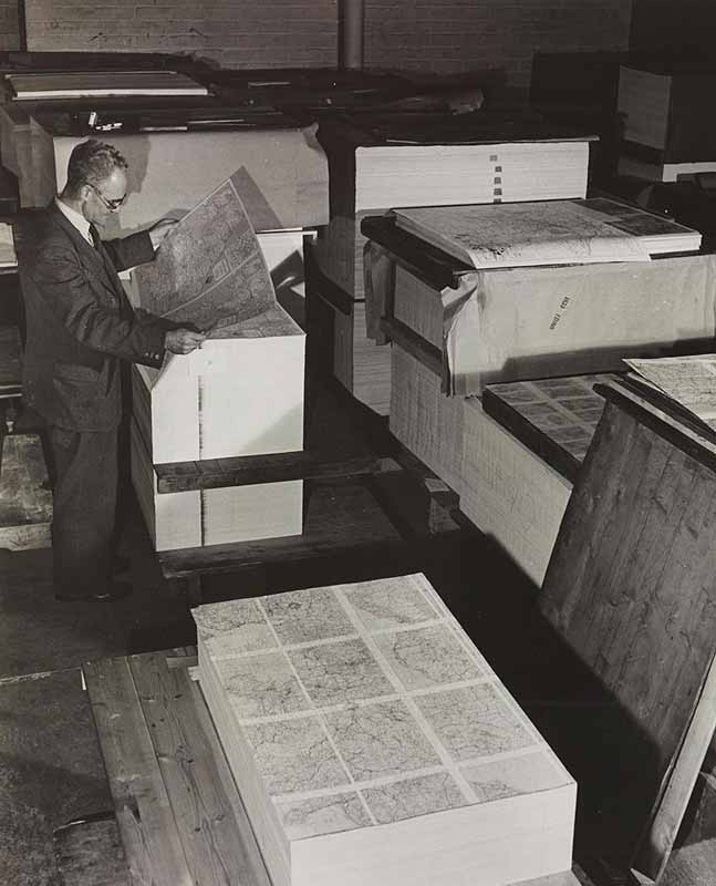
Examining maps before finishing
Willie Dickson checks the quality of maps before they are finished off. Bartholomew always printed more than they needed as there could be problems during printing.

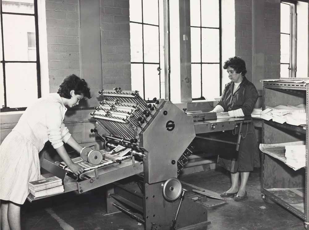
Folding and dissecting maps
This photo shows some of Bartholomew's bindery staff using equipment to fold and dissect maps.
Trimming maps
In this room, Bartholomew's maps were trimmed and had their covers attached. However, the work here was done by hand, rather than with machines.
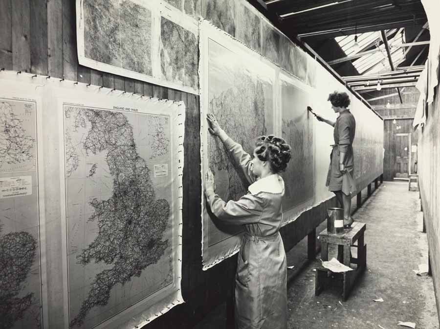
Varnishing wall maps
These women are varnishing Bartholomew's wall maps, a technique which made the maps more durable. Once dry, the maps would be attached to rollers.
Maps such as these were sent to school classrooms all over the British Empire.
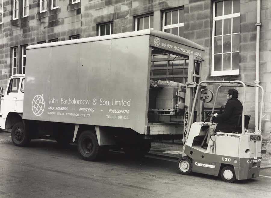
Dispatching maps
Parked outside Duncan Street, this Bartholomew van is being loaded with maps ready for delivery.