1933
(410) [Page 352] - Tamsui and Keelung
Download files
Complete book:
Individual page:
Thumbnail gallery: Grid view | List view
![(410) [Page 352] - Tamsui and Keelung](https://deriv.nls.uk/dcn17/2036/7964/203679643.17.jpg)
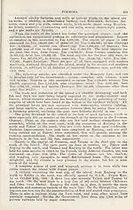
TAMSUI AND KEELUNG
The port of Tamsui lies in lat. 25 deg. 10 min. N., and long. 101 deg.
26 min. E., on the north-western side of the fertile island of Formosa- The
harbour, like all others in Formosa, has a troublesome bar, which has re¬
tarded the growth of the port and has- necessitated the transfer to Keelung
of the steamship agencies that formerly made it their headquarters. None but
vessels of smalt size trade there. The tow® called Hobe, is situated on the
north side of the river, about two milesjf.rom the, bar. In October, 1884, the
French ships under Admiral Courbet bombarded Tamsui, but were unable to-
take the place. The Japanese took-possession on the 7th June, 1803.
The port of Keelung lies to the north-east of Tamsui, in latitude 25 deg.
6 min. N. and longitude 121 deg. 47 min. E. It is situated on the shores of
a bay between the capes of Foki and Peton, some 20 miles apart, amidst bold
and striking scenery, backed by a range of mountains. It was once a Spanish
Settlement, but was subsequently captured and held by the Dutch until they
in turn gave place to the Chinese under Koxinga, formerly a pirate chief,
who caused himself to be, proclaimed King of Formosa. Though but a mere
village, it had long carried on a considerable native trade with Amoy, Chin-
chew, and Foochow. Keelung was opened to foreign trade at the same time-
as the other Formosan ports. The limits of the port are defined to be within
a straight line drawn from Image Point to Bush Island. On the 5th August,
1884, the port was bombarded by the French under Admiral Lespes, when the
forts above the town were reduced to ruins, and the place captured. It was-
then garrisoned by the French, who held it until after the Treaty of Peace
had been signed at Tientsin in June, 1885. The place was occupied by the
Japanese on the 3rd June, 1895.
At Keelung' harbour improvements were completed in 1930 at a cost of
over 25 million Yen, and have largely increased the accommodation available.
During 1900 a lighthouse was completed on Pak-sa: Point, a low headland
on the west coast, some 20 miles south-west of Tamsui, and one has been
erected on Agineourt Island. At Keelung there is a stone quay in connection
with the railway, alongside of which the regular mail steamers of the 6,000
tons class are berthed, the depth of water alongside being 28-30 feet. It is
now possible to accommodate at the quay about 10 steamers each of 10,000
tons capacity, and admit six steamers below this tonnage at the buoys.
The railway line between Tamsui and Taipeh was opened in August, 1901,
and has been of great benefit to the people-of the district. Keelung is the
northern terminus of the trans-Formosan Government Bailway. The capital
city is known by the Chinese name of Taipeh, and also Under the Japanese
nomenclature of Taihoku, which is now applicable, also, to the whole'district,
the former names of Manka, iDaltotei, etc., having 'recently been abolished..
At the mouth of the Tamsui river lies the town of Kobe, Usually known as-
Tamsui to avoid confusion with Kobe in Japan proper,
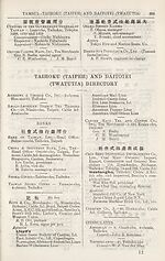
TAMSUI DIRECTORY
Bank , of Taiwan, Lm (Tamsui ’
Y. Tomita, manager
Boyd & Co., Shipping Agents
Brunner, Mono & Cb.1 (Japan), Ltd.—
Sakae-machi, Itchomc 1 P.O. Box 9;
Cable Ad: Cresdent
Paul Houghton, manager
Z. Tobisawa, chief banto
British Consulate (also in charge of
interests of France, Norway and
Spain)—Tamsui; Cable Ad : Britain
Cbnsul—A. R, Ovens
Set display mode to:
![]() Universal Viewer |
Universal Viewer | ![]() Mirador |
Large image | Transcription
Mirador |
Large image | Transcription
Images and transcriptions on this page, including medium image downloads, may be used under the Creative Commons Attribution 4.0 International Licence unless otherwise stated. ![]()
| Asian directories and chronicles > 1933 > (410) [Page 352] - Tamsui and Keelung |
|---|
| Permanent URL | https://digital.nls.uk/203679641 |
|---|
| Attribution and copyright: |
|
|---|---|
| Description | Volumes from the Asian 'Directory and Chronicle' series covering 1917-1941, but missing 1919 and 1923. Compiled annually from a multiplicity of local sources and research. They provide listings of each country's active corporations, foreign residents and government agencies of all nationalities for that year, together with their addresses. Content includes: various treaties; coverage of conflicts; currencies and taxes; consular fees; weights and measures; public holidays; festivals and traditions. A source of information for both Western states and communities of foreigners living in Asia. Published by Hongkong Daily Press. |
|---|---|
| Shelfmark | H3.86.1303 |
| Additional NLS resources: |

