

Download files
Complete book:
Individual page:
Thumbnail gallery: Grid view | List view
BELL BOCK LIGHTHOUSE.
313
west, forming the extensive bay called St. Andrews Bay. At the bottom
of this bay, on a ridge of rock projecting into the sea, stands the ancient
city of St. Andrews (described page 152).
About two miles from St. Andrews is the estuary of the river Eden,
and at a short distance inland, the village of Leuchars. A little to the
east of Leuchars is Tentsmoor Point, the south-eastern point of the firth
of the Tay, and on the opposite shore, in Forfarshire, is Button Ness, the
north-eastern point of the same estuary. There are two lighthouses on
this promontory, and two others on the south shore, nearly opposite to the
village of Broughty Ferry. About
six miles up the Firth of Tay, on the
north shore, is Dundee (described
page 260).
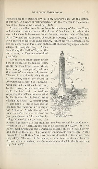
About twelve miles east from this
part of the coast is the famous Bell
Rock, or Inch Cape Rock, which,
from a very remote period, had been
the cause of numerous shipwrecks.
The top of the rock only being visible
at low water, one of the abbots of
Aberbrothock attached to it a frame¬
work and a bell, which being rung
by the waves, warned mariners to
avoid the fatal reef. A tradition
respecting this bell has been embodied
by Dr. Southey in his ballad called
“ Ralph the Rover.” A famous pirate
of this name is said to have cut the
bell from the frame-work “ to plague
the Abbot of Aberbrothock,” and
some time after to have received the
just punishment of his malice by
being shipwrecked on the spot. An
elegant lighthouse, 115 feet high, has now been erected by the Commis¬
sioners of the Northern Lighthouses at an expense of £60,000. It is one
of the most prominent and serviceable beacons on the Scottish shores,
and has been the means of preventing innumerable shipwrecks. About
nine miles from Button Ness is Arbroath, described in the former route
(page 304). The rest of the places, as seen from the steamer between
Arbroath and Aberdeen, are the same as described in the former route
(pp. 303 to 309).
313
west, forming the extensive bay called St. Andrews Bay. At the bottom
of this bay, on a ridge of rock projecting into the sea, stands the ancient
city of St. Andrews (described page 152).
About two miles from St. Andrews is the estuary of the river Eden,
and at a short distance inland, the village of Leuchars. A little to the
east of Leuchars is Tentsmoor Point, the south-eastern point of the firth
of the Tay, and on the opposite shore, in Forfarshire, is Button Ness, the
north-eastern point of the same estuary. There are two lighthouses on
this promontory, and two others on the south shore, nearly opposite to the
village of Broughty Ferry. About
six miles up the Firth of Tay, on the
north shore, is Dundee (described
page 260).
About twelve miles east from this
part of the coast is the famous Bell
Rock, or Inch Cape Rock, which,
from a very remote period, had been
the cause of numerous shipwrecks.
The top of the rock only being visible
at low water, one of the abbots of
Aberbrothock attached to it a frame¬
work and a bell, which being rung
by the waves, warned mariners to
avoid the fatal reef. A tradition
respecting this bell has been embodied
by Dr. Southey in his ballad called
“ Ralph the Rover.” A famous pirate
of this name is said to have cut the
bell from the frame-work “ to plague
the Abbot of Aberbrothock,” and
some time after to have received the
just punishment of his malice by
being shipwrecked on the spot. An
elegant lighthouse, 115 feet high, has now been erected by the Commis¬
sioners of the Northern Lighthouses at an expense of £60,000. It is one
of the most prominent and serviceable beacons on the Scottish shores,
and has been the means of preventing innumerable shipwrecks. About
nine miles from Button Ness is Arbroath, described in the former route
(page 304). The rest of the places, as seen from the steamer between
Arbroath and Aberdeen, are the same as described in the former route
(pp. 303 to 309).
Set display mode to:
![]() Universal Viewer |
Universal Viewer | ![]() Mirador |
Large image | Transcription
Mirador |
Large image | Transcription
| Antiquarian books of Scotland > Scotland/Scots > Black's picturesque tourist of Scotland > (403) |
|---|
| Permanent URL | https://digital.nls.uk/130033026 |
|---|
| Description | 13th edition. |
|---|---|
| Shelfmark | ABS.1.78.20 |
| Additional NLS resources: | |
| Attribution and copyright: |
|
| Description | Thousands of printed books from the Antiquarian Books of Scotland collection which dates from 1641 to the 1980s. The collection consists of 14,800 books which were published in Scotland or have a Scottish connection, e.g. through the author, printer or owner. Subjects covered include sport, education, diseases, adventure, occupations, Jacobites, politics and religion. Among the 29 languages represented are English, Gaelic, Italian, French, Russian and Swedish. |
|---|