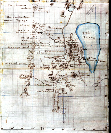
This map of Lake Malawi (formerly Nyasa) was made around 1863 by Dr David Livingstone, the legendary 19th-century Scots missionary-explorer, and a key figure in the battle against slavery. Livingstone embodied the values of the Scotland of his day. A classic 'lad o' pairts', he improved himself through education and qualified as a physician before becoming an evangelical missionary, a scientific explorer, a popular educator, and a campaigner for his great humanitarian cause - the abolition of the African slave trade.
Livingstone drew his map during his ambitious government-funded expedition exhibition of 1859-63 which aimed to establish the navigability of the Zambesi river. Navigation into the interior proved impossible, but much useful scientific and geographical work was done. This may have been recorded to aid his reports and later narratives of his expeditions or to provide information for missionaries and European traders - 'Christianity and commerce' - who might follow him to develop the area or to banish the slave trade that so disrupted society in this part of Africa.
Acc. 10496. Click for larger image
Detail