Biggar and the House of Fleming
(19) [Page 1]
Thumbnail gallery: Grid view | List view
![(19) [Page 1] -](https://deriv.nls.uk/dcn17/9483/94839512.17.jpg)
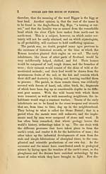
BIGGAR AND THE HOUSE OF FLEMING.
. CHAPTER I.
^historic Remains in ths Biggar district.
IGGAR, a parish in the Upper Ward of Clydesdale, is
bounded on the west by Libberton and the river
Clyde, on the north by Dolphinton and Walston,
on the east by Skirling, and on the south by Coulter
and Kilbucho. In form the parish is nearly triangular, and is
chiefly of a hilly and undulating character, with exception of a
level tract on the south, which is watered by Biggar Burn, and
which forms part of what may be denominated the Strath of
Biggar. This strath or valley, which is 628 feet above the
level of the sea, sends its waters, on the west, into the Clyde,
and on the east, into the Tweed. The parish lies about 23
miles south-west from Edinburgh, and 32 miles south-east
from Glasgow, and has ready communication by good roads,
and now by railway, with all parts of the kingdom. The
name of the parish in old documents is variously written, such
as Bygare, Bygair, Bygris, Bigart, Bigre, Biger, Begar, and Bigar,
and it is only of late years that its present orthography has been
established. Its etymology, according to the learned George
Chalmers, is to be traced to the Scoto-Irish words, "big," soft,
and " thir," land. It is far from unlikely that the title
"soft" was applicable to the lands of the parish at a remote
period ; for, even at the commencement of the present cen-
tury, a large portion of the lowest parts of it consisted of
marshes and peat-mosses. Others, again, think that " big"
may refer to a coarse kind of barley called bigg or bear, and,
A
Set display mode to:
![]() Universal Viewer |
Universal Viewer | ![]() Mirador |
Large image | Transcription
Mirador |
Large image | Transcription
Images and transcriptions on this page, including medium image downloads, may be used under the Creative Commons Attribution 4.0 International Licence unless otherwise stated. ![]()
| Histories of Scottish families > Biggar and the House of Fleming > (19) [Page 1] |
|---|
| Permanent URL | https://digital.nls.uk/94839510 |
|---|
| Description | A selection of almost 400 printed items relating to the history of Scottish families, mostly dating from the 19th and early 20th centuries. Includes memoirs, genealogies and clan histories, with a few produced by emigrant families. The earliest family history goes back to AD 916. |
|---|

