Topographical, statistical, and historical gazetteer of Scotland > Volume 2
(227) Page 215
Download files
Complete book:
Individual page:
Thumbnail gallery: Grid view | List view

LANARKSHIRE.
215
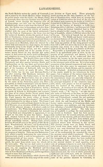
the North Med win waters the parish of Carnwath,
and is joined by the South Medwin before mingling
its united stream with the Clyde ; the Mouse, rising
in Carnwath, flows through Carstairs into the parish
of Lanark, winds through the charming glen of
Cartlane-craigs, and falls into the Clyde opposite
Kirkfield-bank, about a mile from the town of Lan-
ark ; the Nethan rises in Lesmahago, and after flow-
ing through a most beautiful district of country,
studded with the seats of the landed aristocracy,
joins the Clyde at Clydesgrove ; the Avon rises on
the borders of Ayrshire, divides the parish of Avon-
dale or Strathavon ; it then enters Stonehouse, and
becomes the boundary between this parish and Glass-
ford, and at another part between it and Dalserf ; it
then passes on to Hamilton, where the channel be-
comes bold and romantic in a high degree, the banks
occasionally rising to the height of 300 feet above
tbe bed of the dashing stream, and the summits
crowned with gnarled oak of the growth of cen-
turies; having forced its way through this rocky
course, it then enters the fertile holms of Hamilton,
and completes its course by mingling with the Clyde
at Hamilton-bridge. The South Calder rises in the
bleak moorland district of Linlithgowshire, near
Tarrymuek, and after passing between Shotts and
Cambusnethan on the one hand, and between Dal-
ziel and Shotts on the other, and finally forming a
part of the boundary of Bothwell, falls into the
Clyde after a course of nearly 20 miles. The
North Calder has its rise near Bertram-Shotts,
and after watering Old Monkland, increases the
Clyde at Daldowie ; the Calder- water, or for dis-
tinction's sake the Rotten Calder, rises on a moor
in East Kilbride, and flowing through that parish
by the name of the Park-burn, passes into Blan-
tyre parish, at which it commingles with the Rotten-
burn, and after skirting that parish, Kilbride, and
Cambuslang, joins the Clyde at Turnwheel. Lastly,
we have the classic Kelvin, which takes its rise in
the parish of Kilsyth in Stirlingshire, and towards
the close of its course divides Govan parish from
the Barony parish of Glasgow, losing its waters in
the Clyde opposite the pretty village of Govan.
[See separate articles on these streams.] The county
is little celebrated for its lakes or lochs. The Crane-
loch is situated in a wild and bleak district in the par-
ish of Dunsyre, at an elevation of 800 feet above the
level of the adjacent streams; it is about a mile in
circumference. The White-loch, also about a mile in
circumference, is situated in Carnwath, but instead
of being bleak and inhospitable in appearance, it is
fringed on two sides by some fine timber. Lang-
loch, situated between the town of Lanark and
Hyndford-bridge, is a sheet of water of great length,
though remarkably narrow. Bishop's-loch covers
between 80 and 90 acres in the parish of Old Monk-
land ; Woodend-loch, 50 acres ; and Lochend-loch,
40 acres. Lam-loch is a large sheet of water in the
parish of Cadder ; and here is also Loch-Grog, of
smaller extent, and gradually becoming less, from
the progress of draining. There are also Robroyston-
loch, which is rapidly undergoing the same process ;
Johnston-loch, nearly a mile in circumference ; and
Gastinqueen-loch of less extent. There are the
Hogganfield and Frankfield lochs in the Barony-
parish, the water from which turns the wheels of
the town mills. The last we shall notice is a lake
or reservoir formed by art for a most important pur-
pose, viz., for supplying the Monkland and the
Forth and Clyde canals. It is situated in the par-
ishes of New Monkland and Shotts, and its superficies
extend to more than 300 acres.
The mountains in Lanarkshire which deserve the
name, are all situated in the hilly range of tbe south-
ern division or Upper ward. Those principally
worth mention are the lofty Louthers, on the bor-
ders of Dumfries-shire, which have an average ele-
vation of 2,450 feet above the level of the sea, and
the highest peak towers to the height of 3,100 feet ;
Culter-fell is 2,330 feet; Tinto is 2,236 feet; Cairn-
table, on the borders of Ayrshire, is 1,630 feet;
Dolpinton-hill is 1,550 feet; and Dunsyre-hill 1,230
feet. Perhaps the highest inhabited land in Scot-
land is situated in this county, viz., the mining vil-
lage of Leadhills, which is 1,300 feet above the level
of the sea. The town of Lanark has an elevation
of 656 feet. The Middle and Lower wards possess
no elevated features of this kind, but are in general
so open in their view towards the frith of Clyde,
that from any portion of the rising ground varying
from 150 to 200 feet above the level of the sea, the
spectator may descry on a clear day the serrated
peaks of the Isle of Arran, at a distance of 50 miles.
Respectable as Lanarkshire has now been ren-
dered in an agricultural point of view, by the en-
terprise of her proprietors and farmers, it is not
from the productions of its surface-soil that the
district has become by far the most populous and
wealthy in Scotland, and its name has become known
to the uttermost parts of the sea. It is to her ample
possession of the mineral treasures of coal, iron, and
lead, that this shire owes its supremacy over all
other districts in North Britain, and the majority of
those m England. A detailed geological description
of the county would be too voluminous for these
pages ; but a vidimus of the various strata may not
be uninteresting, though brief. In the Upper ward,
the mountainous ranges are generally composed of
grawacke, or trap-rock, and indeed these constitute
the principal formation of the extensive range of
hills, which, with greater or less of regularity, run
from the confines of the county of Ayr to the
Pentlands. In treating of this subject, Mr. Patrick
gives the following comprehensive account in his
valuable work : — " If," says he, " we take the gra-
nite rocks of Galloway as the base, we have super-
incumbent upon them ; first, the grawacke of Lead-
bills and Wanlockhead ; seeond, the red sandstone
over which the Clyde is precipitated at Lanark ;
and, third, the coal formation of the Middle and
Lower wards, consisting of bituminous shale, coal,
grey limestone, grey sandstone, and clay ironstone,
thus affording a beautiful illustration of the transi-
tion and carboniferous epochs." The lofty terri-
tory of Leadhills is perhaps the most ancient min-
ing district in Scotland. Lead has been success-
fully worked here for several centuries, and besides
rich veins of this mineral, gold and silver have been
found to exist in it, and have been worked, parti-
cularly in the reign of James V. of Scotland, who
employed miners from Germany in this service.
The precious metals were no doubt found, and
coins struck from them, called the bonnet-piece ;
but it was soon discovered that even gold might
be bought too dear, or, in other words, that the
cost of the workmanship far exceeded the value of
the precious metal which it produced. The search
for gold and silver was therefore abandoned, and
the occupation of the miners has been confined to
the working of lead. Copper ore has been found
hi this mineral district in small quantity, and a
vein of antimony is known to exist, but neither are
sufficiently abundant to encourage the working on a
large scale. Spars of every kind, some of them sur-
passingly beautiful, are found to accompany the prin-
cipal mineral, lead, the veins of which generally run
south-east and north-west, with an eastward dip
of one foot in three. Lead is known to exist in
some of the parishes adjacent to Crawford, in
Set display mode to: Large image | Transcription
Images and transcriptions on this page, including medium image downloads, may be used under the Creative Commons Attribution 4.0 International Licence unless otherwise stated. ![]()
| Gazetteers of Scotland, 1803-1901 > Topographical, statistical, and historical gazetteer of Scotland > Volume 2 > (227) Page 215 |
|---|
| Permanent URL | https://digital.nls.uk/97451314 |
|---|
| Description | Volume second: I-Z. |
|---|---|
| Shelfmark | Map Room Ref.2 |
| Attribution and copyright: |
|

