Topographical, statistical, and historical gazetteer of Scotland > Volume 2
(132) Page 120
Download files
Complete book:
Individual page:
Thumbnail gallery: Grid view | List view

KIL
120
KIL
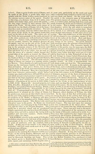
is level. From a point 2 miles west of Doune, ami
2£ north of the Forth, a gentle hilly ridge runs
parallel with the Teith, 4 miles north-westward to
the extreme western point of the parish. Parallel
to this ridge, at a distance from it of 3 miles, runs
another and similar ridge, quite across the parish, —
the two ridges forming in their interior sides the
basin of the Teith. Up the whole north corner of
the parish rise the Braes of Doune, till at the boun-
dary they send up considerable elevations. The soil
exhibits every variety, from the richest carse clay on
the plains of the Forth, to the poorest heath-clad
moor on the hills of the north. The whole vale of
the Teith, the carse-grounds on the south, and much
of the other sections, are well-enclosed and highly
cultivated. Various roads, ramifying and intersect-
ing one another, traverse the southern division of
the parish ; two run up the vale of the Teith, one
on each side of the river, leading the way from Stir-
ling to the gorgeous scenery of the Trosachs and
Loch-Katrine on the one hand, and to that of Loch-
Earn and Loch-Tay on the other; but no road in-
vites the access of a wheeled vehicle beyond the
second ridge of the parish, or toward the Braes of
Doune. A bridge of two arches was thrown across
the Teith at Doune in 1535, by the patriotic Robert
Spittal, tailor to James V. The old castle and the
village of Doune are noticed in a separate article :
See Doune. Three-fourths of a mile north- west of
Doune are the continuous hamlets of Buchany and
Burn-of-Cambus. Still nearer Doune, but on the
opposite bank of the Teith, and communicating with
it by a bridge, is Deanston. Here, for a long period,
have been extensive cotton-works, which, half-a-
century ago, employed between 200 and 300 persons,
and which now give employment or support to about
one-third of the large population of the parish. At
Deanston has been established, also, a large iron-
foundry. — Population of the parish, in 1801, 3,044;
in 1831, 3,752. Houses 426. Assessed property, in
1815, £15,465 Kilmadock is in the presbytery of
Dunblane, and synod of Perth and Stirling. Patron,
Lady Willoughby de Eresby. Stipend £288 7s. Id. ;
glebe £7. Unappropriated teinds £625 2s. Od. The
parish-church is situated at the village of Doune.
Its predecessor, however, or that which was in use
till the year 1756, stood in a different locality, — once
the residence of St. Madoc, or Madocus, and after-
wards the site of the monastery of St. Madoc, which
had six dependent chapels. This Madoc is the saint
who gives name to the parish. In Doune are two
meeting-houses, one belonging to the United Seces-
sion, and the other to the Original Burghers. The
parish has a parochial school, and six unendowed
schools, aggregately attended by at least 590 scholars,
and has been, and still is, eminent for having well-
qualified and successful teachers. Parish school-
master's salary not stated.
KILMAHOG, a hamlet in the parish of Callander,
Perthshire, situated on the left bank of the northern
head-stream of the river Teith, immediately above
its point of confluence with the southern head-
stream. A mile east of the hamlet is the village of
Callander ; and J of a mile north- west of it, is the
celebrated pass of Leny.
KILMALCOLM,' a parish in Renfrewshire,
bounded on the north by Port-Glasgow and the river
Clyde; on the east by Erskine, Houstoun, and Kil-
barchan ; on the south by Lochwinnoch ; and on the
west by Greenock, Innerkip, and Largs. This is
the largest parish in Renfrewshire, being about 6
miles square, and containing 19,800 English acres.
* This name is derived from King Miitrolm III., who was
commemorated us a saint, and to whom tile church was dedi-
cated.
A great part, particularly on the south and west
sides, is moorish land, rising to a considerable height,
and very bleak and barren. On the south side of
the parish is the extensive moss of Kilmalcolm.f
The greatest expanse of country, of a uniform fea-
ture, is a hollow plain, shelving both from south and
north, towards the Gryfe and its tributary streamlets
in the centre. This is thickly scattered over with
farm-hamlets ; whilst the soil, which is incumbent
on rotten rock, is naturally fine pasture-land. Much
of it, indeed, is in cultivation, and produces good
crops of grain and potatoes, besides some clover and
turnips. More than 6,000 acres of this description
of soil are situated in one unbroken expanse in the
heart of the valley of the Gryfe. Here and there,
throughout the parish, are clumps of planting, which
give variety to the scenery. The parish abounds
with excellent water, the principal streams being the
Gryfe and the Duchal The extensive barony of
Duchal, in this parish, was, for many ages, the chief
property and place of residence of the ancient family
of Lyle, Lord Lyle, which became extinct about 1556.
Twelve years before that date, most part of it was
sold by Lord Lyle to John Portertield of that ilk.
It now belongs to James Corbett Porterfield, Esq.
The remains of the strong and romantic castle of this
barony stand upon the confluence of the Duchal with
another rivulet. In 1710, a mansion-house was
built about a mile east from this. The presentman-
sion was built in 17C8. It stands on the right bank
of the Gryfe, and is well-sheltered with wood. — -The
barony of Dennistoun originally belonged to a family
of the same name, from whom it passed, about the
end of the 14th century, to Sir William Cunningham
ot Kilmaurs, ancestor of the Earls of Glencairn, by
marriage with Margaret, eldest daughter and co-
heiress of Sir Robert Dennistoun. Finlayston, sur-
rounded by extensive woods and plantations, on the
banks of the Clyde, is the mansion-house of this
estate, and was long the chief residence of the noble
family of Glencairn. On the death of John, the 15th
Earl, in 1 796, it and the barony of Dennistoun (long
better known by the name of Finlayston}, devolved
on Robert Graham, Esq., of Gartmore, who was son
of Margaret, eldest daughter of William, the 12th
Earl. In the time of that Earl of Glencairn, who
was among the first of the nobility that made pro-
fession of the Protestant religion, his house of Fin-
layston was a place of refuge for those of that faith,
and there John Knox dispensed the sacrament of the
Lord's Supper. The cups used upon this occasion
were two candlesticks of the finest silver. The
lower. part or sole formed the cup, which was screwed
into the upper. These cups were used in the parish-
church at the dispensation of the sacrament so long
as the family of Glencairn continued to reside here.
They were then replaced by four copper cups, gilt,
furnished by the Countess of Glencairn, who, it is
said, carried along with her the venerated silver cups,
which, it is also reported, are still in the possession
of the relations of that family The greater part of
the barony of Newark is in this parish, but the an-
cient castle is in that of Port-Glasgow. Newark
also belonged to the Dennistouns. On the death of
Sir Robert Dennistoun, it devolved on Sir Robert
Maxwell, of Calderwood, who had married his 2d
daughter, Elizabeth. It long afterwards passed to a
family named Cochran, and then to the Hamiltons.
It now belongs to Lady Shaw Stewart, whose father,
the late Robert Farquhar, Esq., purchased it from
Lord Belhaven Cairncurran, which anciently form-
s' In this district, when moss wants consistency, if due; in the
usual way, it is formed into convenient pieces for fuel, and
spread abroad to dry. Thus prepared, it is locally called grulc,
the u having the souud of the I'loiiclt letter.
Set display mode to: Large image | Transcription
Images and transcriptions on this page, including medium image downloads, may be used under the Creative Commons Attribution 4.0 International Licence unless otherwise stated. ![]()
| Gazetteers of Scotland, 1803-1901 > Topographical, statistical, and historical gazetteer of Scotland > Volume 2 > (132) Page 120 |
|---|
| Permanent URL | https://digital.nls.uk/97450174 |
|---|
| Description | Volume second: I-Z. |
|---|---|
| Shelfmark | Map Room Ref.2 |
| Attribution and copyright: |
|

