Gazetteer of Scotland
(114) Page 112
Download files
Complete book:
Individual page:
Thumbnail gallery: Grid view | List view

FOR
119
FOR
pleasant scats in Stratherne. Population
835.
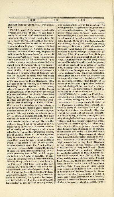
FORTH, one of the most considerable
rivers in Scotland'. It takes its rise from a
spring in the N. side of Benlomond moun-
tain, in Stirlingshire, and running from W.
to E. nearly the whole breadth of the king-
dom, forms that frith or arm of the German
ocean to which it gives its name It tra-
verses Stirlingshire for 10 miles, under the
name oft he water of Duchary, augmented
as it proceeds by a number of streams. It
then enters Perthshire, where it unites with
the water from Lochard in Aberfoyle. The
northern branch issues from a beautiful lake
called Loch Chon, from which it is precipi-
tated in full stream oyer a perpendicular
rock ; it then forms another expansion, a
third, and a fourth, before it descends into
the low country, to unite with the other
branch. When united, it assumes the name
of the Avendow, or Black River, and, after
a course of about 5 miles, it becomes the
boundary of Stirlingshire at Gartmore,
where it assumes the name of the Forth.
It is augmented by the Goodie at the bridge
of Frew, and about 2 or 3 miles above Stir-
ling, by the rivers of Teath and Allan; then
it enters that extensive plain which is term-
ed" the Carse of Stirling and Falkirk- Thro'
this valley its meanders are so extensive
and frequent, as to form a great many pe-
ninsula;, on one of which, immediately op-
posite to Stirling, stands the ruinous tower
of the abbey of Cambuskenneth, the only
remnant of that venerable pile. The sce-
nery here is truly interesting. By land the
distance from Stirling to Alloa is only 6
miles, while by water it is no less than 24.
After passing Alloa, it expands into a con-
siderable bay, upwards of 20 miles in length,
but of unequal breadth. At the Queens-
ferry it contracts considerably, being not
more than two miles over; in the middle of
which is the small island of Inchgarvie,
with its fortifications. For 3 or 4 miles it
continues contracted, till, passing the isiand
of Cramond and Inverkeithing bay, it ex
pands gradually into a frith, which, oppo-
site to Leith, is 7 miles in breadth. It con-
tinues to expand gradually for several miles,
forming many safe harbours and bays on
the Fife coast, till it loses itself in the Ger-
man ocean. The mouth of the Forth con-
tains several small islands, particularly the
isle of May, the Bass, the islands of Fiddrie
and Inchkeith, and, farther up, are the is-
lands of Cramond, Inchgarvie, Inchcolm,
and Inchmickery. The Forth is navigable
for vessels of 80 tons as far as Stirling bridge,
,j and vessels of 300 tons as far as Alloa. 1 At
! j Grangemouth it is joined by the great canal
of communication from the Clyde. It pos-
sesses many good harbours; and, above
Queensferry, the whole river may be consi-
dered as one of the safest road-steads in Bri-
tain. Inverkeitliingbay, Burntisland roads.
Leith roads, the Ely, &c. are places of safe
anchorage. It abounds with white fish of
all kinds ; and higher up, there are many
valuable salmon fishings, particularly at
Stirling, Alloa, Kincardine, &c. It is ge-
nerally visited by an annual shoal of her-
rings. On the shores of the frith every where
are established salt works ; and the greater
part of the coasts of the counties of Perth,
j Fife, Stirling, and the Lothians, abound
I with inexhaustible repositories of coal, lime-
stone, and ironstone. Since the completion
of the great canal between the two seas, the
tonnage which entered the frith of Forth
has increased greatly. The length of its
course in a direct line is upwards of 90 miles,
but, calculating all the turns and windings,
for which it is so remarkable, it cannot be
estimated at less than 259 miles.
FORTINGAL, a parish in Perthshire,
conjoined with Kilchonan, 37 miles long,
and 17 broad, occupying the N. W. part of
the county. It comprehends 3 districts,
viz. Fortingal, Glenlyon, and Rannoch, be-
sides an estate of 1G ploughgates, S. of 'fay-
bridge, 8 miles from the church. The dis-
trict of Forbingal is about Smiles in length,
is a fertile valley, with the river Lyon run-
ning through the bottom, containing a few
villages, and finely ornamented with wood.
Glenlyon is a narrow glen, 23 miles long,
scarcely more than a gun-shot broad, the
sides being formed of a ridge of the highest
mountains in Perthshire. This district con-
tains many small villages, some of which
have no sunshine for some months in win-
ter. Kannoch is also surrounded with
high mountains, having Loch Rannoch
in the middle of the valley. The soil
of this district is very indifferent. Many
large woods of birch, and an extensive
fir wood, still remain, of that immense fo-
rest which occupied the N. district of Perth-
shire, and the county of Inverness. Besides
Loch Rannoch, there are other extensive
lakes, of which Loch Errack and Loch Lyon
are the chief. From each of these Lakes
issue riveis of considerable size. The hills
of Glenlyon and Bein-aidlanich, in Ran-
noch, are the chief mountains. Besides a
great many forts throughout the district,
there is an extensive Roman encampment ,
| of which the area is about SO acres. The
Set display mode to: Large image | Transcription
Images and transcriptions on this page, including medium image downloads, may be used under the Creative Commons Attribution 4.0 International Licence unless otherwise stated. ![]()
| Gazetteers of Scotland, 1803-1901 > Gazetteer of Scotland > (114) Page 112 |
|---|
| Permanent URL | https://digital.nls.uk/97423062 |
|---|

